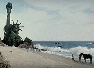
Where Should We Hold Back the Sea?
Maps Show Baseline Plan for the Atlantic Coast
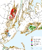
Preparing for sea level rise requires deciding which lands will be elevated, protected with dikes, or revert to nature. A multi-year project by the US Environmental Protection Agency worked with 130 counties to create maps showing which lands would be protected given existing policies, to hopefully start the dialogue on which lands should be protected. An article in the scientific journal Environmental Research Letters summarizes that study, but the sea level rise planning maps are here.
What's expected in your state?
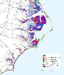
Statewide maps provide a quick overview of how much of the shore would be protected under current policies. Will we squeeze the wetland and shallow water ecosystems between development and the rising sea? Or disappoint homeowners who would prefer to think that their communities are safe? .
What should we do?
The maps are new, but the ideas have been around awhile. We provide links
to papers that explore why communities need to choose soon between the retreat and shore
protection pathwatys, how the federal government could use the wetland regulatory
program to facilitate rather than thwart nature's response to sea level rise, as well as
rolling easements and other ways to allow wetlands to
migrate inland without hurting property owners.