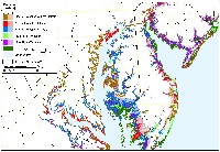
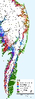
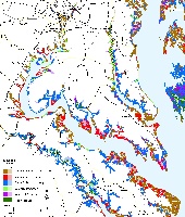
Maps depicting likelihood of shore protection along the Maryland Coast
from a new article in Environmental Research Letters
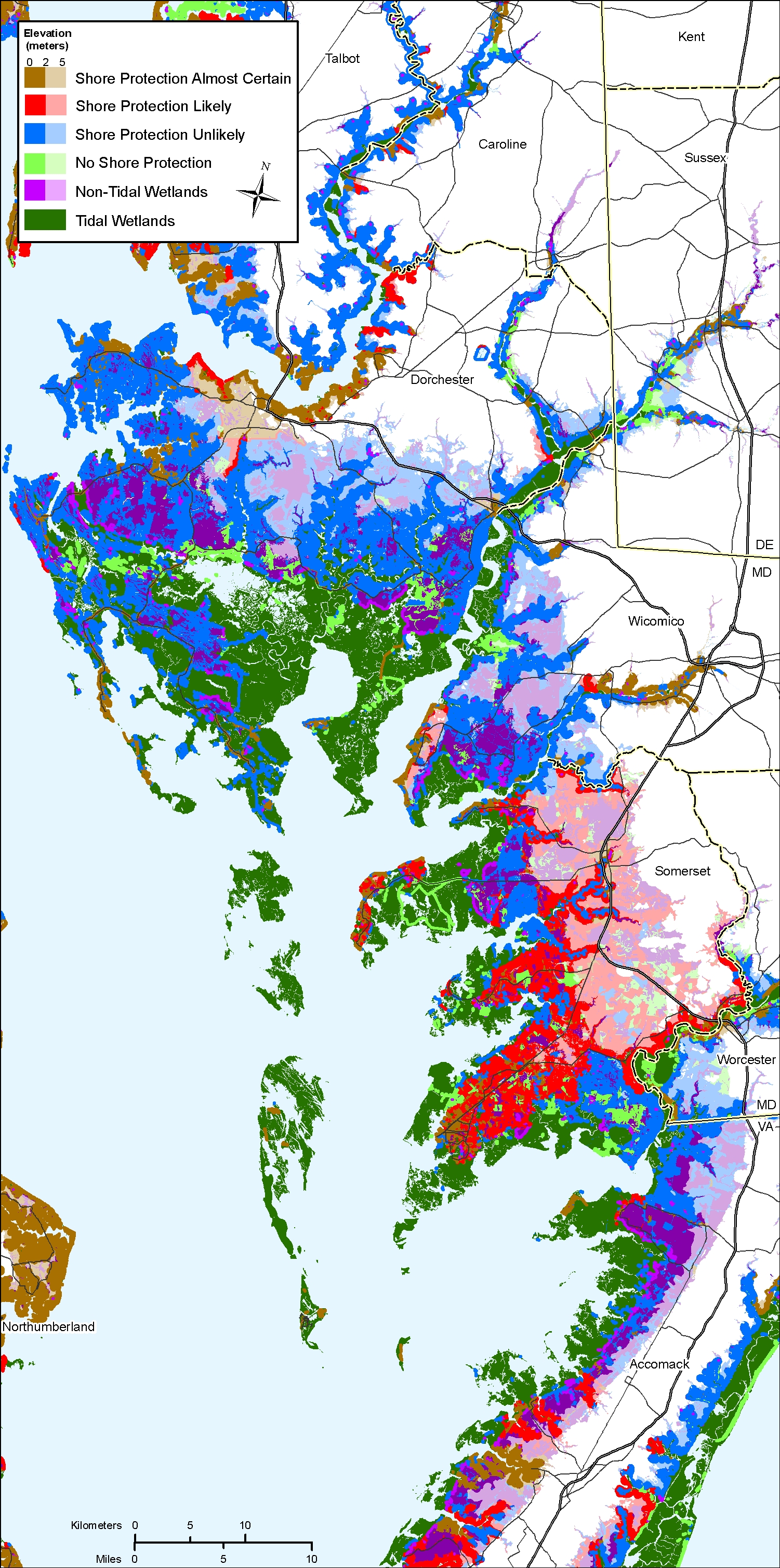
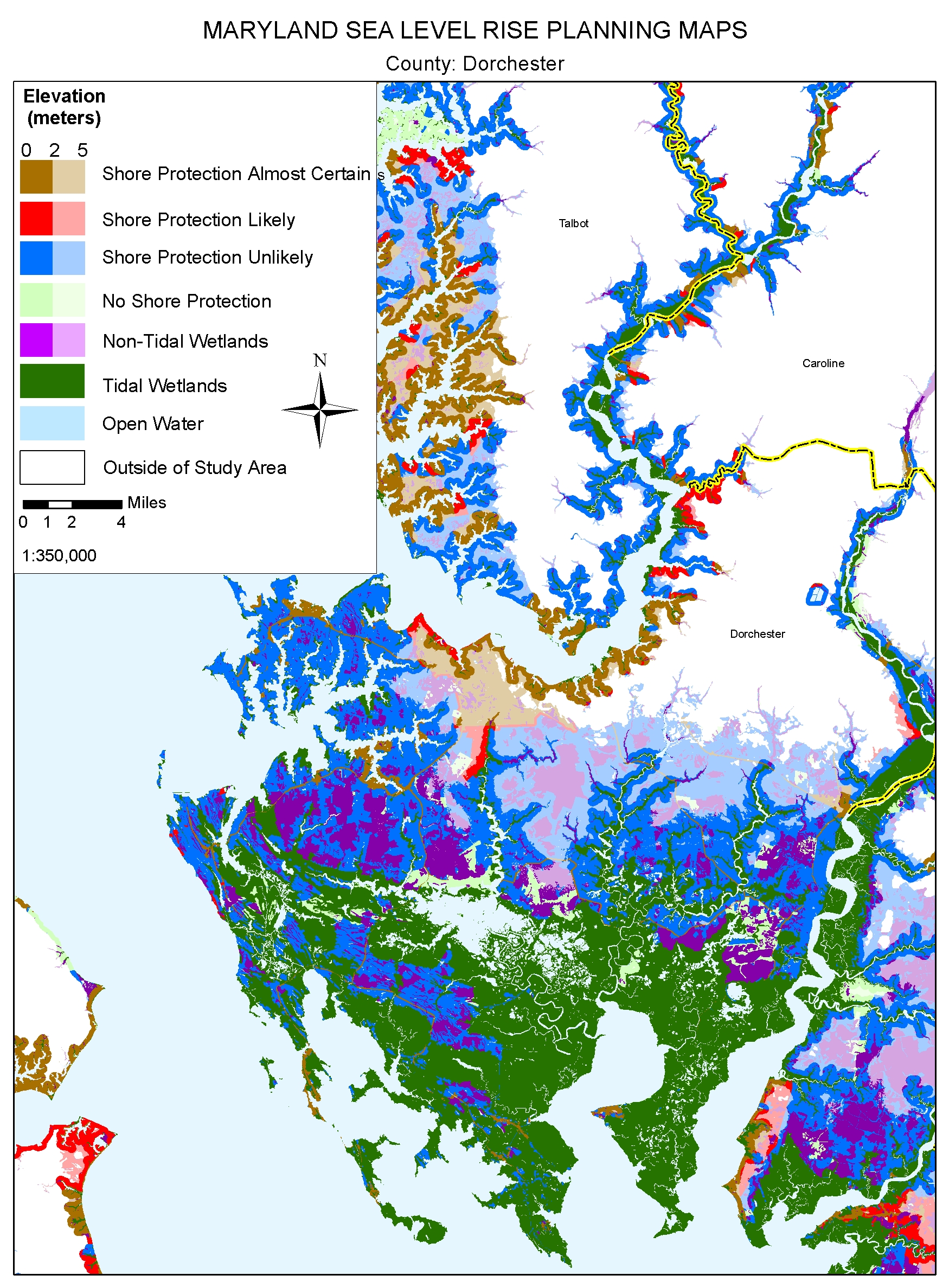
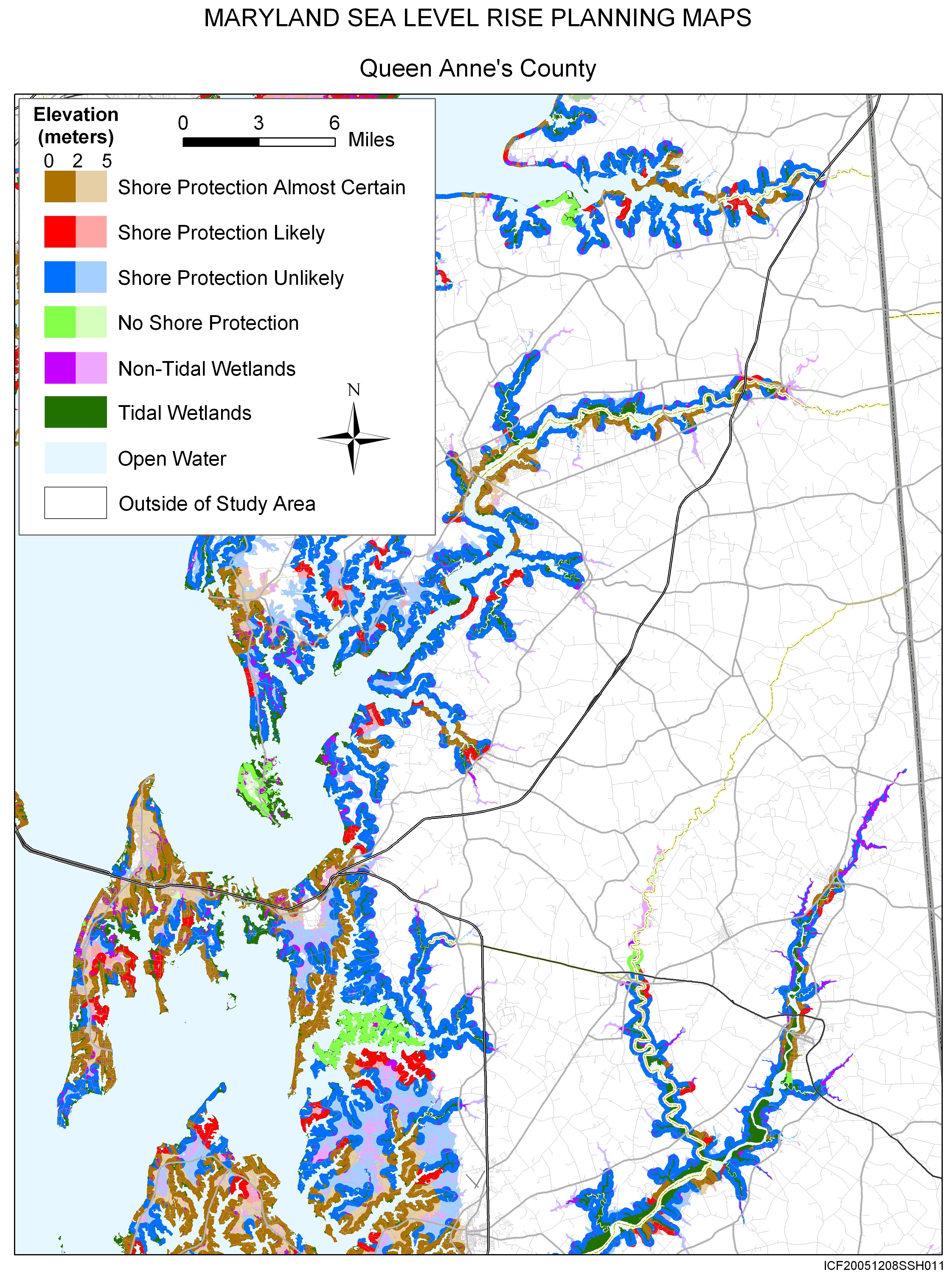
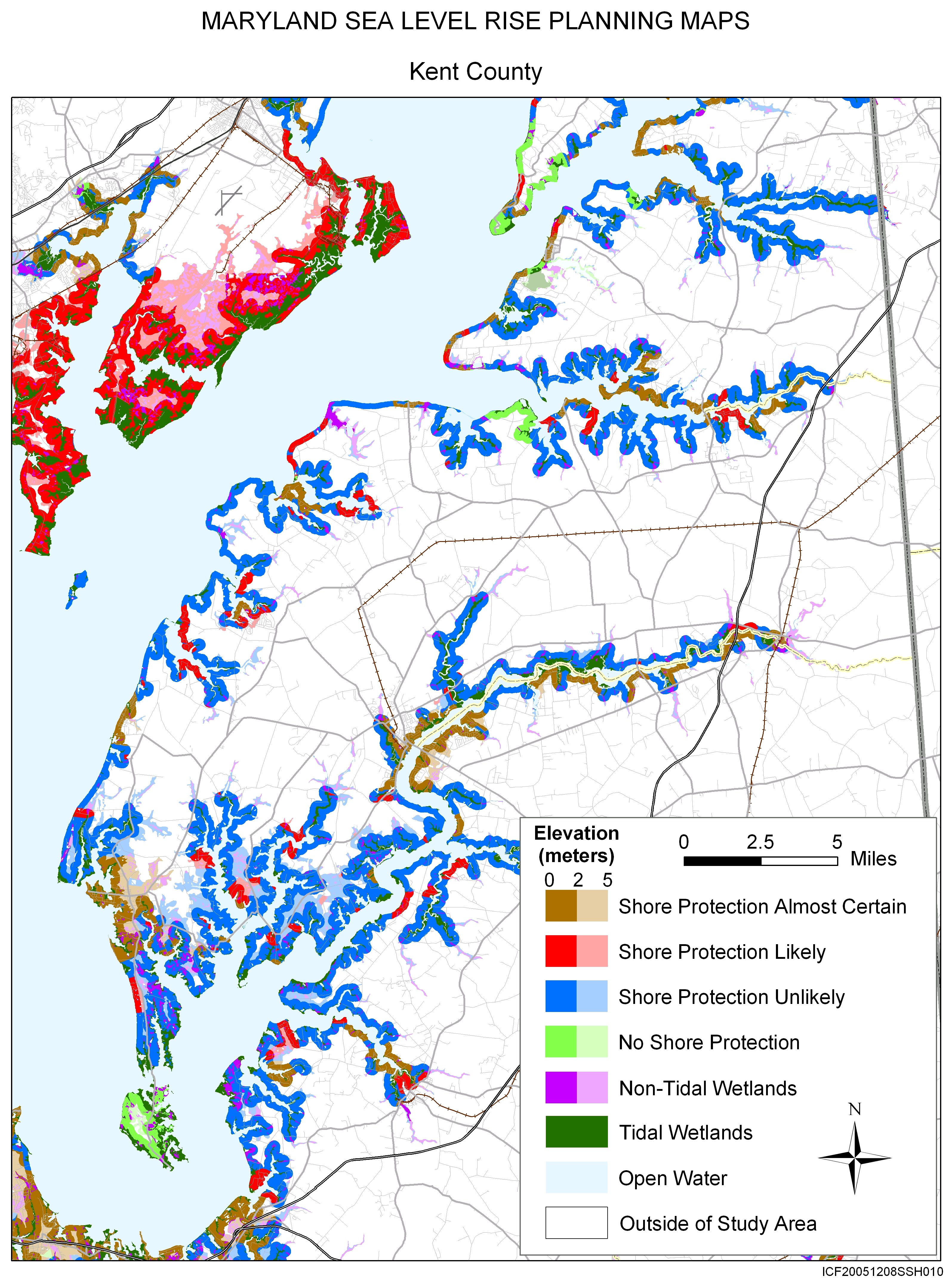
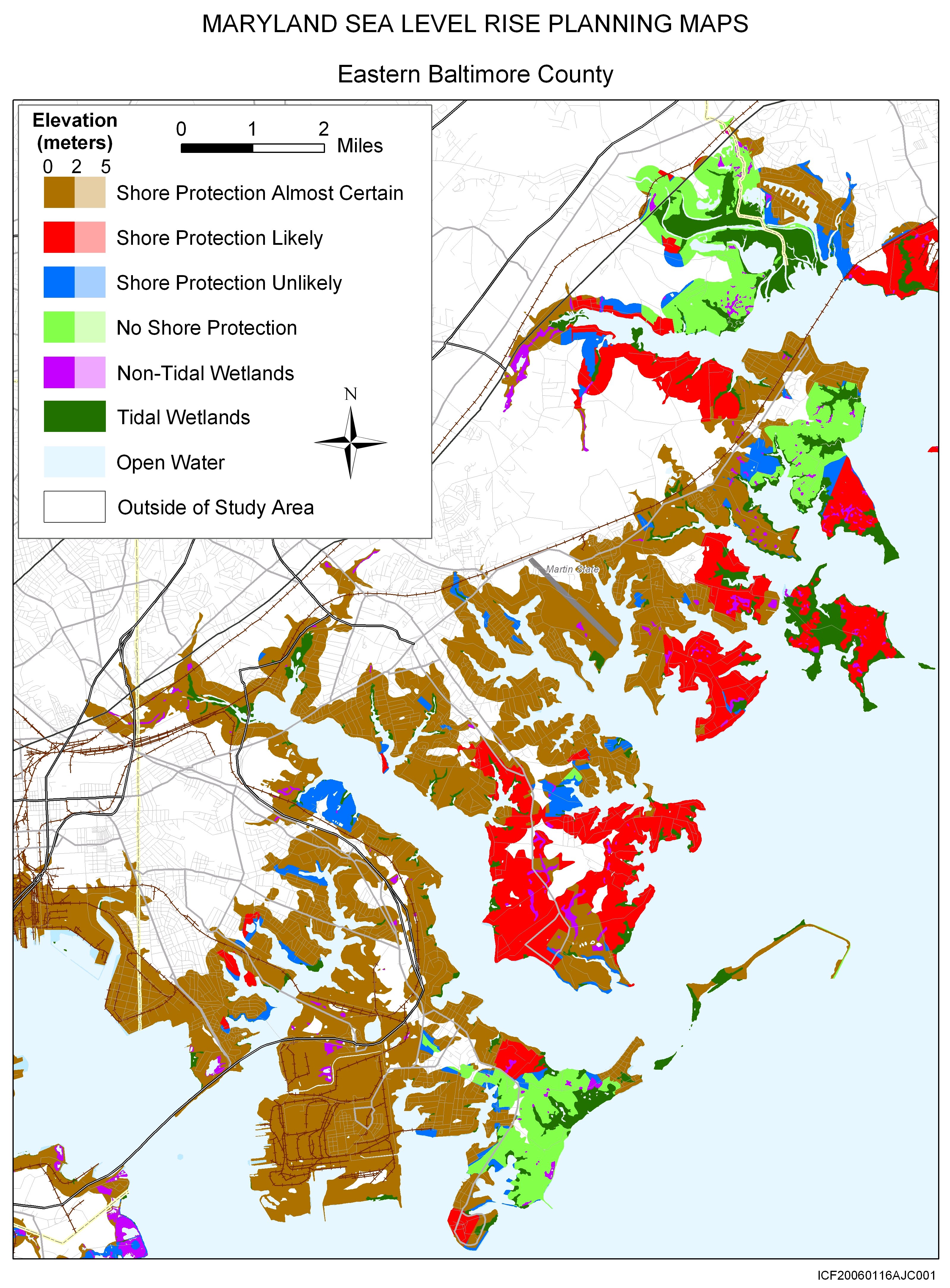
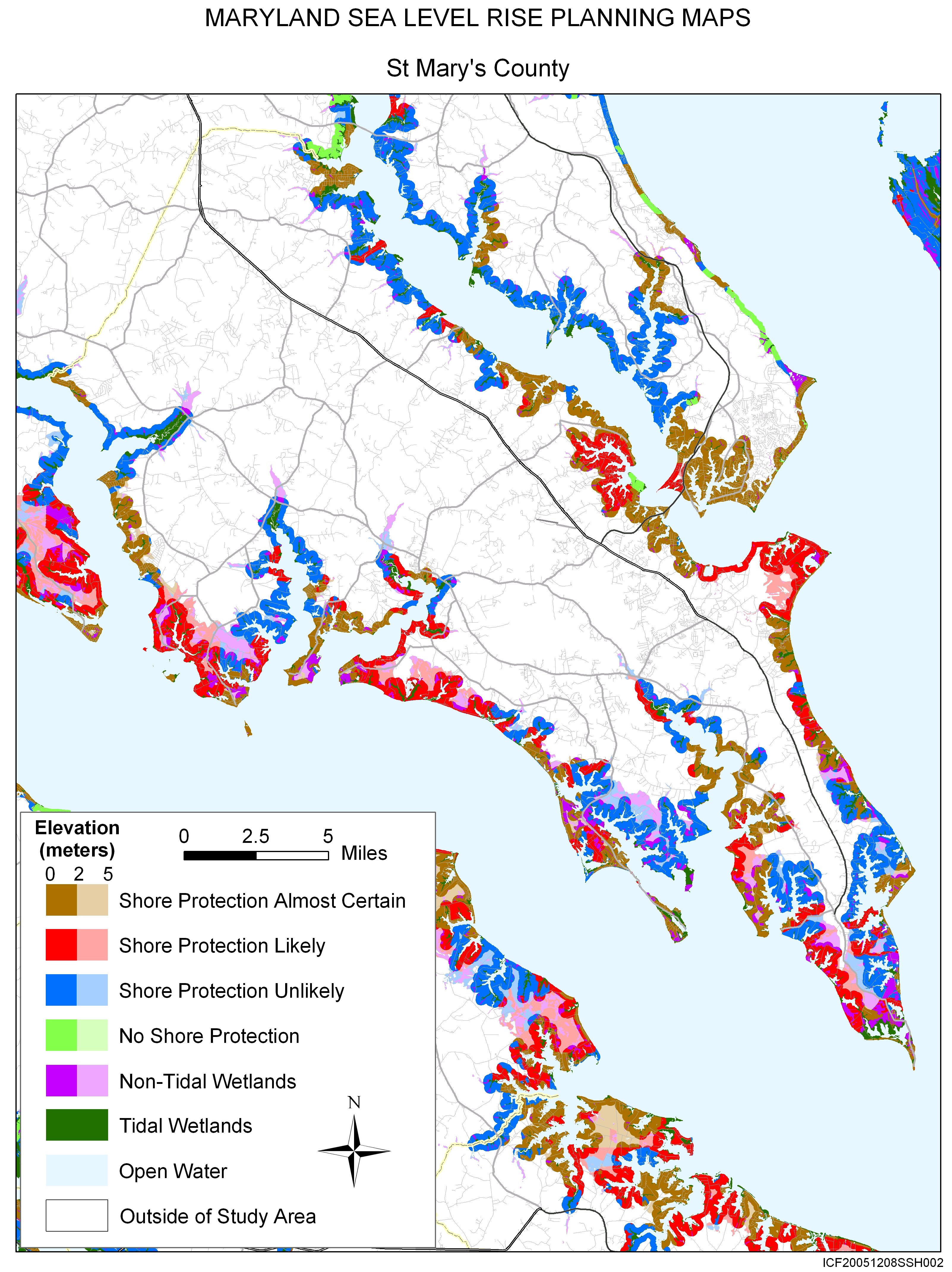
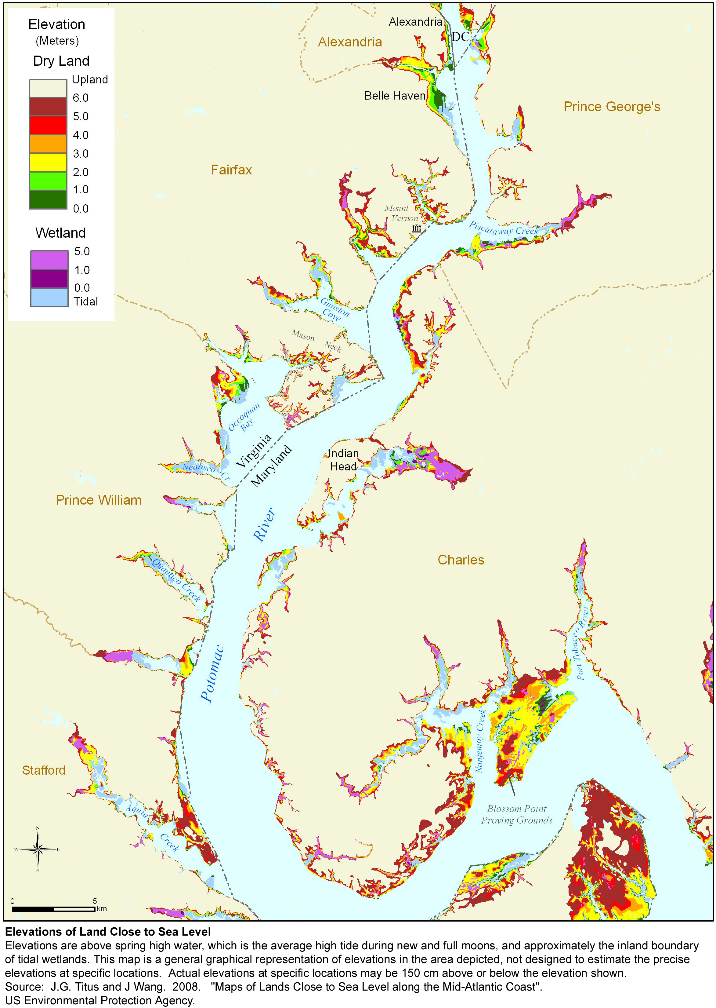
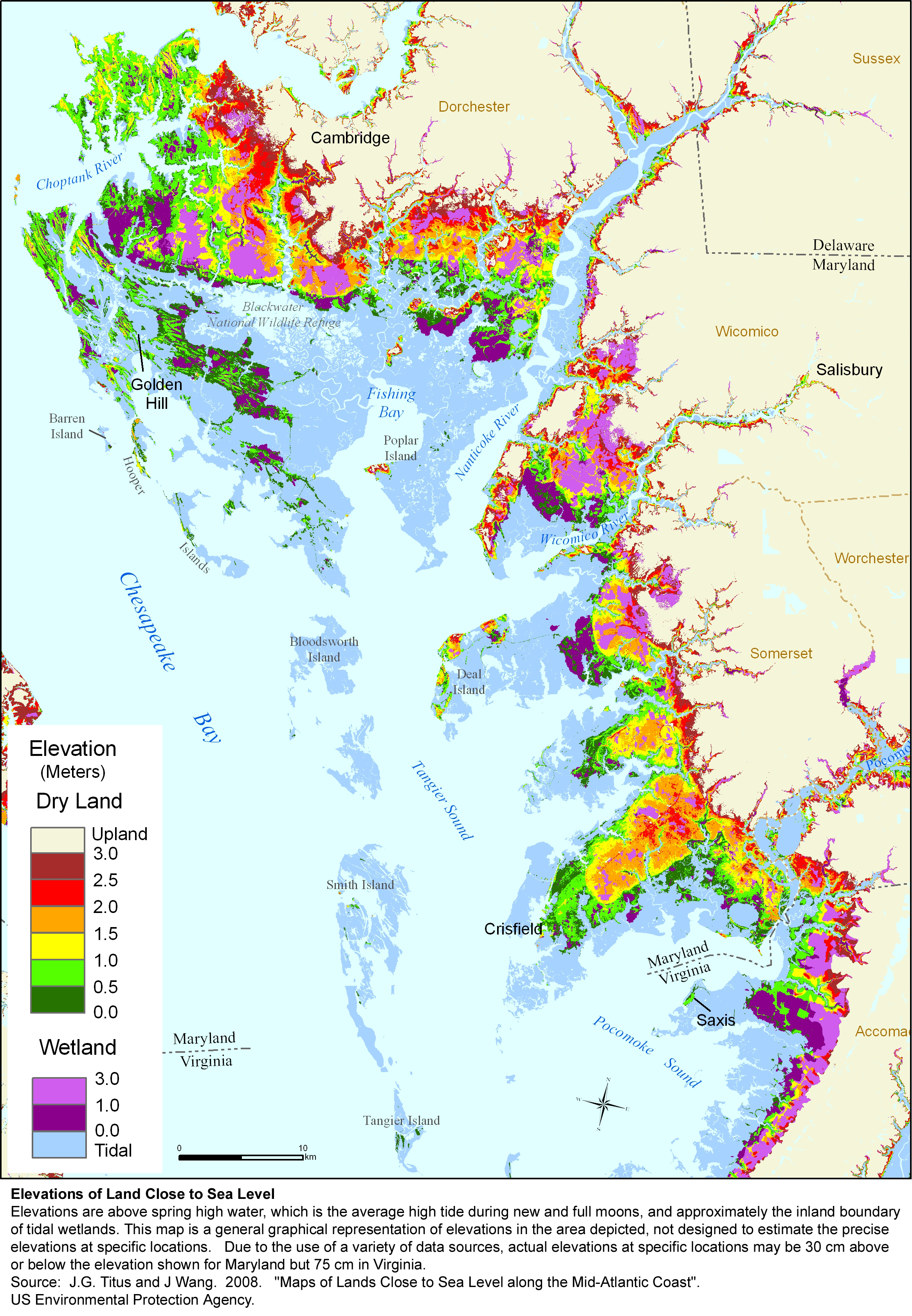
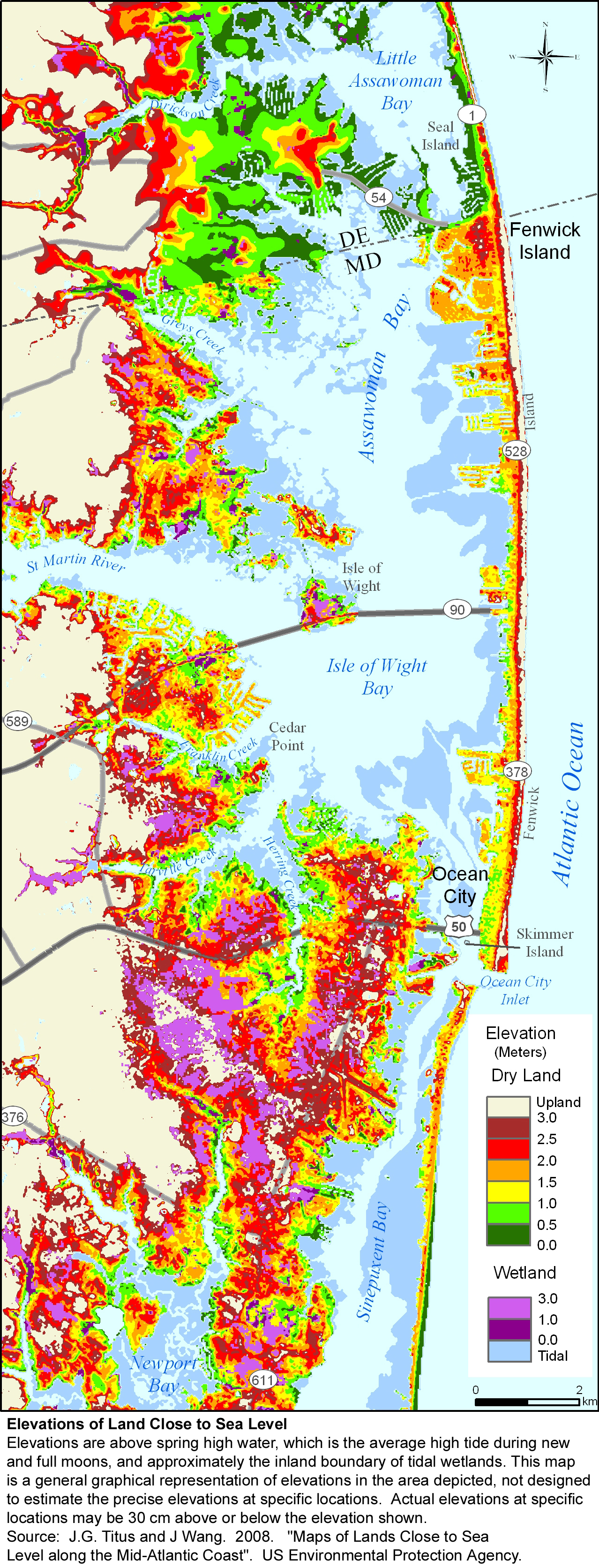
A $2 million effort to map the likelihood of shore protection as sea level rises is summarized in a new article entitled "State and local governments plan for development of most land vulnerable to rising sea level along the U.S. Atlantic Coast." The maps divide coastal low lands into four categories: developed (shore protection almost certain), intermediate (shore protection likely), undeveloped (shore protection unlikely), and conservation (no shore protection). The western shore of Chesapeake Bay is largely developed with shore protection almost certain, except for several military installations and parts of Calvert County, where clff regulations prohibit shore protection to preserve habitat for endangered species--even at the price of homes having to be lost or relocated. The Eastern shore and most tributaries to the bay are more lightly developed. Because of the state's Critical Areas Act, 90% of the undeveloped areas will have no more than 1 home per 20 acres, making shore protection unlikely. For further details, please see the report by Nuckols et al. or the summary of findings for Maryland.
Many people in Maryland have expressed concern over the environmental effects of shore protection. As a result the state is undertaking a regulatory mapping effort different from--but complementary to--the maps in this study. The new maps will divide the coast into areas where hard shore protecton will be allowed, and areas where it will not be allowed unless there are extenuating circumstances. Where it is not allowed, other approaches to shore protectin will be allowed, such as beach nourishment and combinations of marsh plantings with small breakwaters to protect the new marsh.
The maps from this study can be downloaded individually by clicking on a thumbnail map below; the entire set is also available in a zipped file. These jpg files were designed for printing at 300 dots per inch on 8-1/2 X 11 inch paper. If you simply click on the links below and try to read them on your computer screen, some of them may look strange, depending on your internet browser. If so, please save the jpg map onto your computer's hard drive and then open the file with the program you normally use to read jpg files.
|
The Whole Kitten Kaboodle |
|
|
The Mother Load of Maps |
|
|
|
|
|
||
|
|


