Maps depicting likelihood of shore protection in the District of Columbia
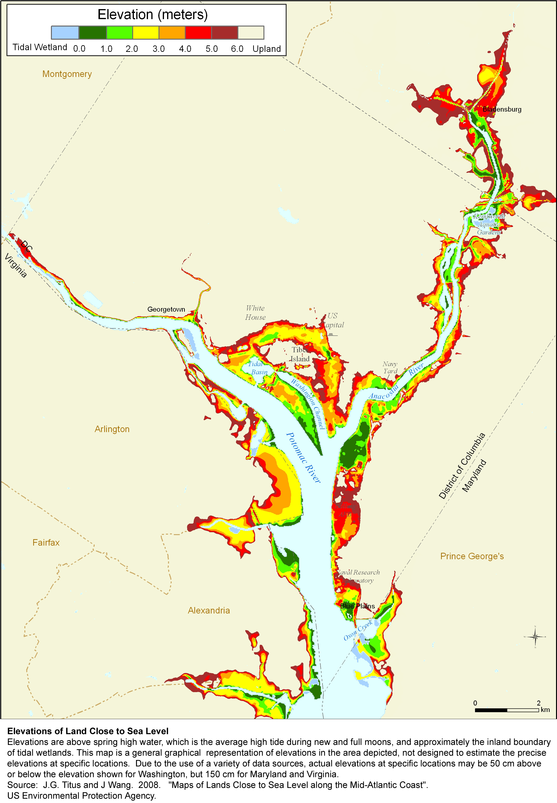
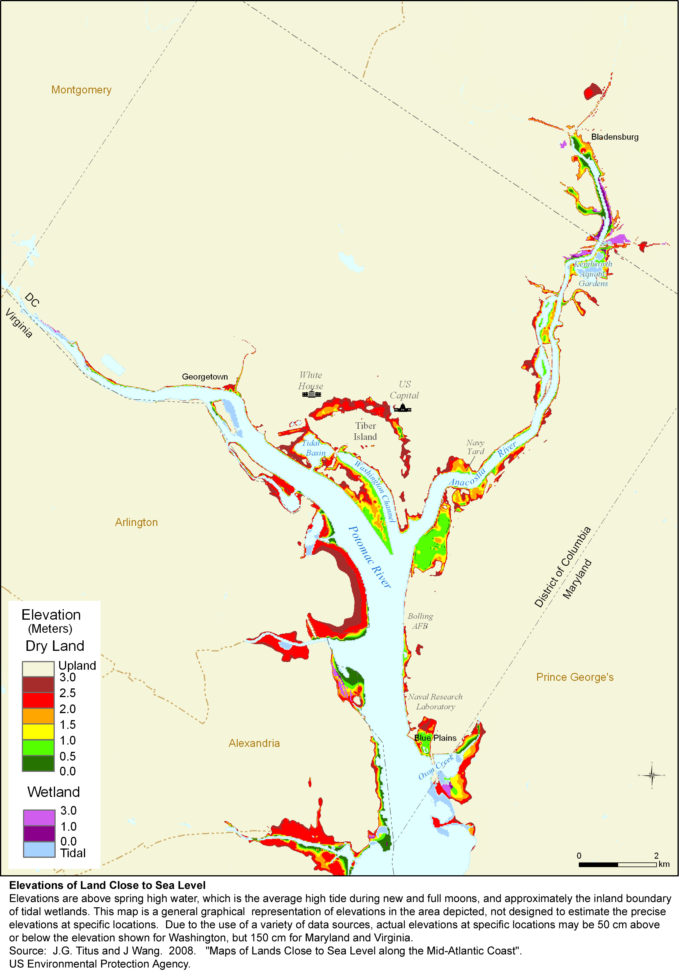
A $2 million effort to map the likelihood of shore protection as sea level rises is summarized in a new article entitled "State and local governments plan for development of most land vulnerable to rising sea level along the U.S. Atlantic Coast." The maps divide coastal low lands into four categories: developed (shore protection almost certain), intermediate (shore protection likely), undeveloped (shore protection unlikely), and conservation (no shore protection). Most of the District of Columbia is almost certain to be protected, but efforts to restore the Anacostia River provide for some natural shores north of Massachusetts Avenue. For further details, see the complete EPA report or our summary of that report
The maps from this study can be downloaded individually by clicking on a thumbnail map below; the entire set of maps from the study is also available in a series of zipped files. Since we only have one planning map for the District, we also show the corresponding elevation maps. These jpg files were designed for printing at 300 dots per inch on 8-1/2 X 11 inch paper. If you simply click on the links below and try to read them on your computer screen, some of them may look strange, depending on your internet browser. If so, please save the jpg map onto your computer's hard drive and then open the file with the program you normally use to read jpg files.
|
|
|
The Mother Load of Maps |

