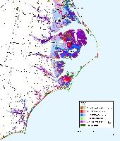
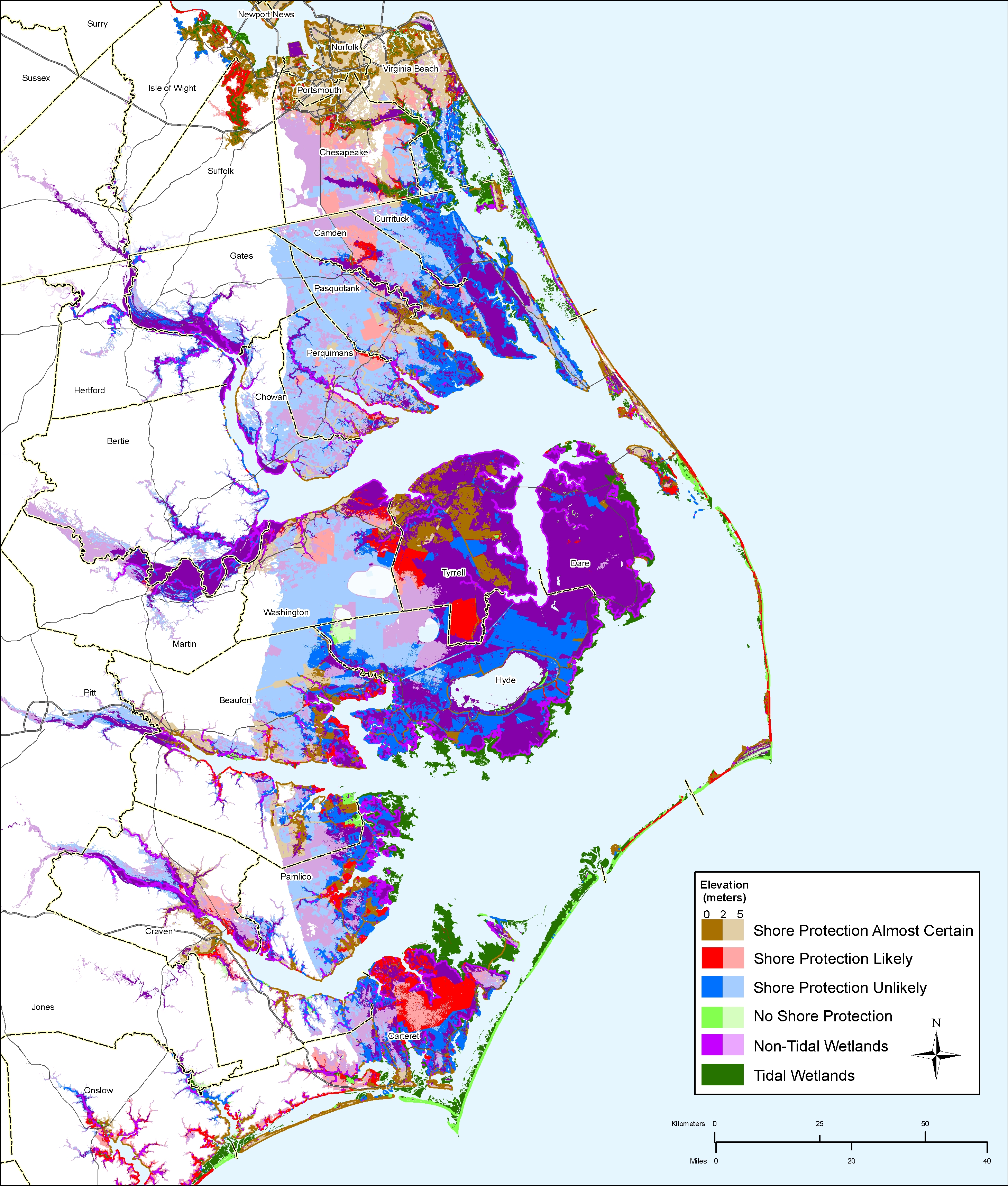
Maps depicting likelihood of shore protection along the North Carolina coast
From a new article in Environmental Research Letters
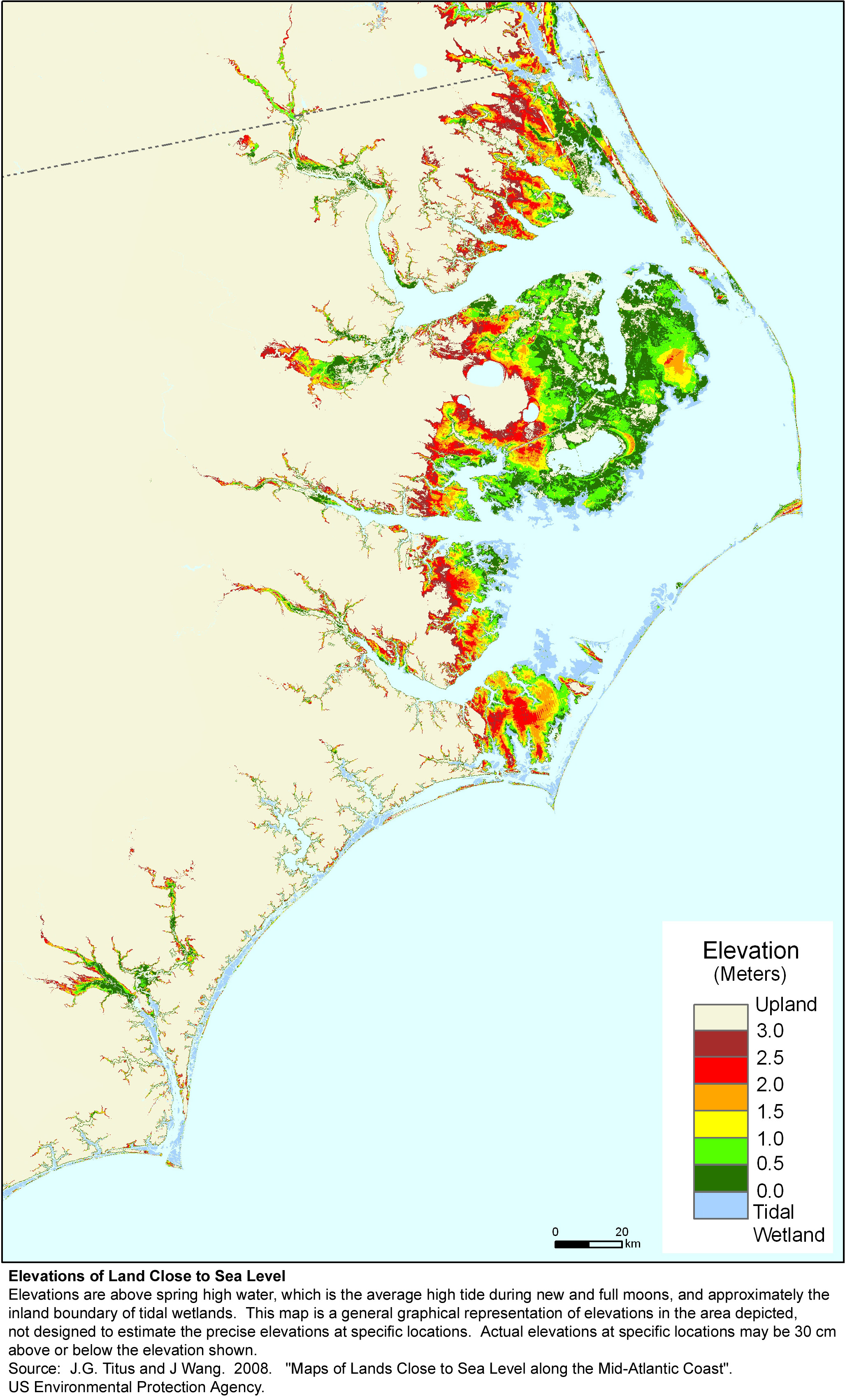
A $2 million effort to map the likelihood of shore protection as sea level rises is summarized in a new article entitled "State and local governments plan for development of most land vulnerable to rising sea level along the U.S. Atlantic Coast." The maps divide coastal low lands into four categories: developed (shore protection almost certain), intermediate (shore protection likely), undeveloped (shore protection unlikely), and conservation (no shore protection). The North Carolina portion of the study was led by North Carolina Seagrant
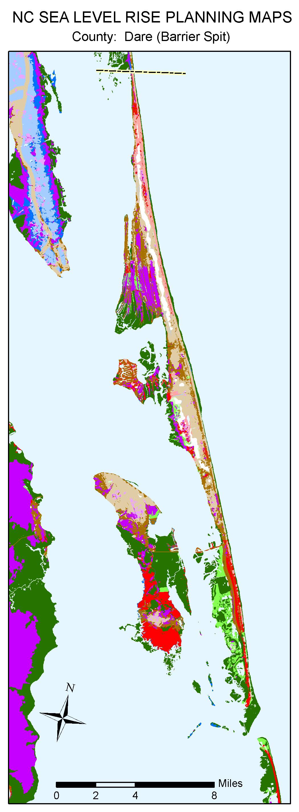
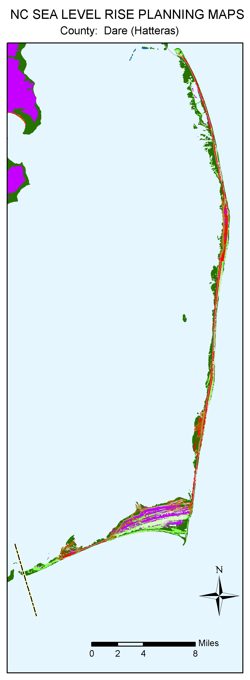
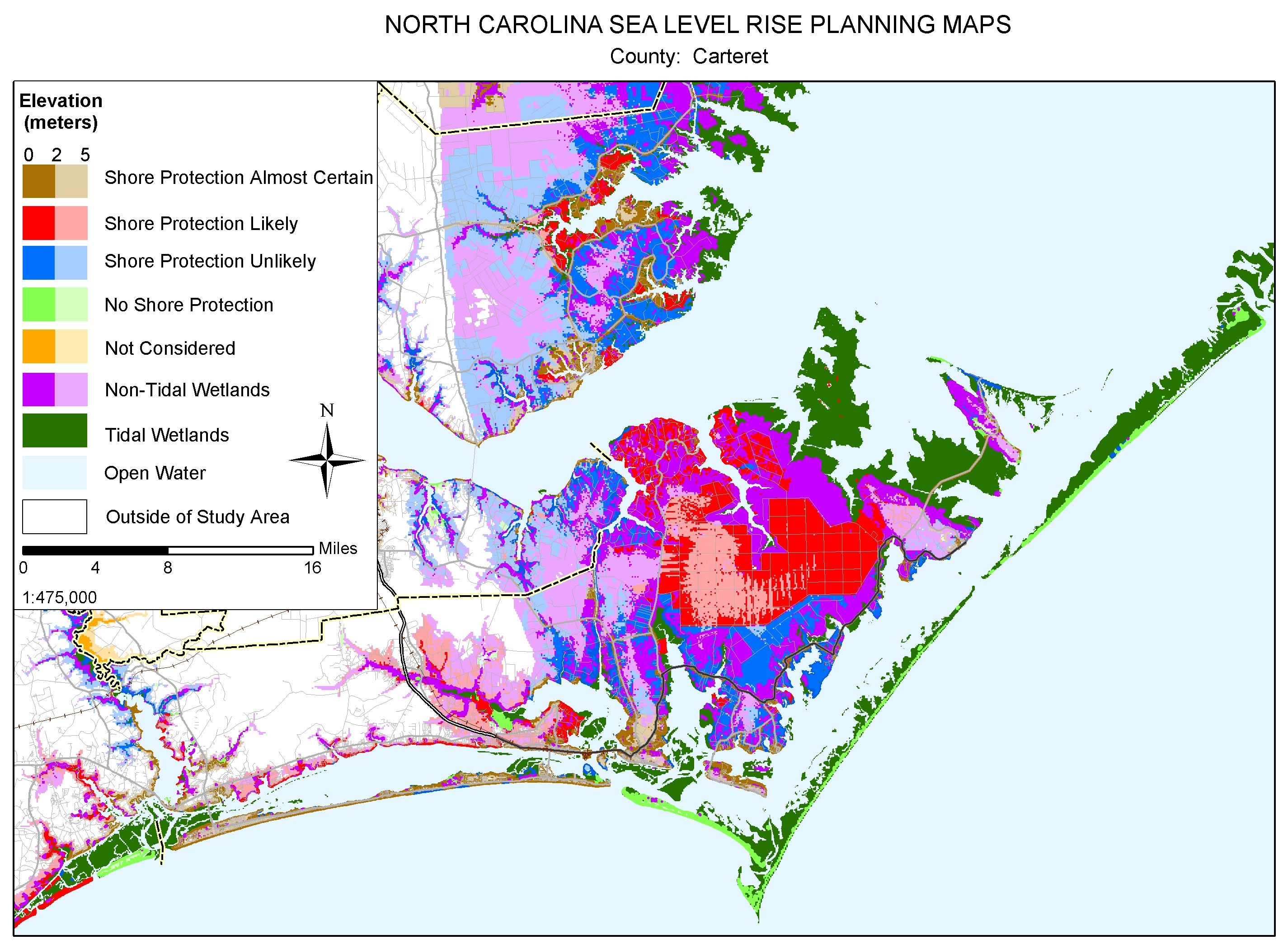
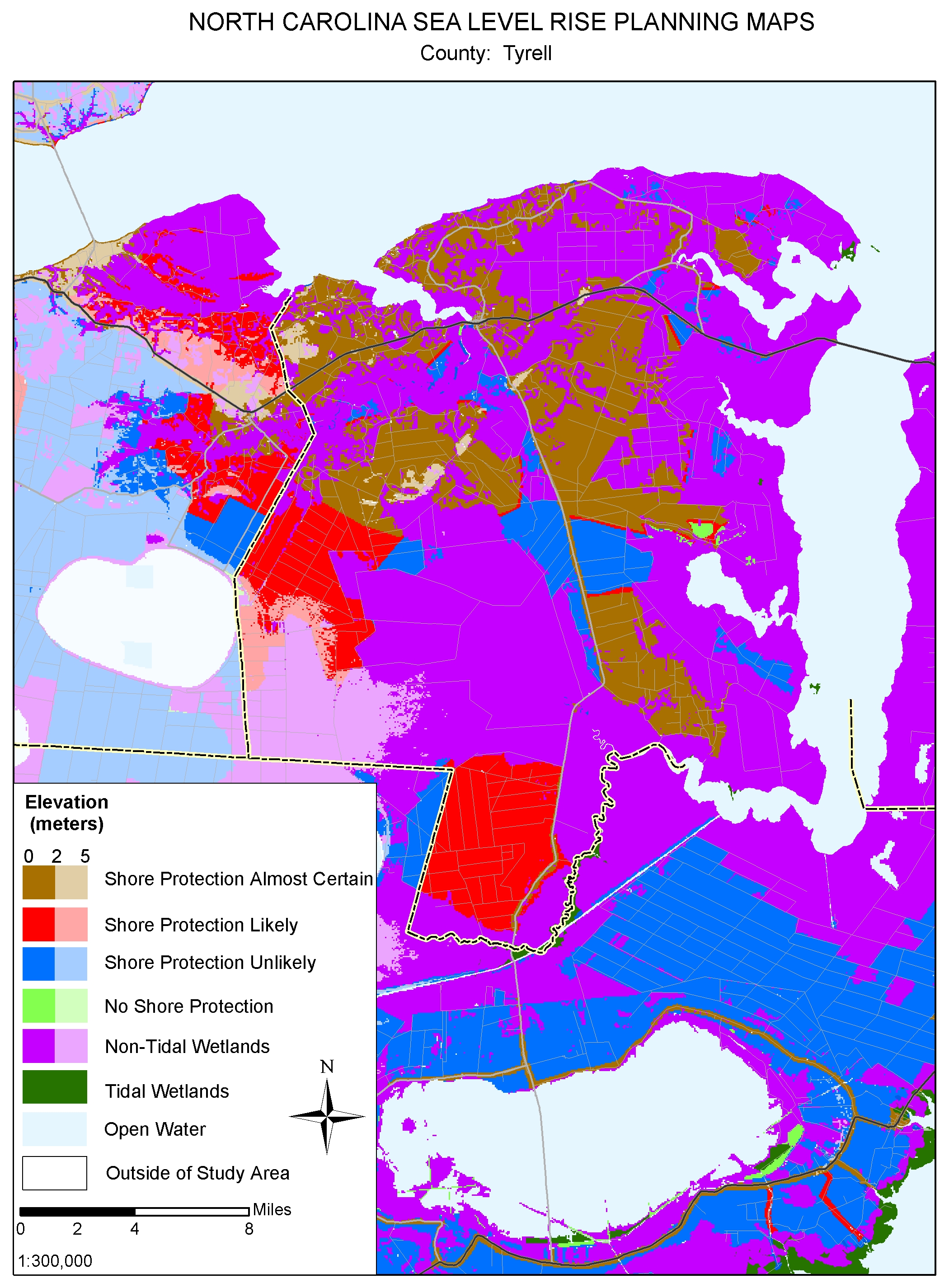
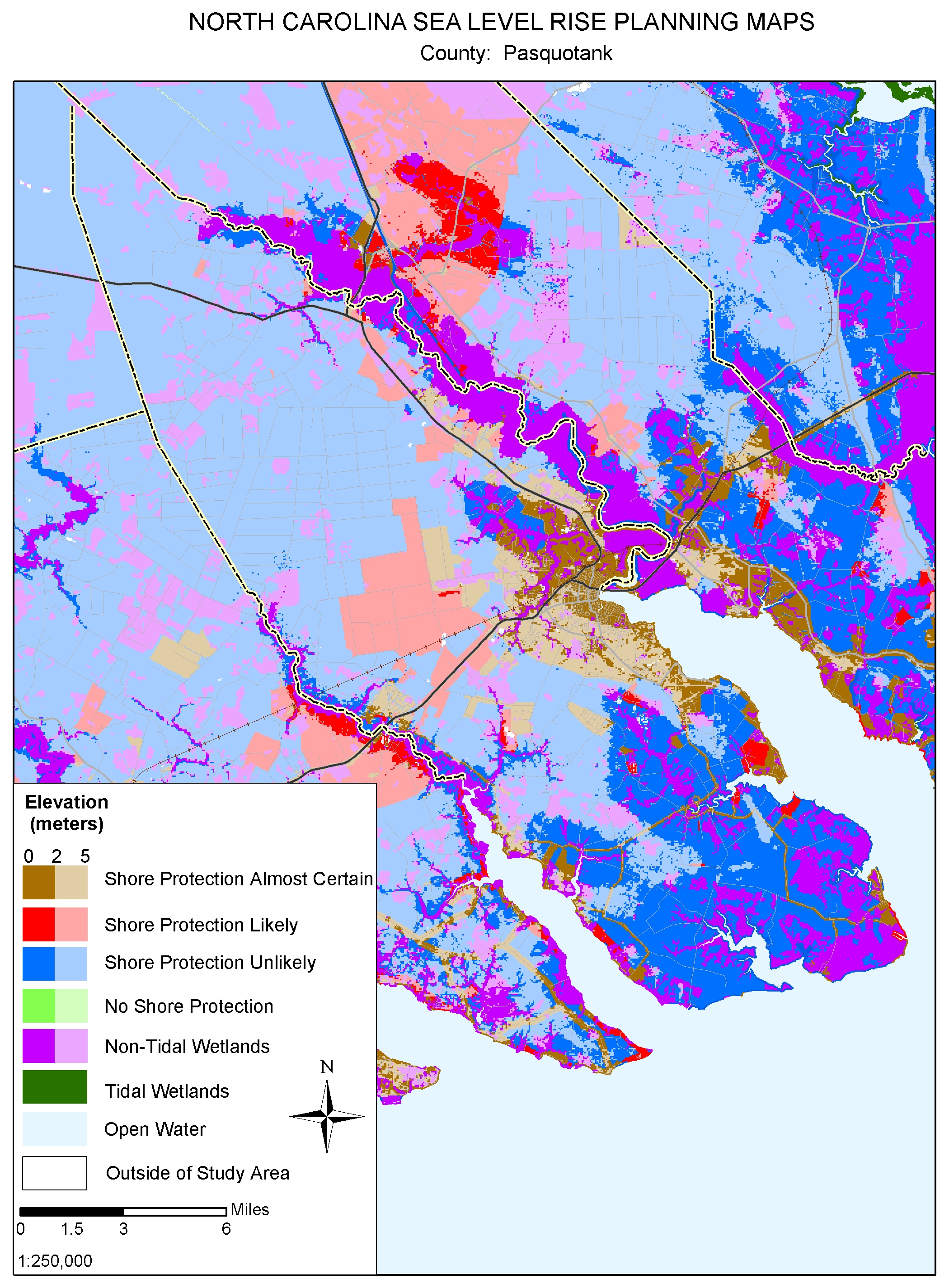
Coastal cities such as Wilmington, Manteo, Beaufort, and Morehead City would almost certainly be protected--at least for the first meter or two of sea level rise. Shore protection has been authorized for most of the developed Outer Banks, making it almost certain in some aras. Nevertheless, the lack of public access precludes public funds for shore protection in some areas, while isolated comunities such as Rodanthe are relatively expensive to protect. The National Park Service plans to allow shores to retreat along undeveloped portions of the Outer Banks, a committmnent backed up by a $10 million relocation of the Cape Hatteras Lighthouse. Most of the land vulnerable to sea level rise is along the Albemarele and Pamlico Sounds. These lands are lightly developed, with little immediate prospects for development except for land immediately along the shore front, Nevertheless, some agricultural areas in Tyrell and Hyde counties are protected with dikes, and Tyrell county expects to expand that practice as sea level rises. For further details, see the report by Clark et al. or the summary of North Carolina findings.
Several of the maps from this study can be downloaded individually by clicking on a thumbnail map below; the entire set is available in a zipped file. These jpg files were designed for printing at 300 dots per inch on 8-1/2 X 11 inch paper. If you simply click on the links below and try to read them on your computer screen, some of them may look strange, depending on your internet browser. If so, please save the jpg map onto your computer's hard drive and then open the file with the program you normally use to read jpg files.
|
The Whole Kitten Kaboodle |
The Mother Load of Maps | ||
|
|
|
|


