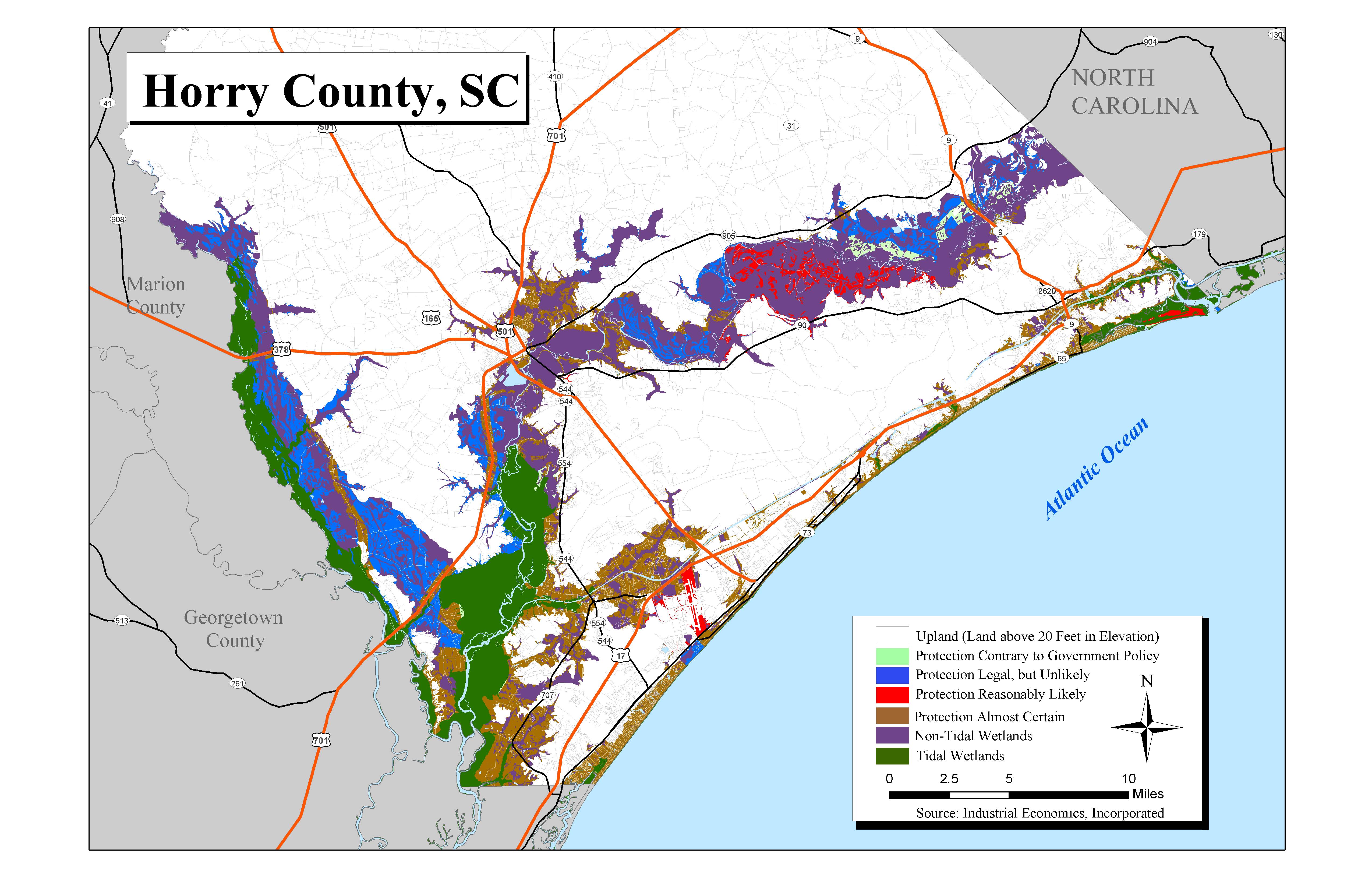
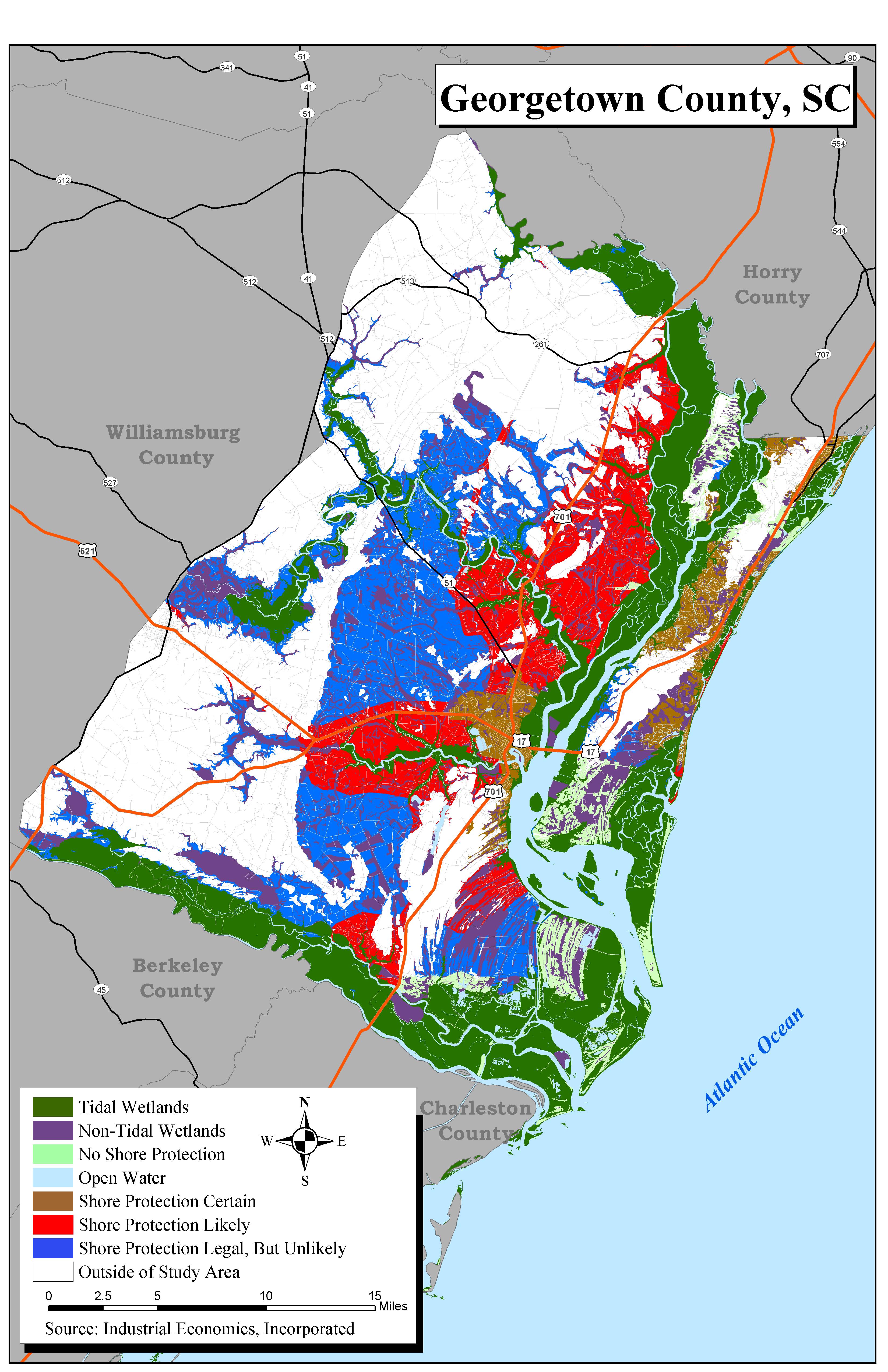
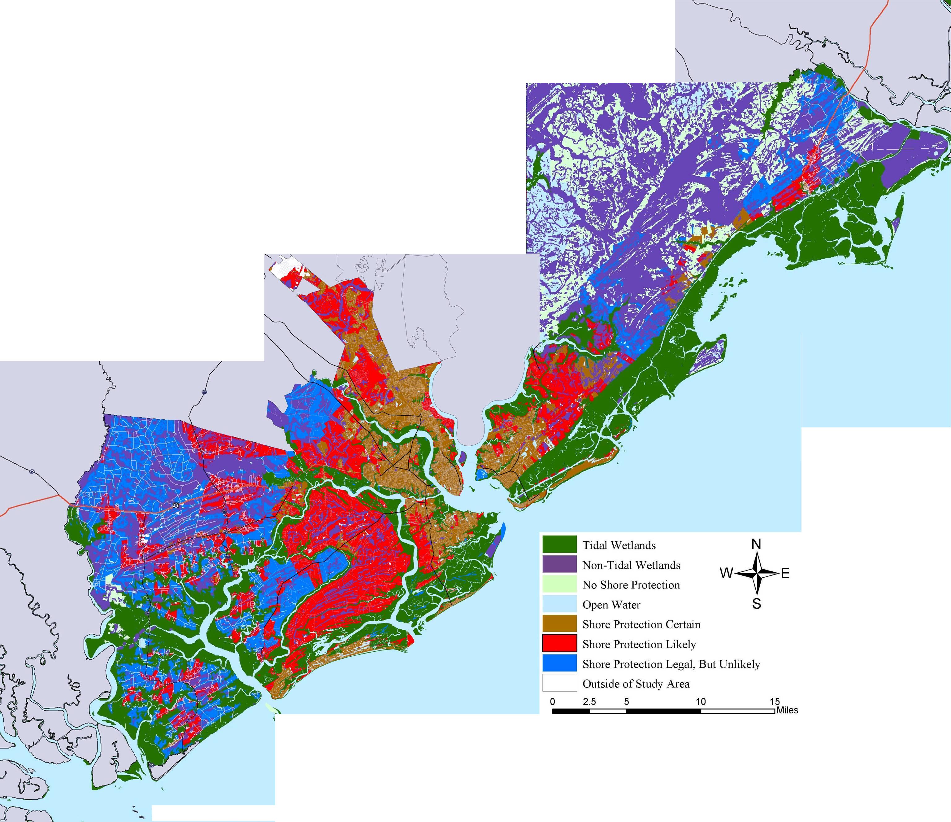
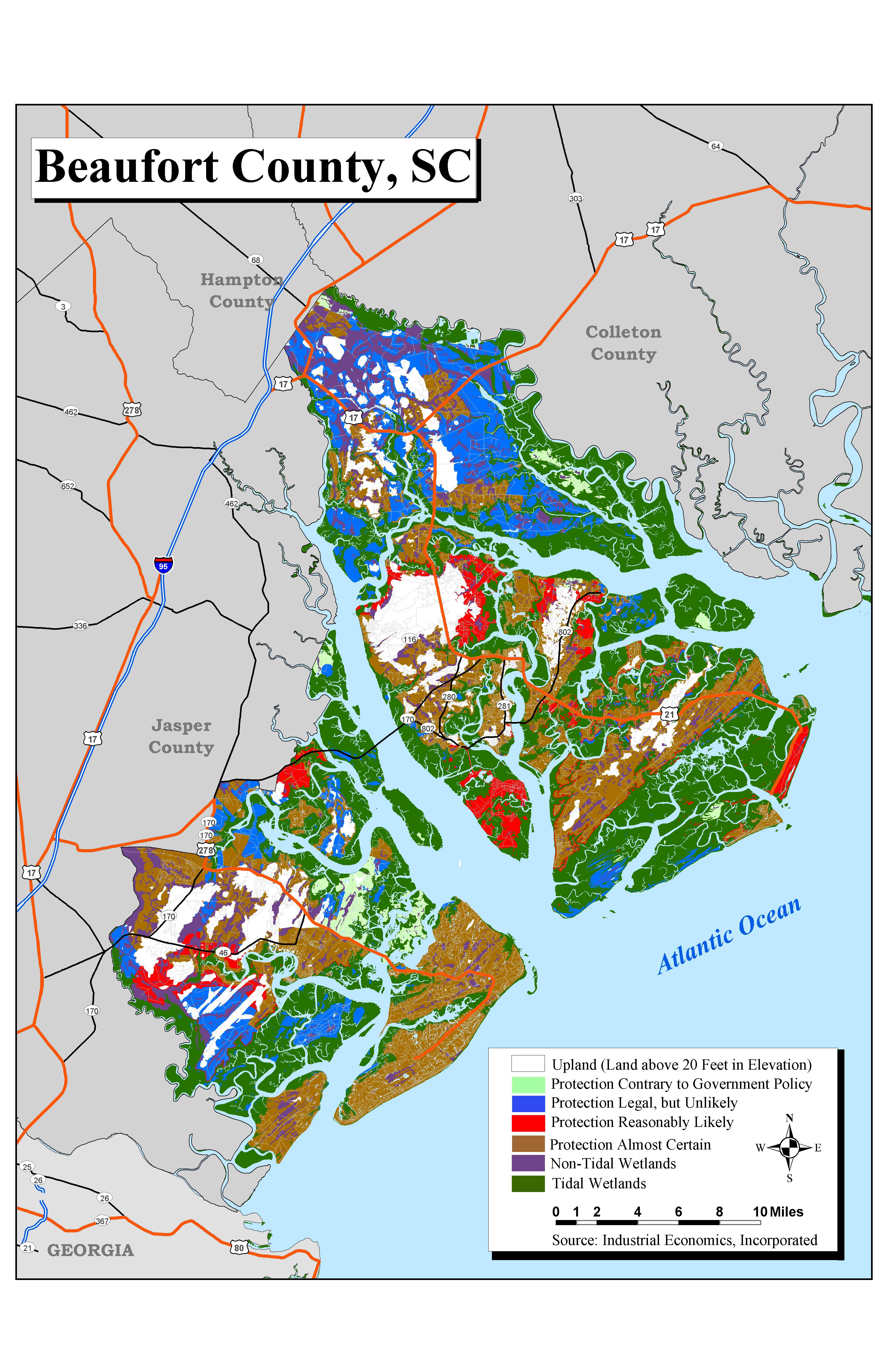
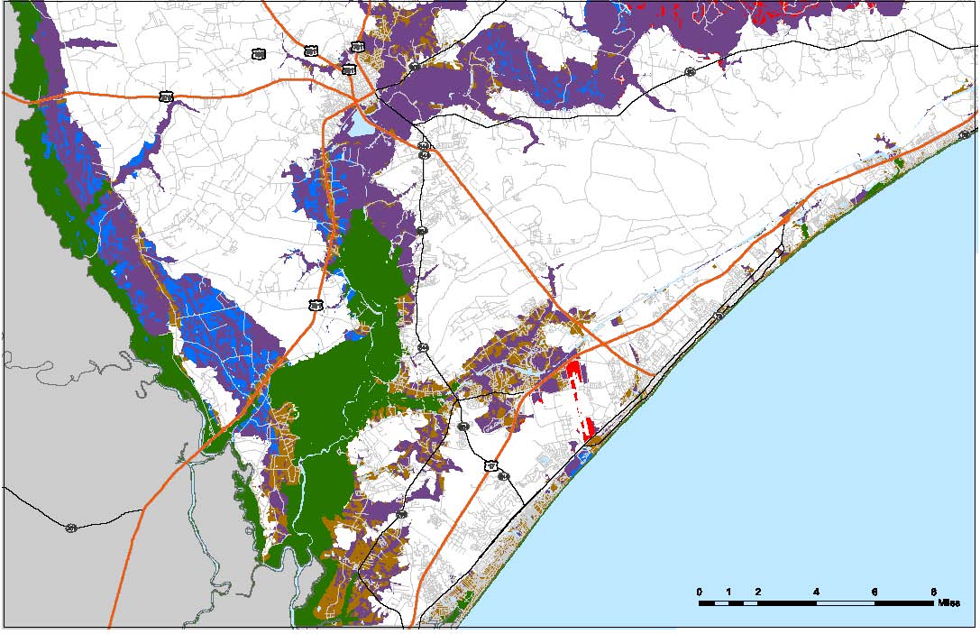
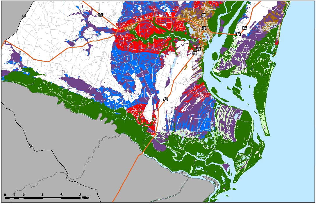
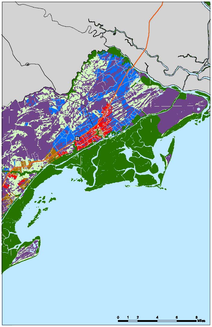
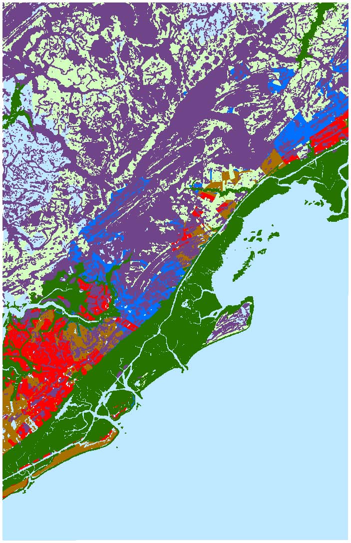
Maps depicting likelihood of shore protection along the South Carolina coast
From a new article in Environmental Research Letters
A $2 million effort to map the likelihood of shore protection as sea level rises is summarized in a new article entitled "State and local governments plan for development of most land vulnerable to rising sea level along the U.S. Atlantic Coast." The maps divide coastal low lands into four categories: developed (shore protection almost certain), intermediate (shore protection likely), undeveloped (shore protection unlikely), and conservation (no shore protection).
Coastal cities such as Charleston, Beaufort, and Myrtle Beach would almost certainly be protected--at least for the first meter or two of sea level rise. Shore protection has been authorized for the highly developed Grand Strand. Many of the developed barrier islands are privately owned with no public access and would be ineligible for federal funding, but the owners have spend their own money for beach nourishment on some of those islands. Inland from the ocean, there are large areas of conservation lands, especially between Charleston and the North Carolina border. Athough there are no immediate prospects for developing the large area of private lands, neither local zoning nor state law would prevent those areas from eventually becoming developed. For further details, see the sea level rise planning study by Matheny et al.
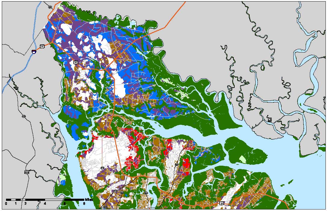
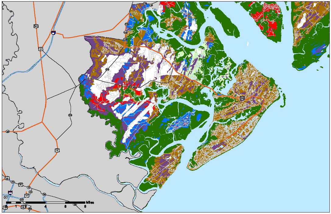
Example maps from this study can be downloaded individually as jpgs or pdfs by clicking on the links below; the entire set is available in a zipped file. The maps were designed for printing at 300 dots per inch on 11 X 17 inch paper.
|
The Whole Kitten Kaboodle |
The Mother Load of Maps |
||
|
|
|
|
|
|
|
|
|