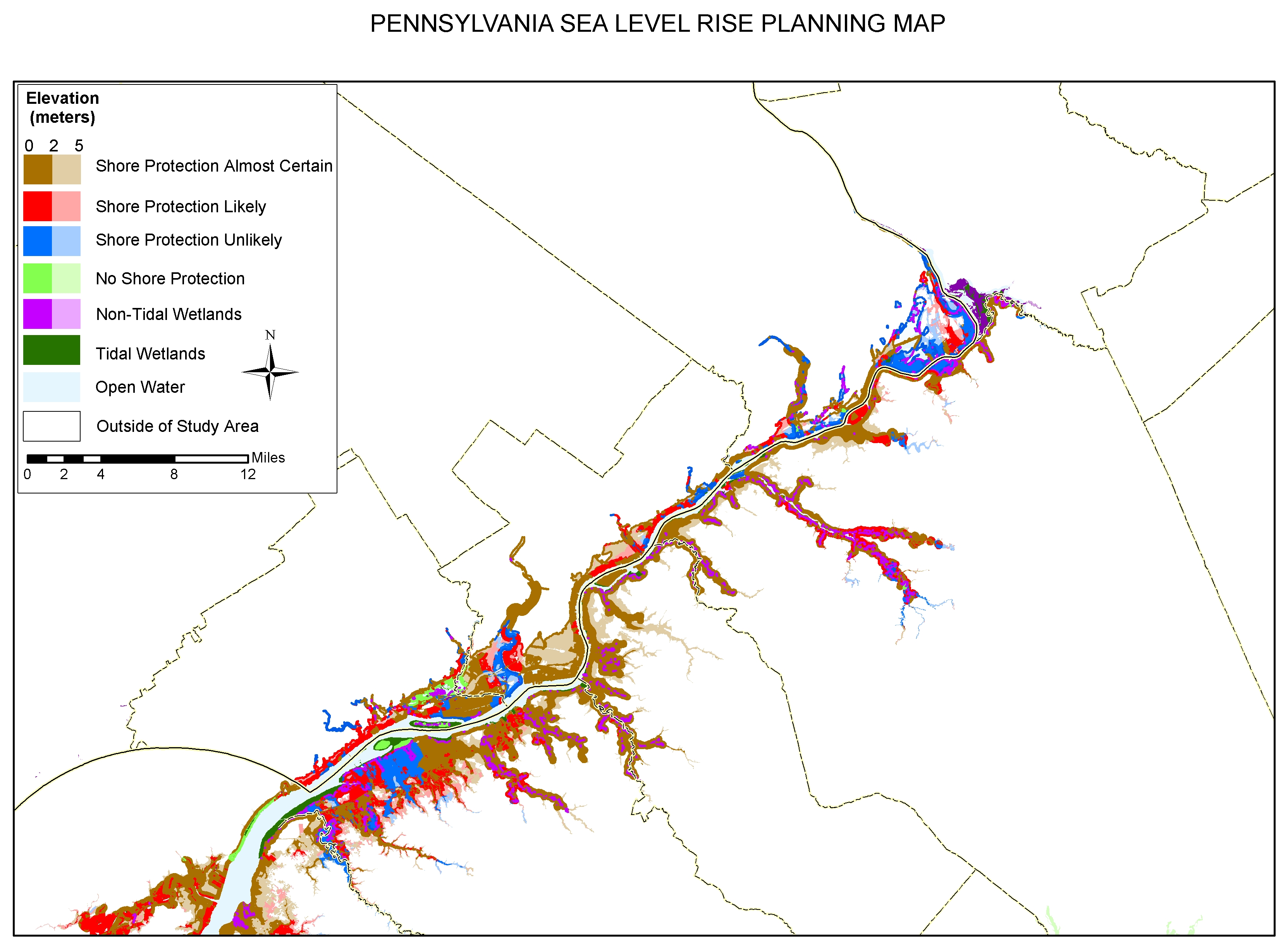
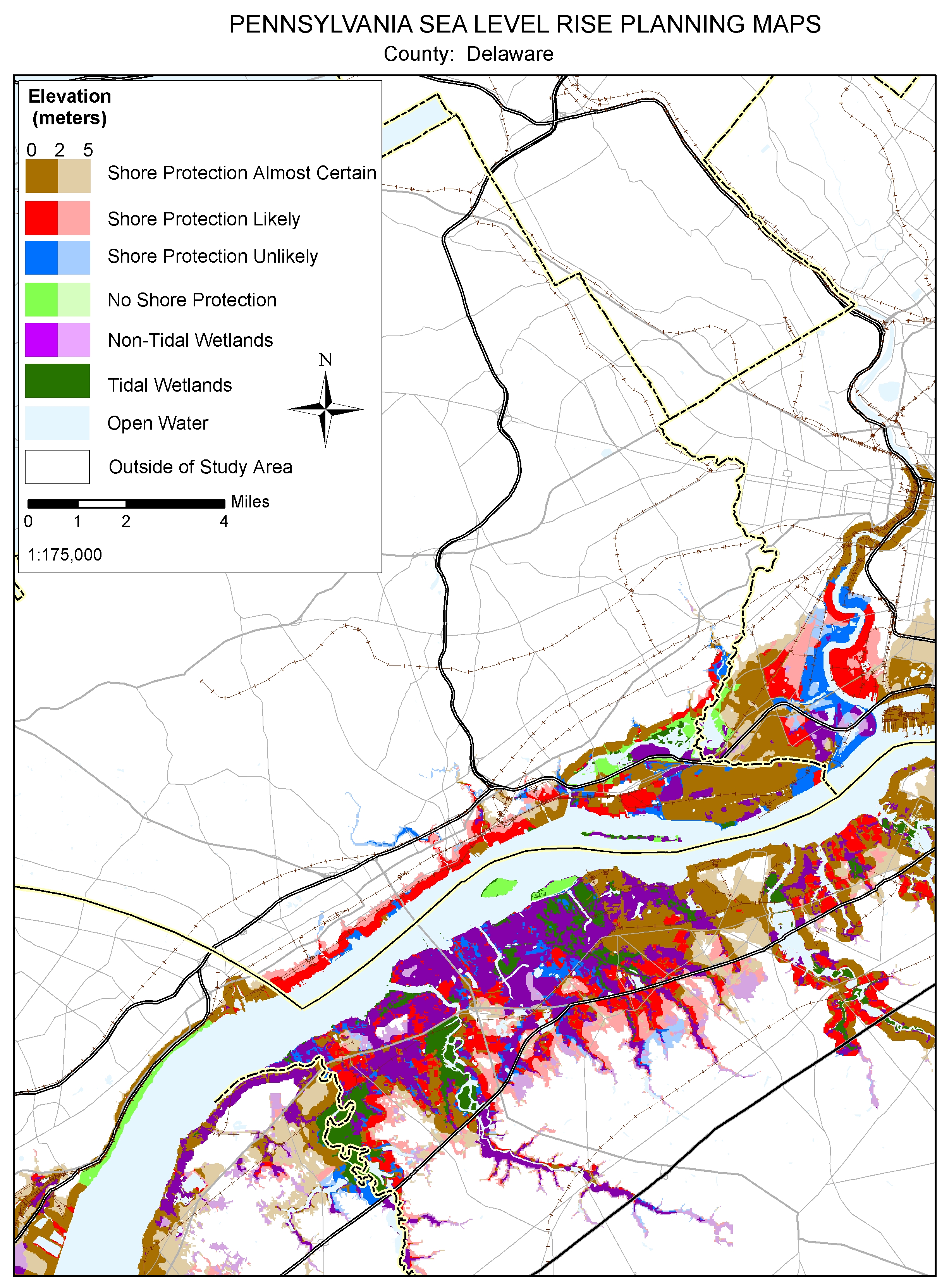
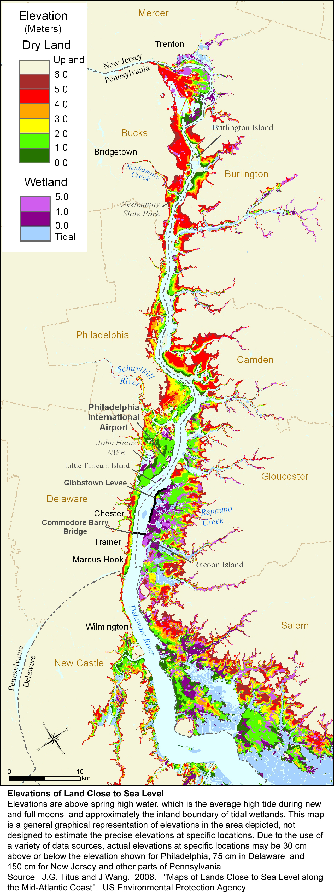
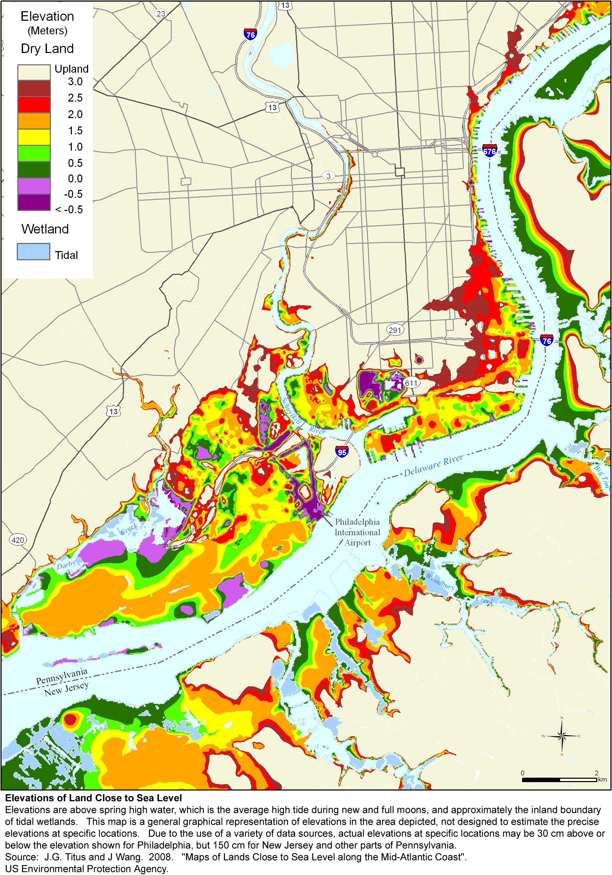
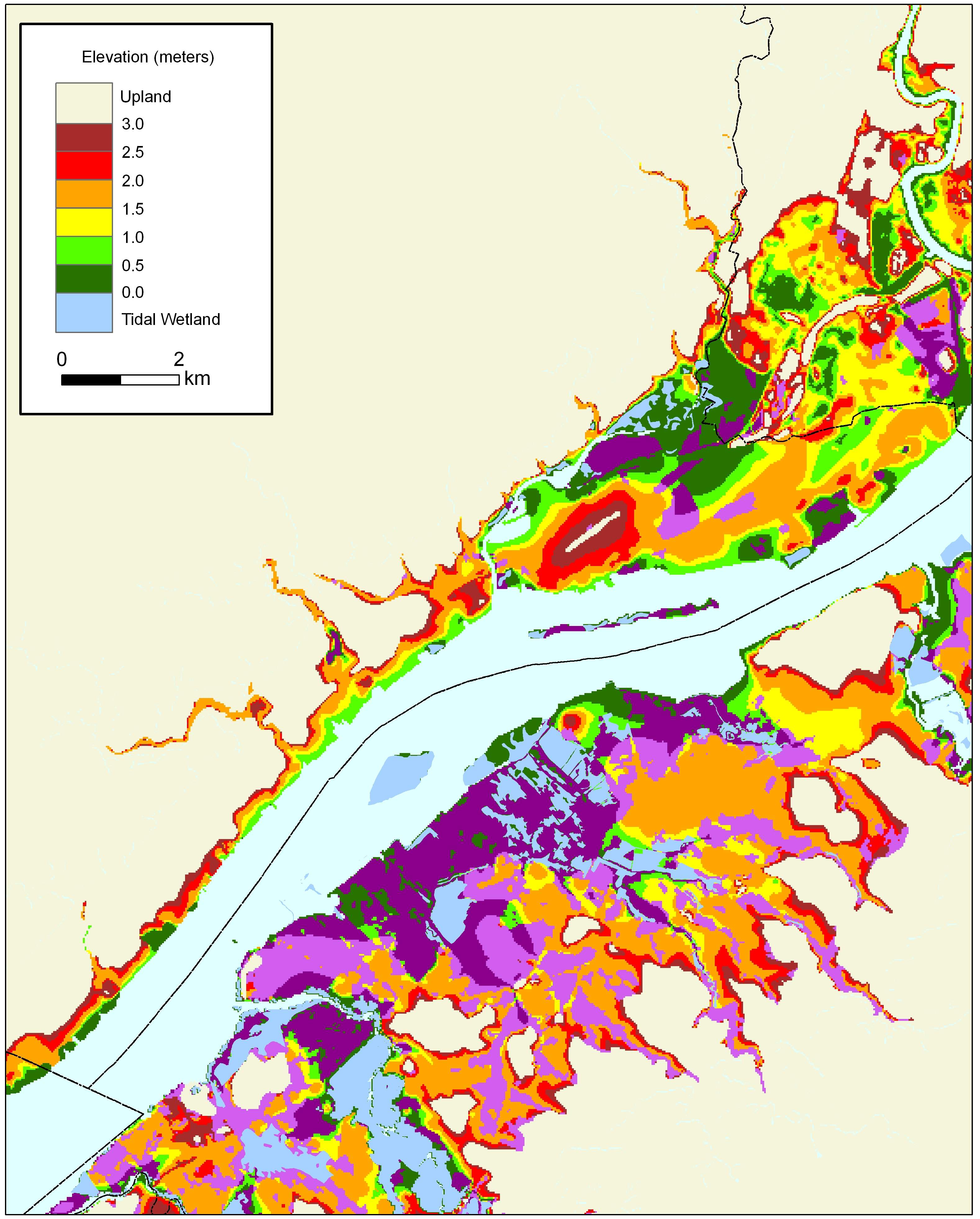
Maps depicting likelihood of shore protection along the Pennsylvania shores of the Delaware River from a new article in Environmental Research Letters
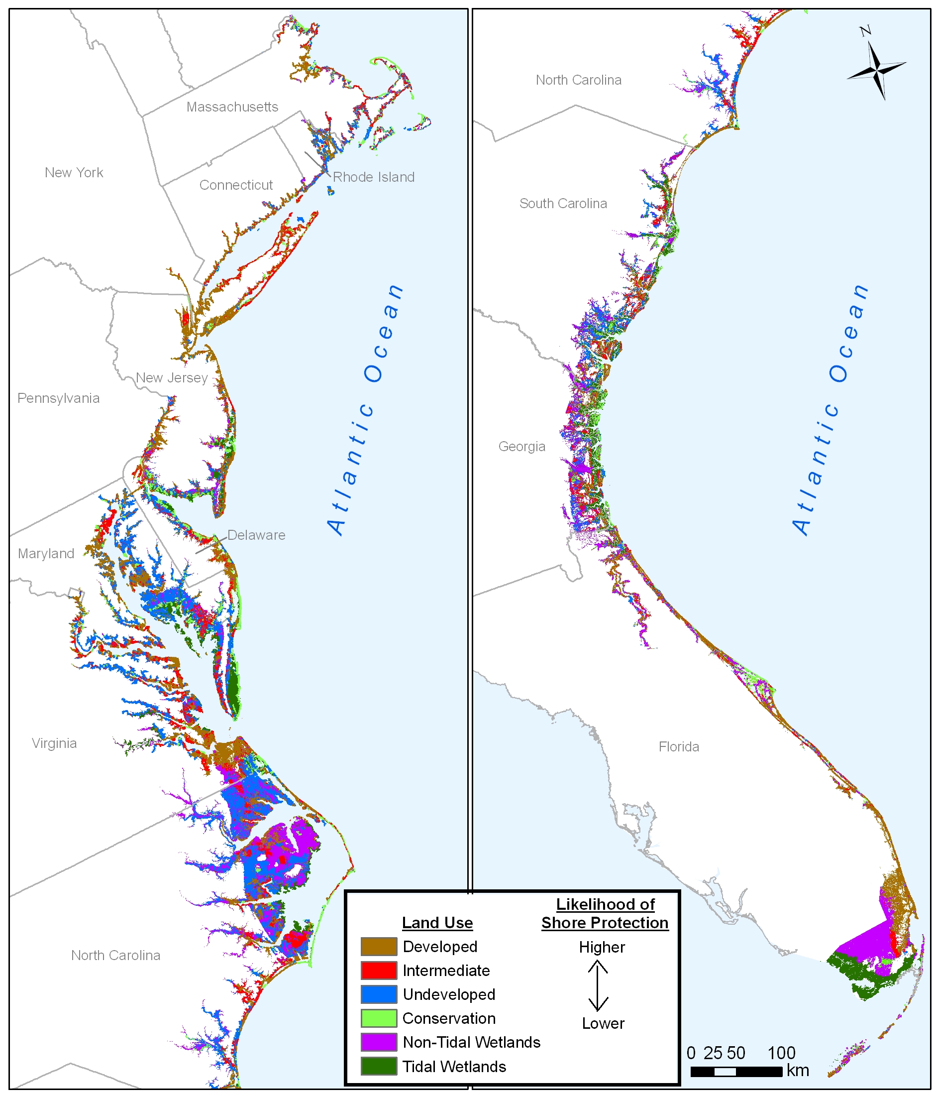
A $2 million effort to map the likelihood of shore protection as sea level rises is summarized in a new article entitled "State and local governments plan for development of most land vulnerable to rising sea level along the U.S. Atlantic Coast." The maps divide coastal low lands into four categories: developed (shore protection almost certain), intermediate (shore protection likely), undeveloped (shore protection unlikely), and conservation (no shore protection). The Delaware Valley Regional Planning Council undertook the analysis for coastal Pennsylvania. Although most of the Pennsylvania shore is developed, aging industrial facilities are likely to be replaced in many areas with mixed use and residential development emphasizing public access to the shore. Such redevelopment will offer an opportunity to move back from the shore. As a result, those lands were viewed as likely--but not certain--to be protected. For further details, see the report by Chris Linn or the summary of Pennsylvanis findings.
The maps from this study can be downloaded individually by clicking on a thumbnail map below; the entire set is available in a zipped file. These jpg files were designed for printing at 300 dots per inch on 8-1/2 X 11 inch paper. If you simply click on the links below and try to read them on your computer screen, some of them may look strange, depending on your internet browser. If so, please save the jpg map onto your computer's hard drive and then open the file with the program you normally use to read jpg files.
|
The Whole Kitten Kaboodle |
The Mother Load of Maps |
||


