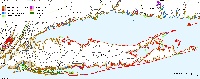
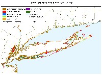
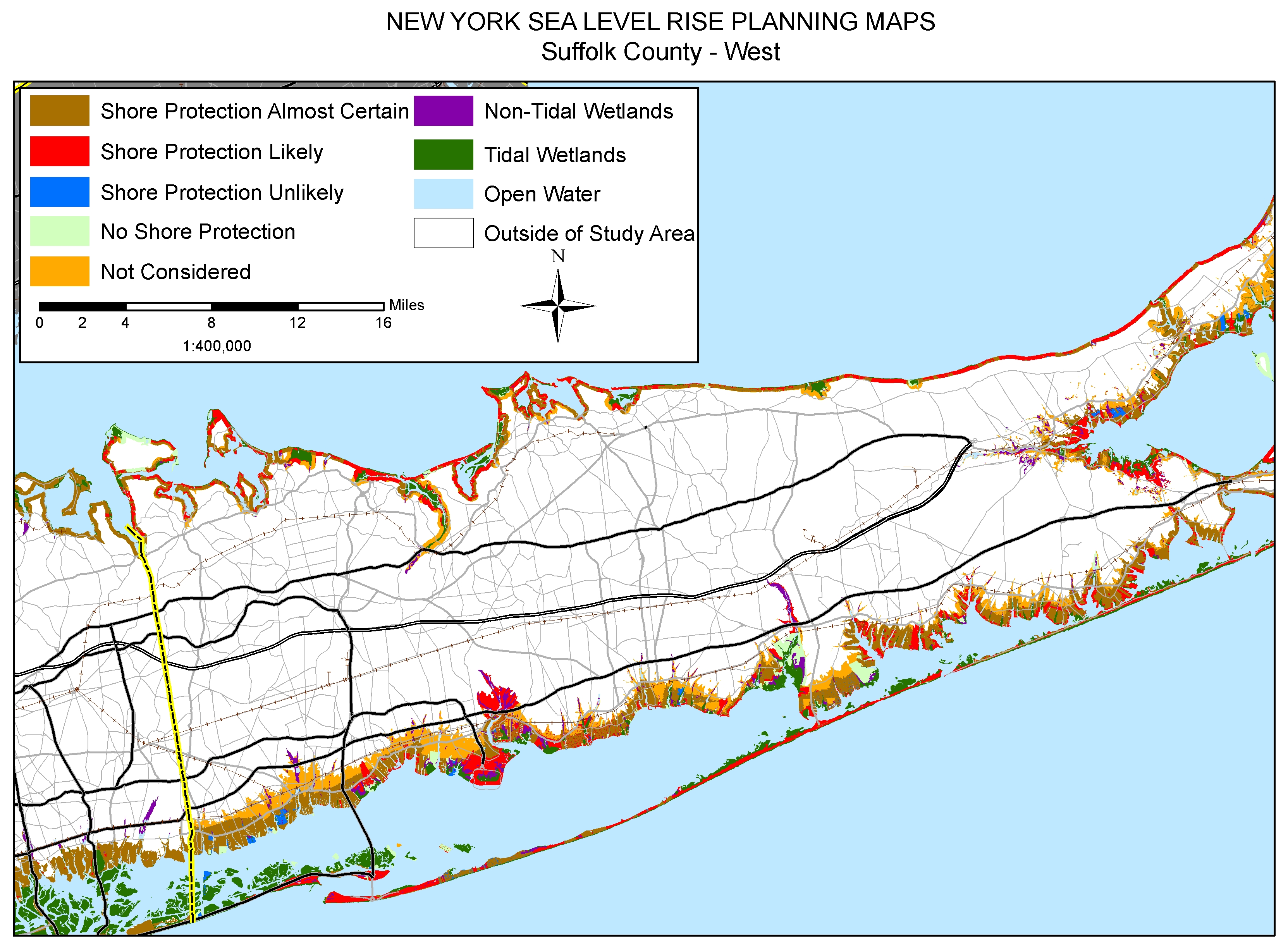
Maps depicting likelihood of shore protection along the New York shoreline from a new article in Environmental Research Letters
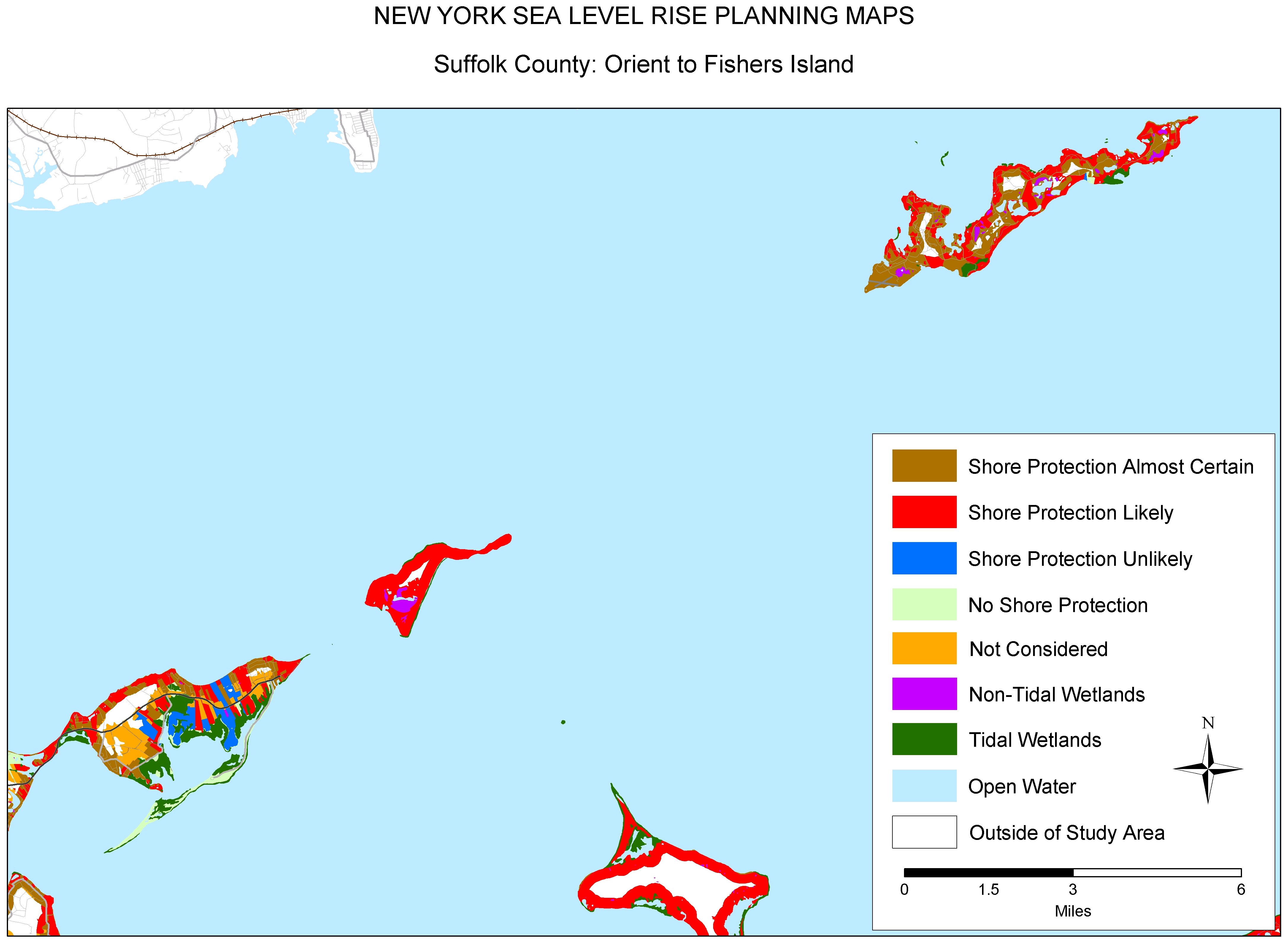
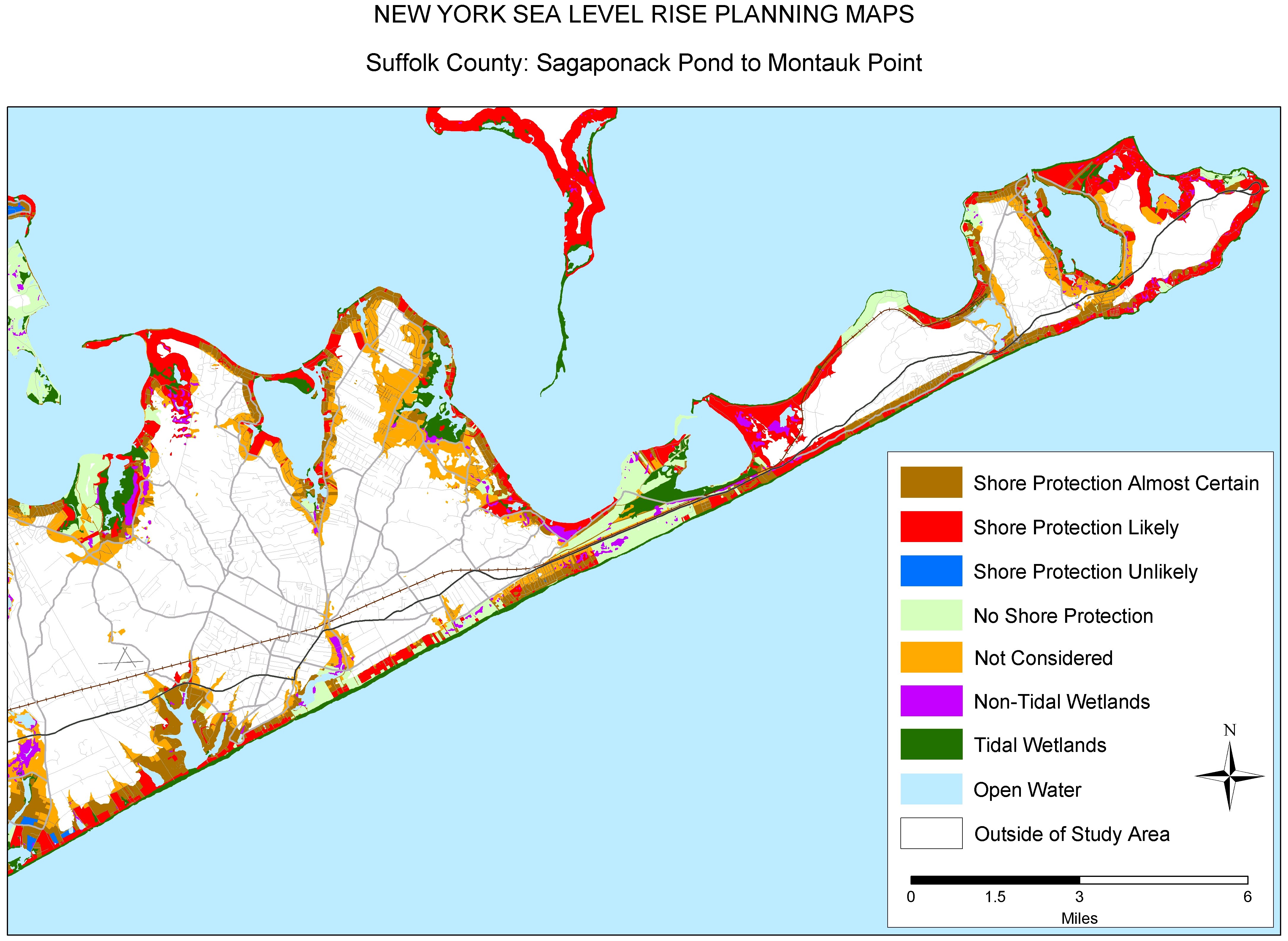
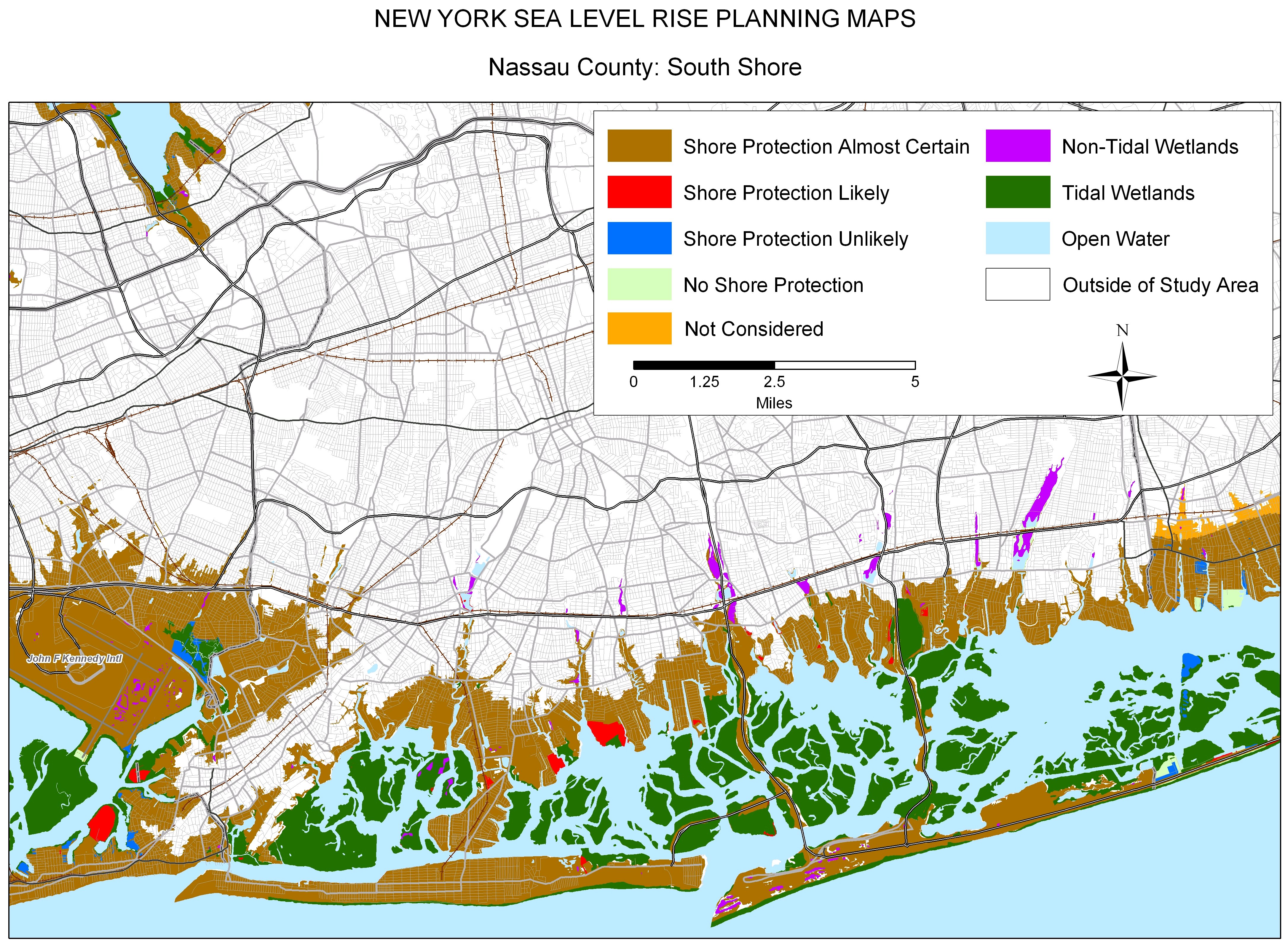
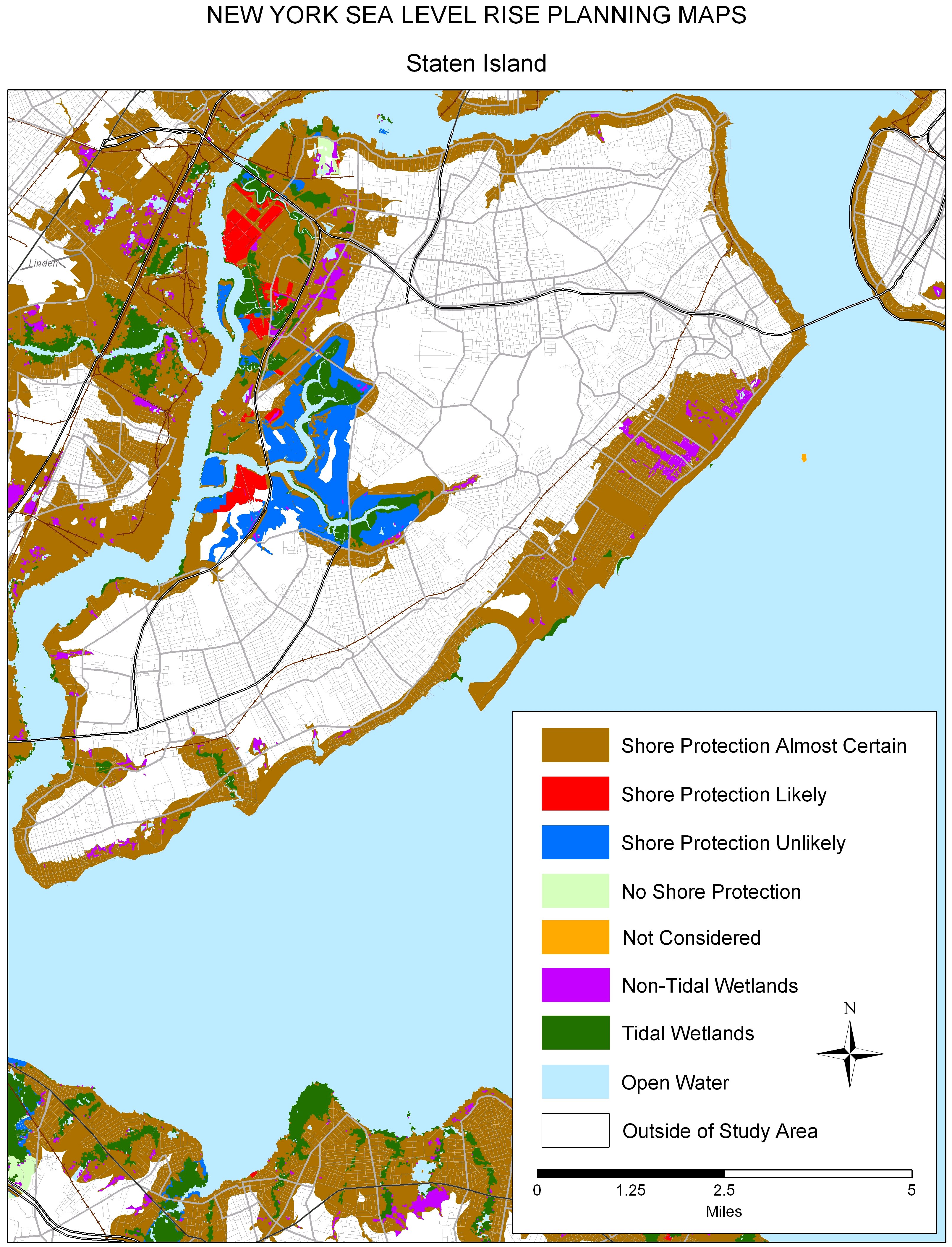
A $2 million effort to map the likelihood of shore protection as sea level rises is summarized in a new article entitled "State and local governments plan for development of most land vulnerable to rising sea level along the U.S. Atlantic Coast." The maps divide coastal low lands into four categories: developed (shore protection almost certain), intermediate (shore protection likely), undeveloped (shore protection unlikely), and conservation (no shore protection).
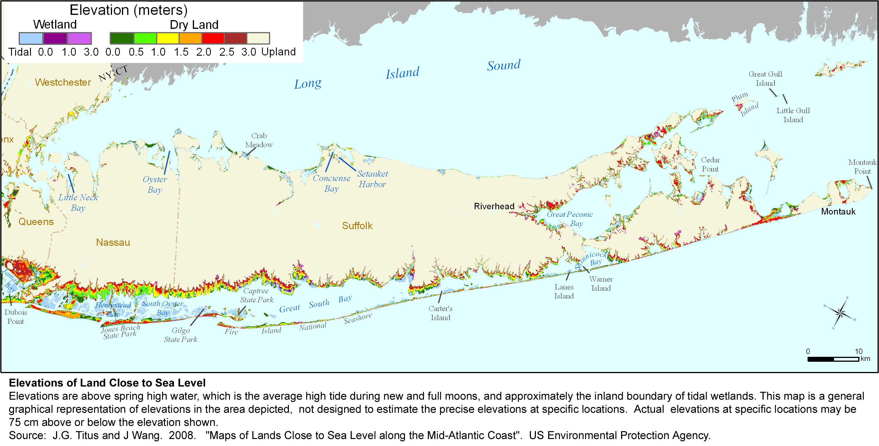
New York Seagrant prepared the maps for New York based on land use data and other information provided by local governments. Most lands in densely developed New York City and Westchester County--as well as the mainland of Nassau County, are almost certain to be protected. Many of the lightly developed barrier islands are likely to be protected either because of major through roads or the risk to the densely populated mainland from allowing the barrier islands to disintegrate. For additional details, see the report by Jay Tanski or the summary of statewide findings
Several of the maps from this study can be downloaded individually by clicking on a thumbnail map below; the entire set is available in a zipped file. This page provides maps jpg files designed for printing at 300 dots per inch on 8-1/2 X 11 inch paper. If you simply click on the links below and try to read them on your computer screen, some of them may look strange, depending on your internet browser. If so, please save the jpg map onto your computer's hard drive and then open the file with the program you normally use to read jpg files.
|
The Whole Kitten Kaboodle |
|
|
The Mother Load of Maps |
|
|
|
||||
|
|


