!

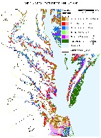
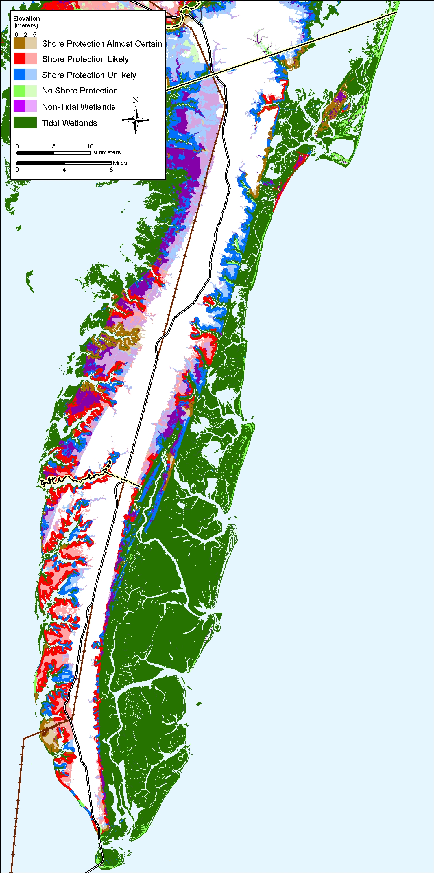
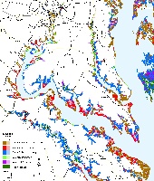
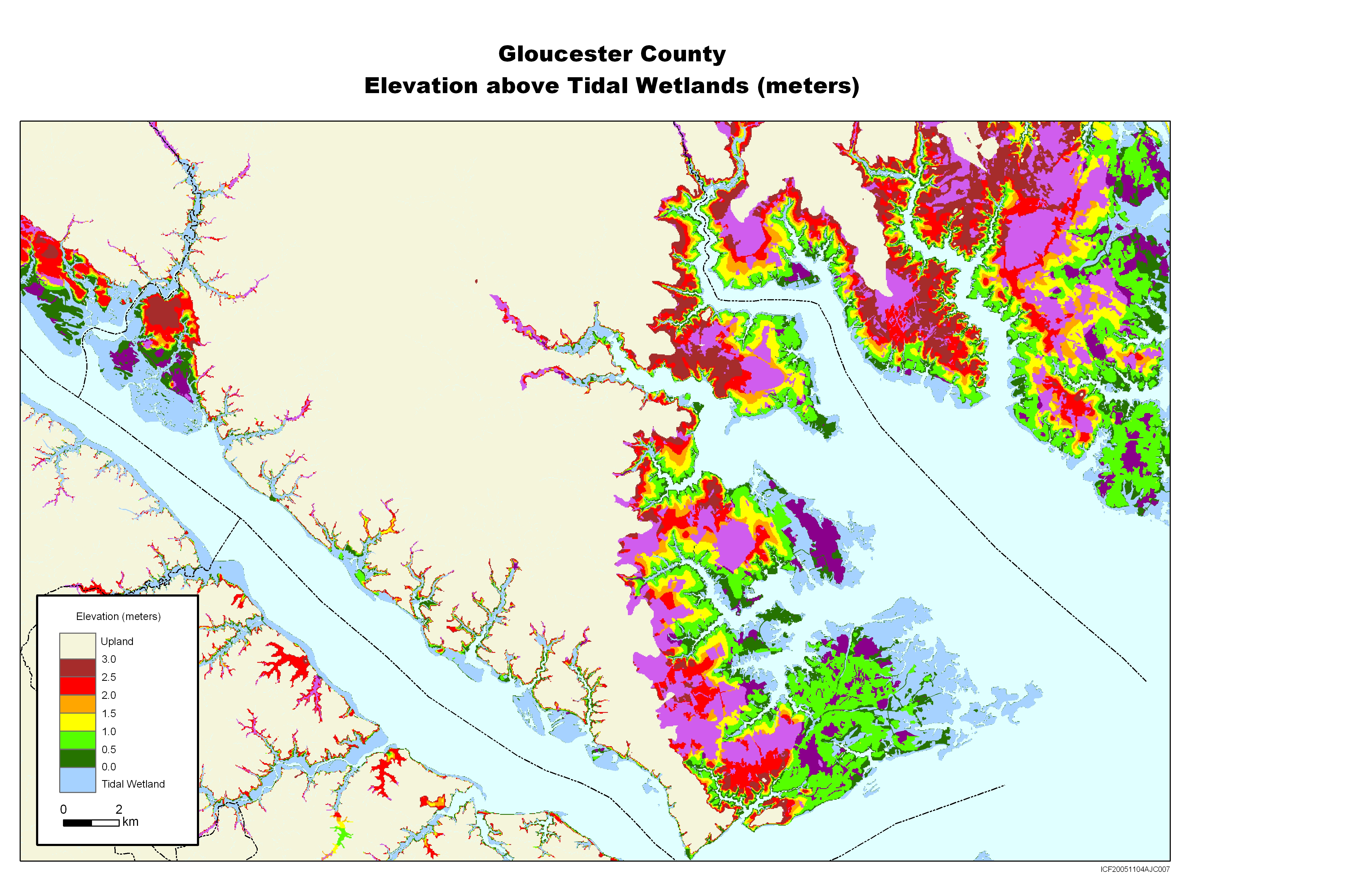
Maps depicting likelihood of shore protection along the Virginia coast

From a new article in Environmental Research Letters

!

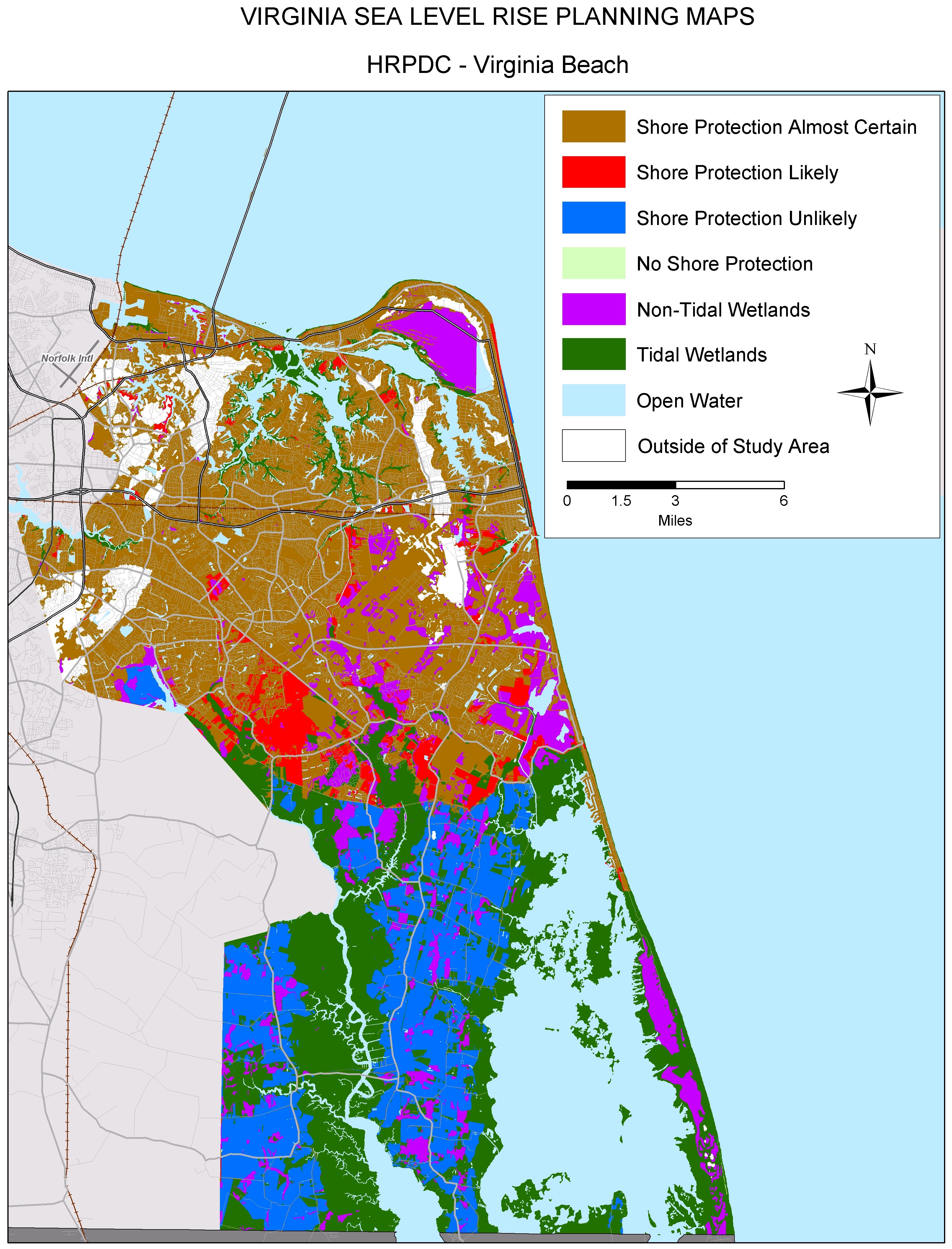
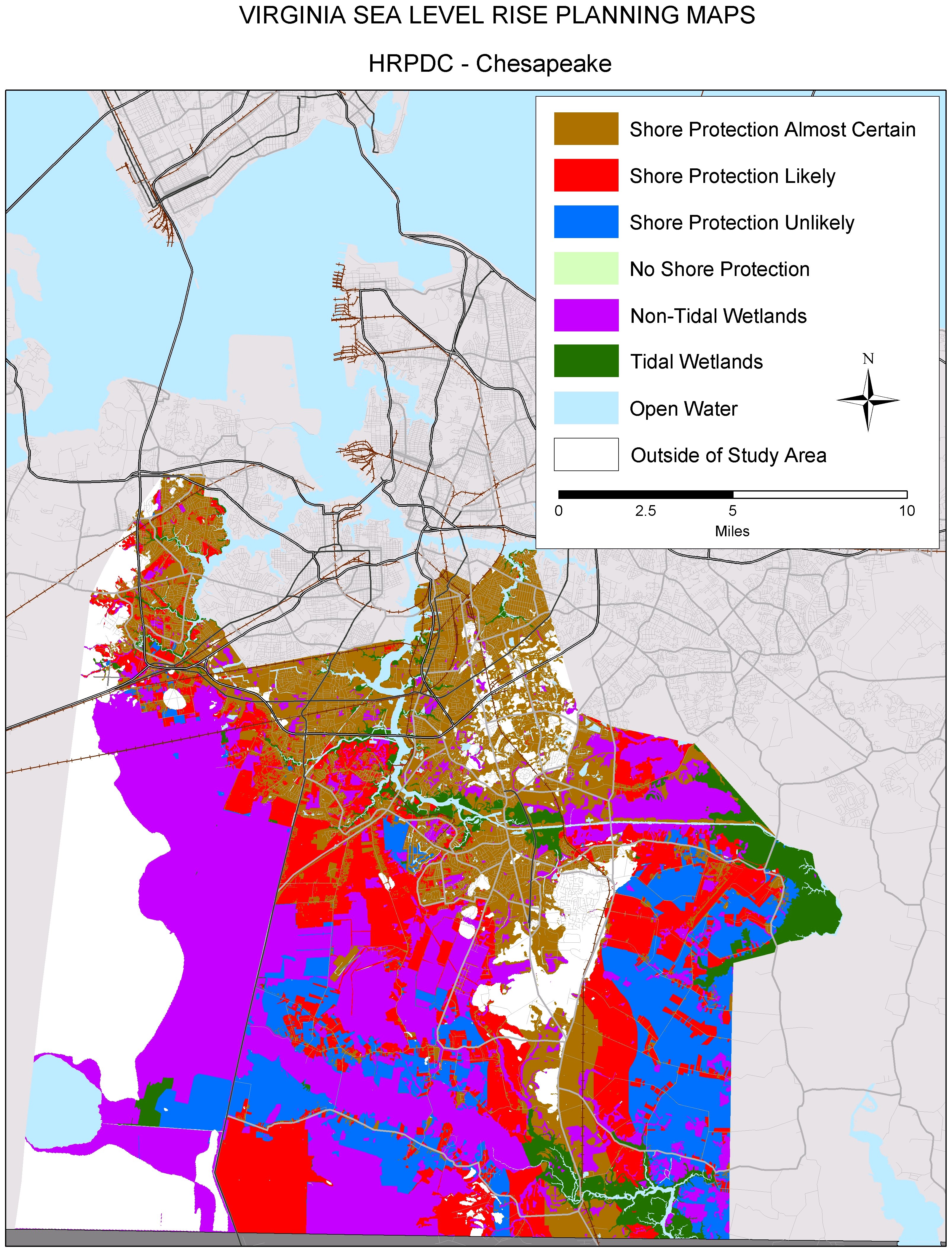
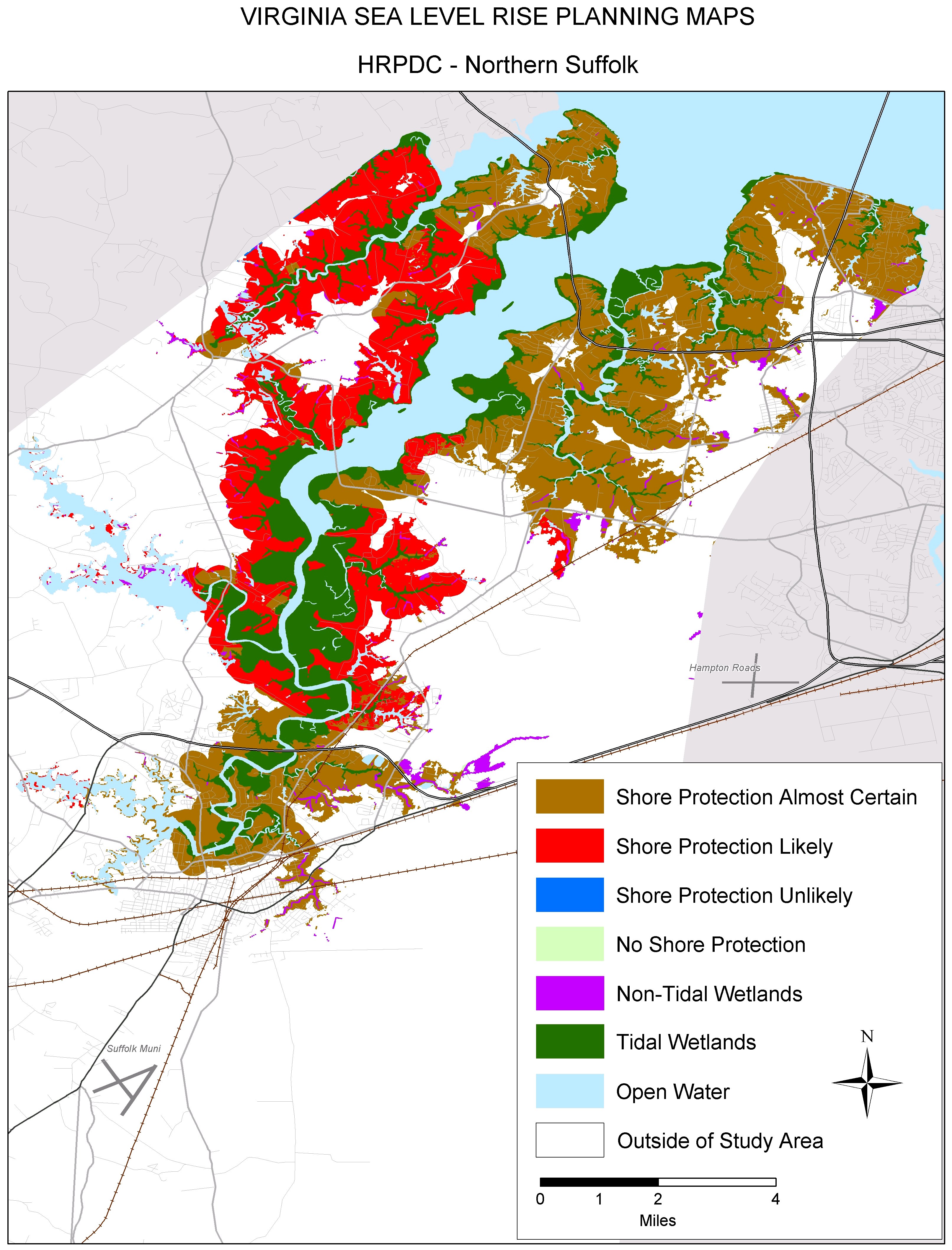
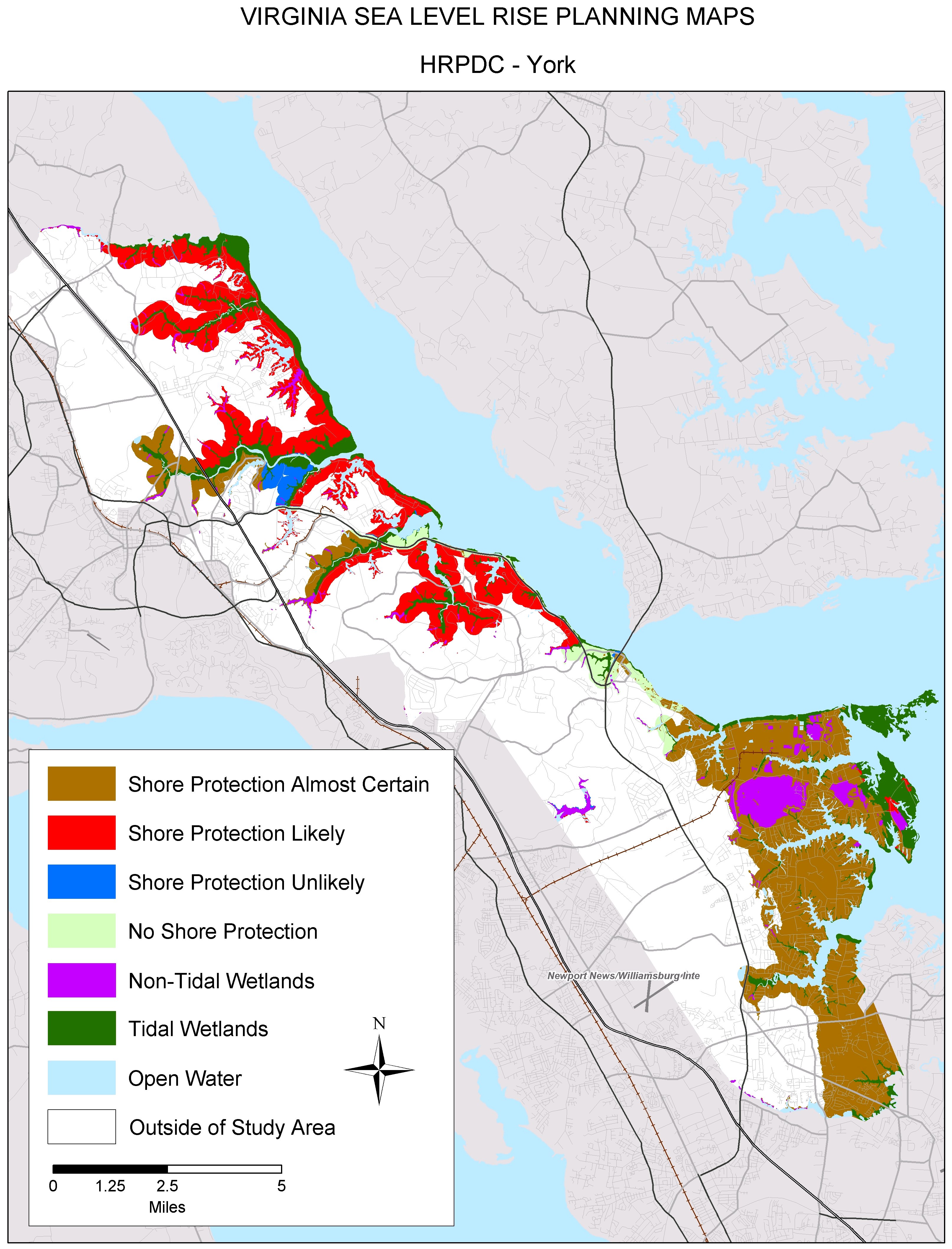
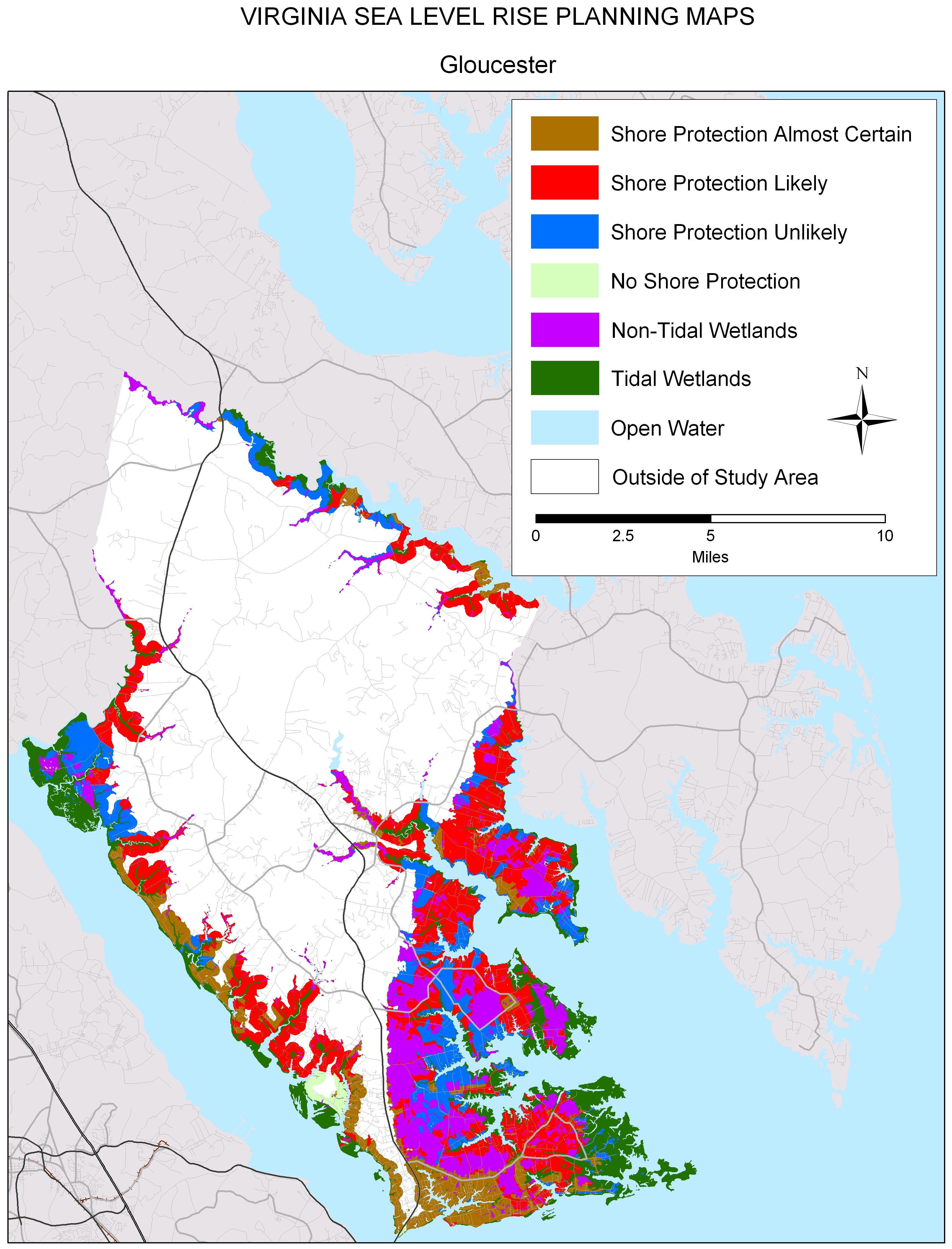
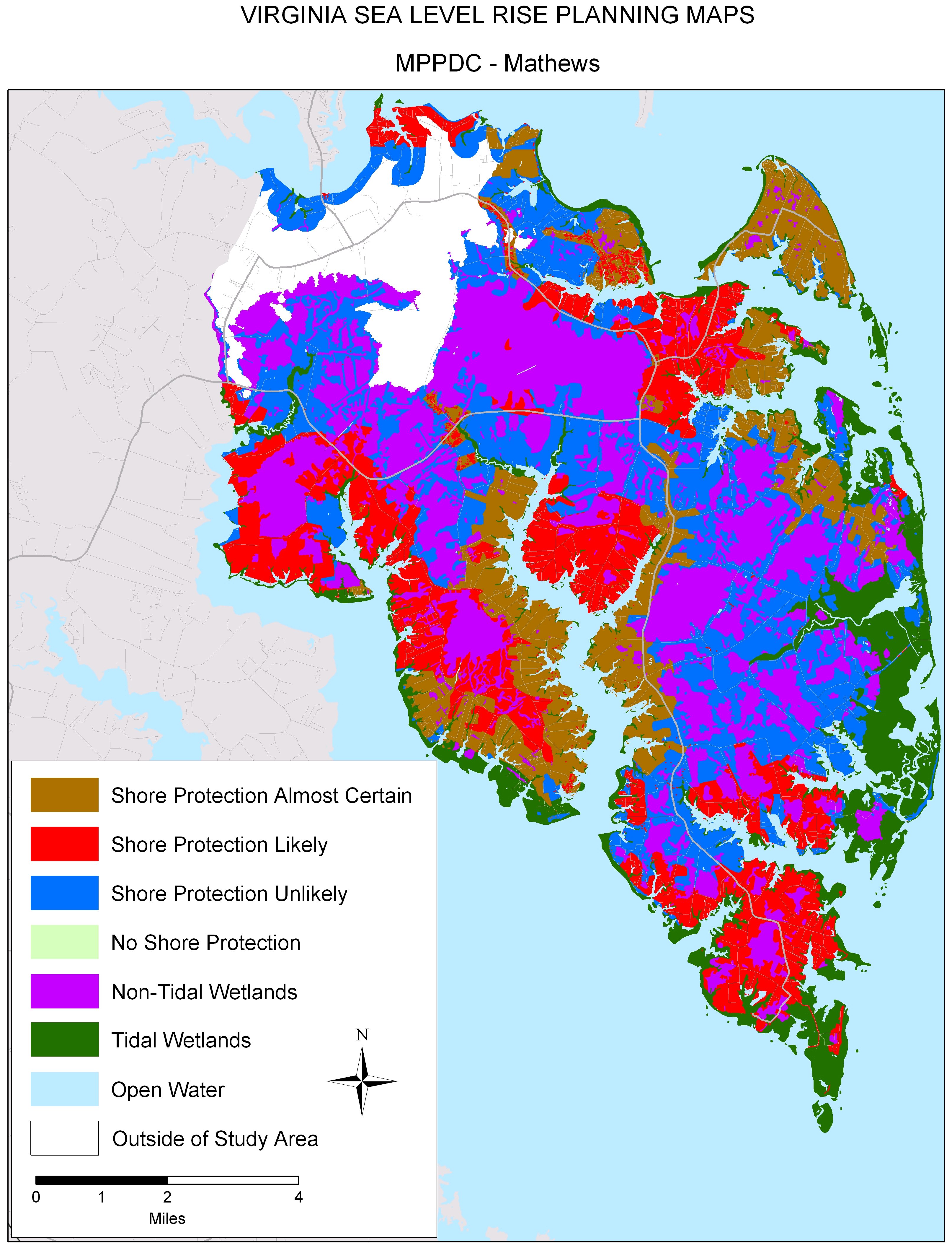
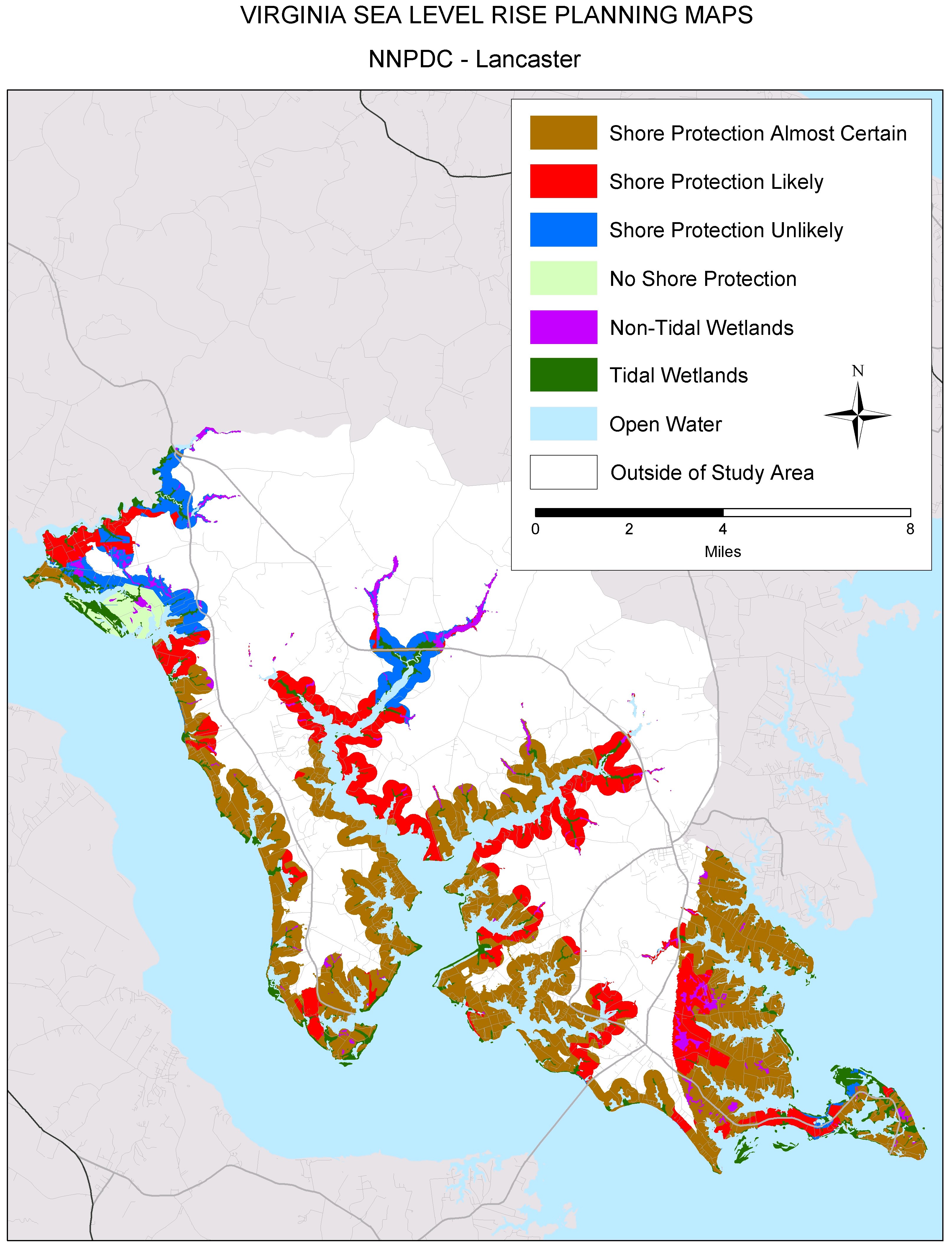
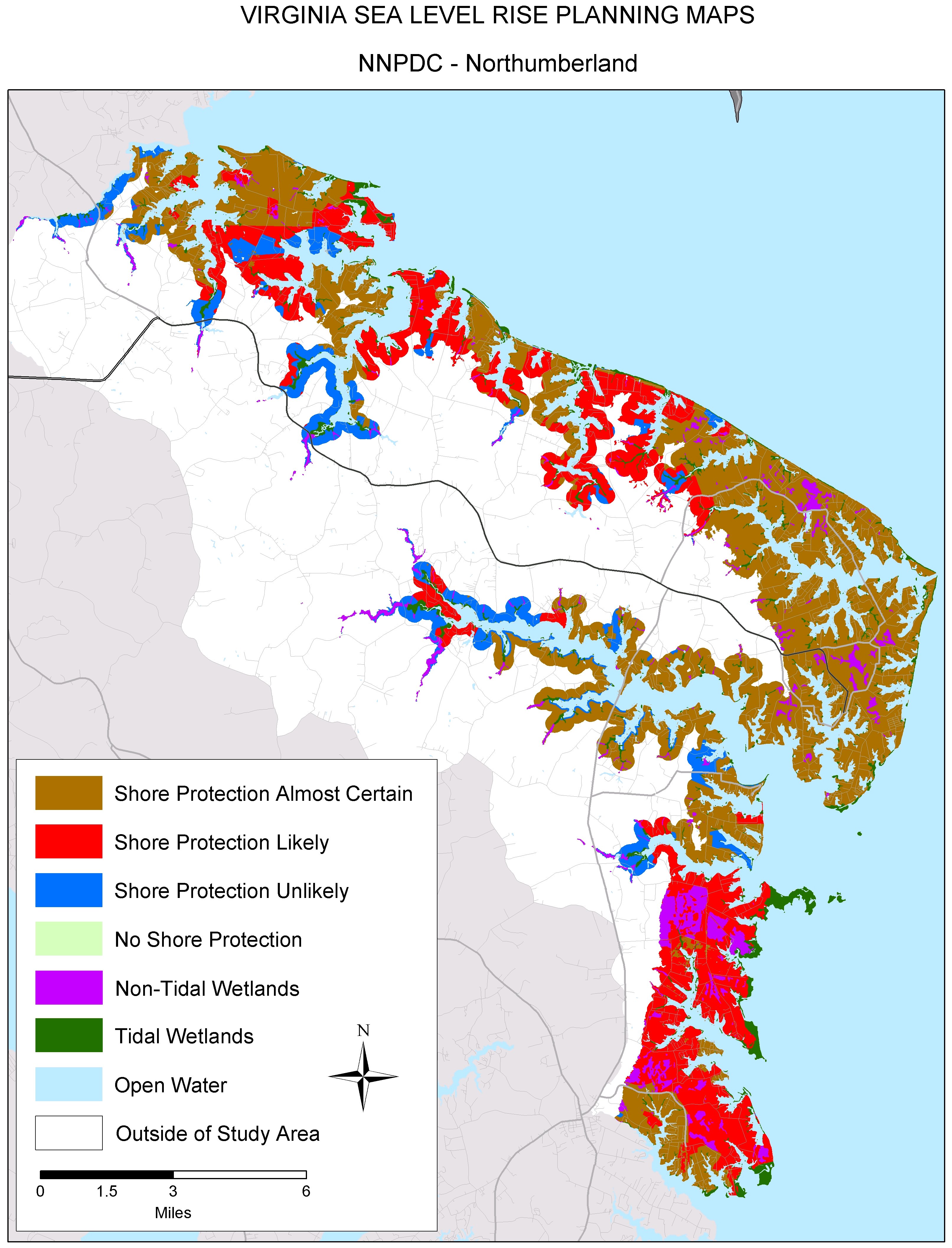
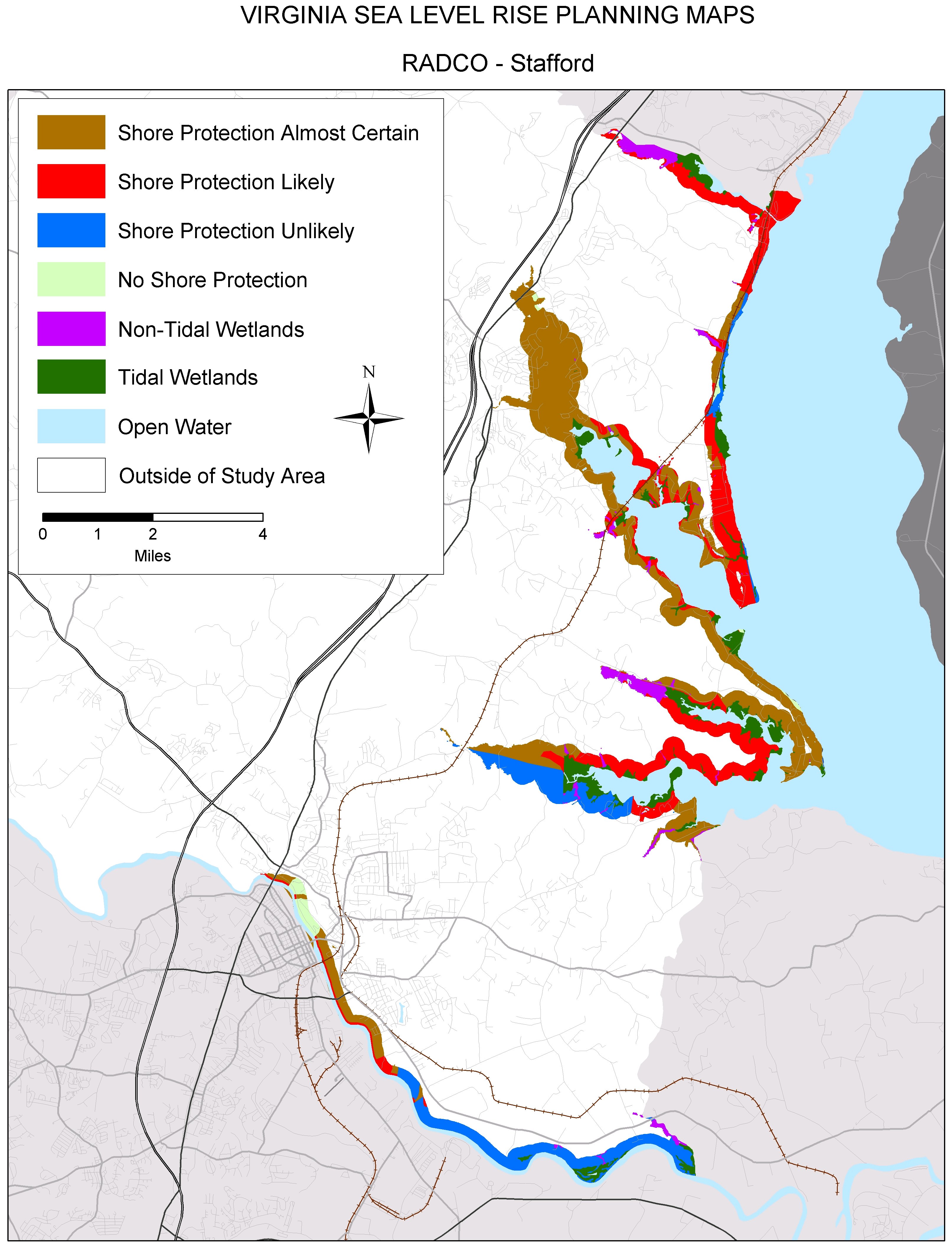
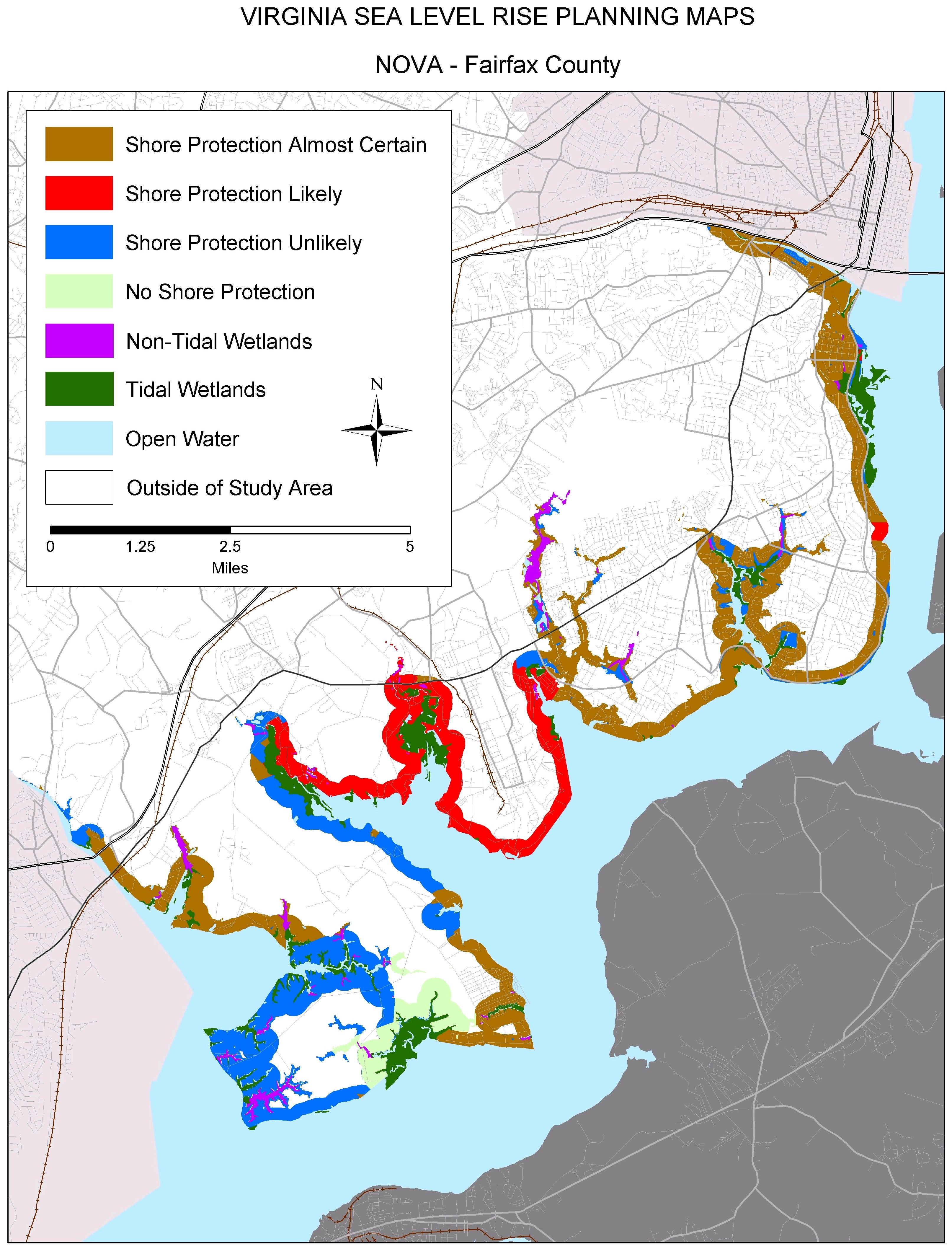
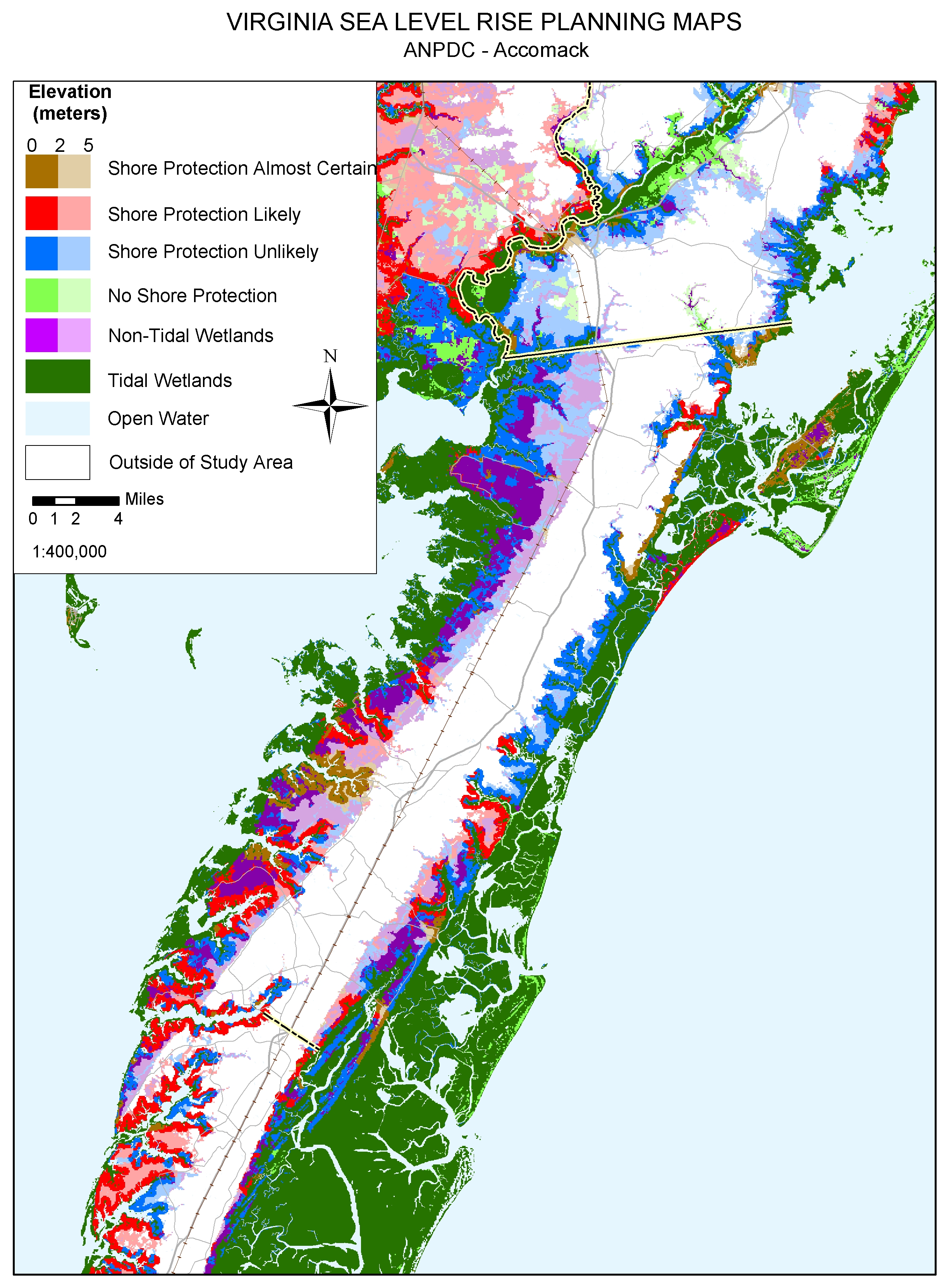
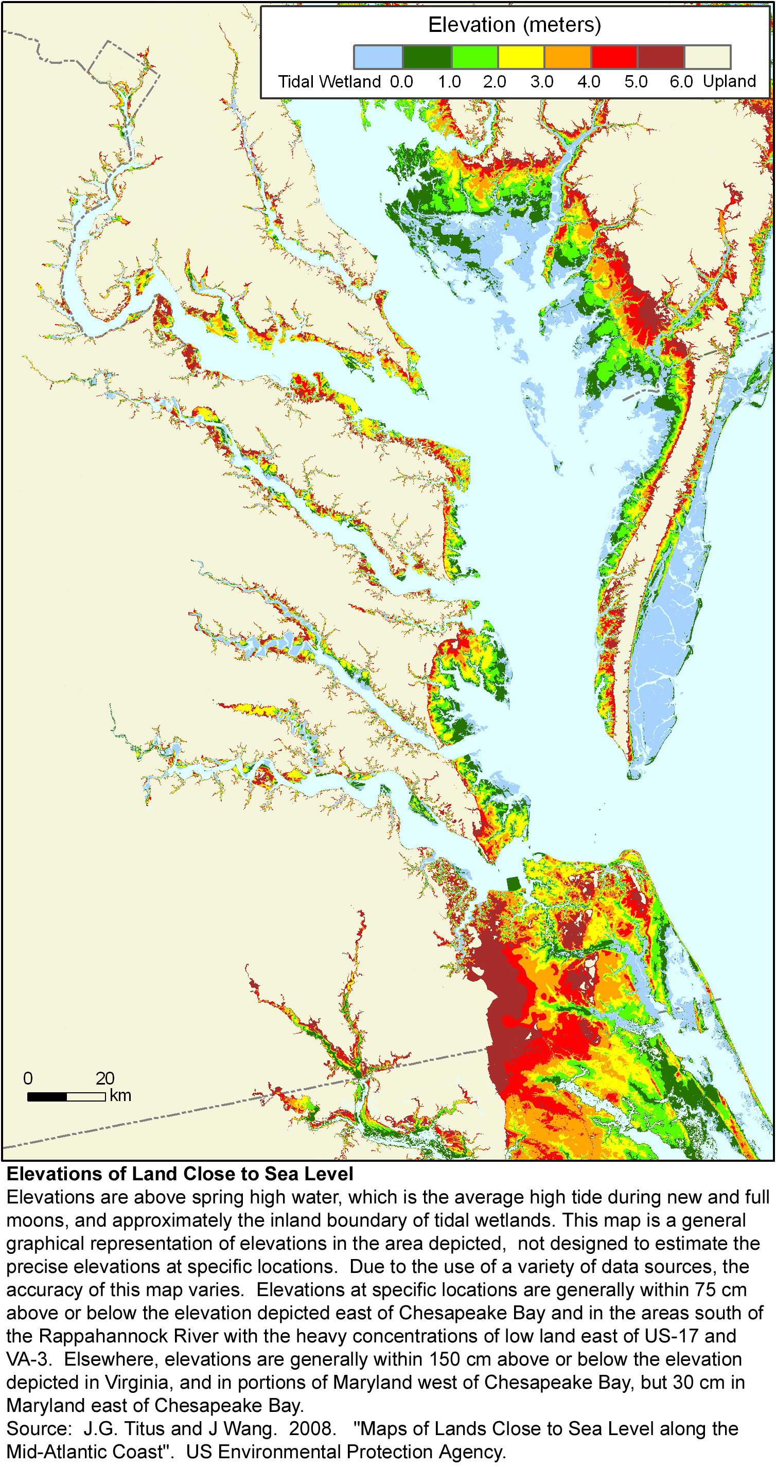
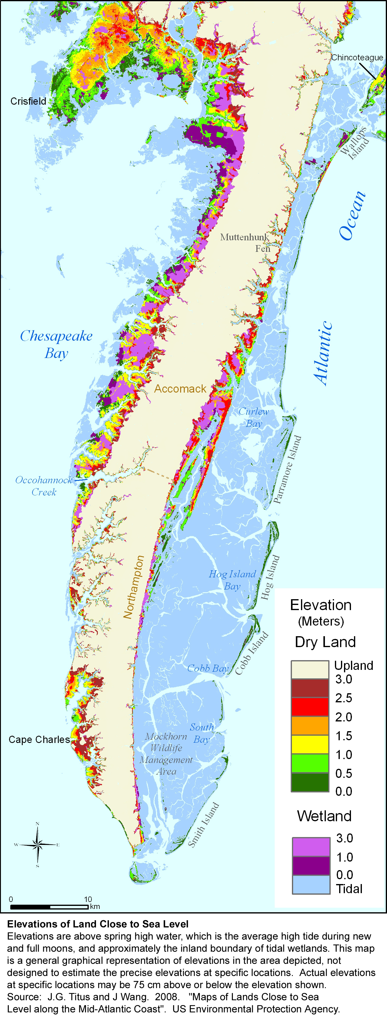
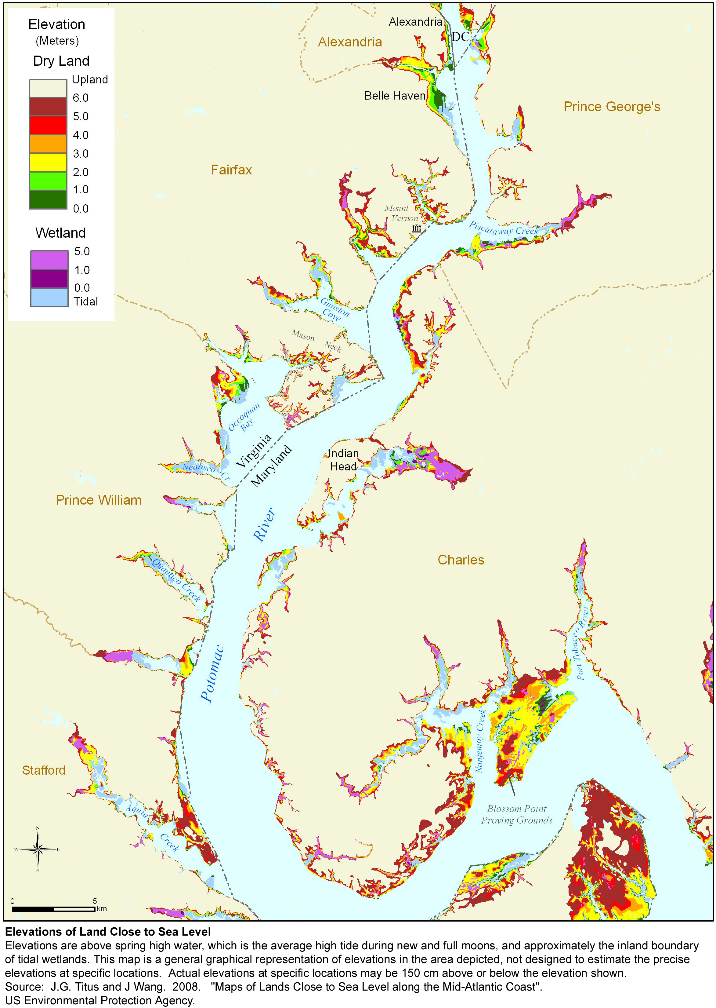
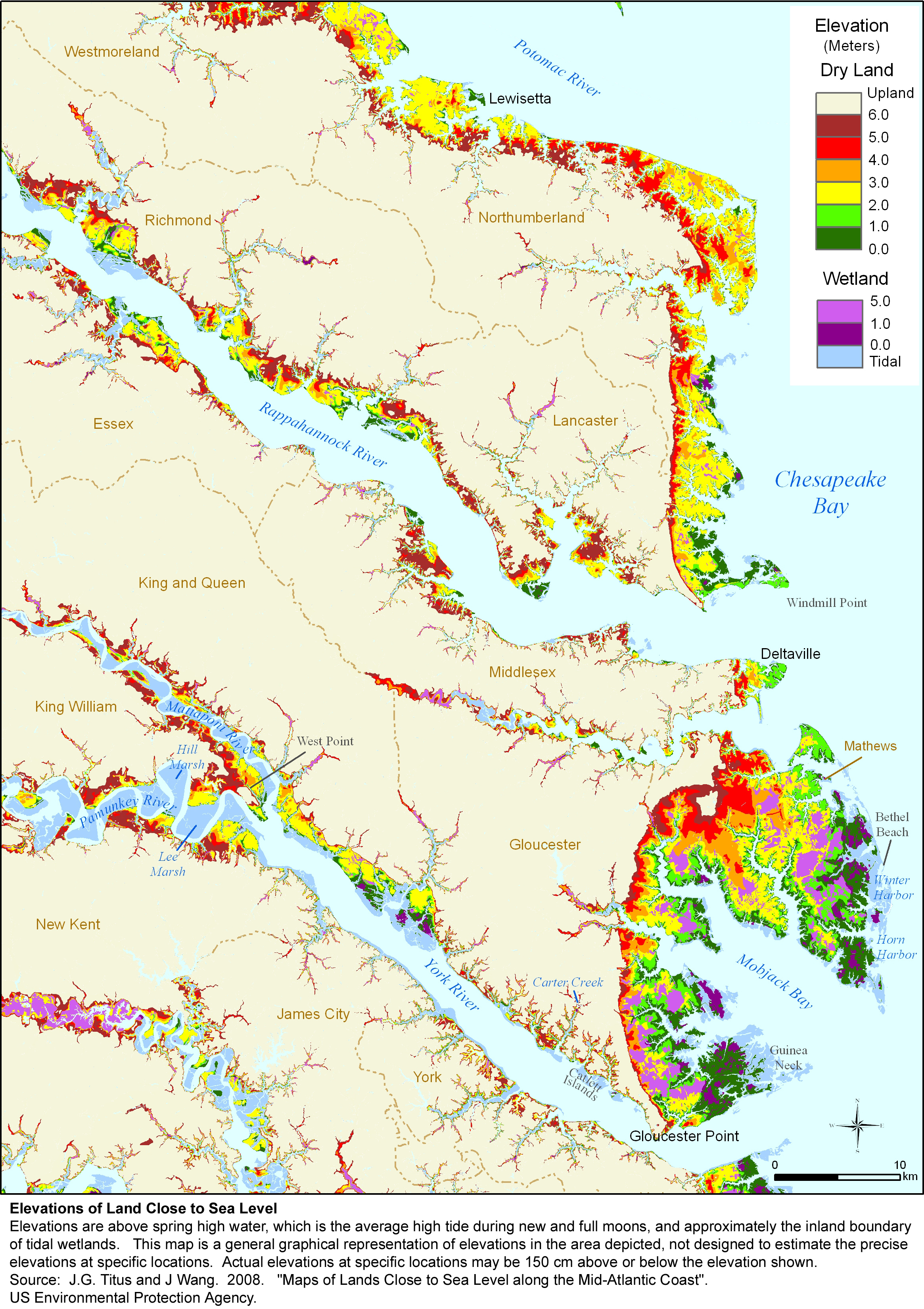
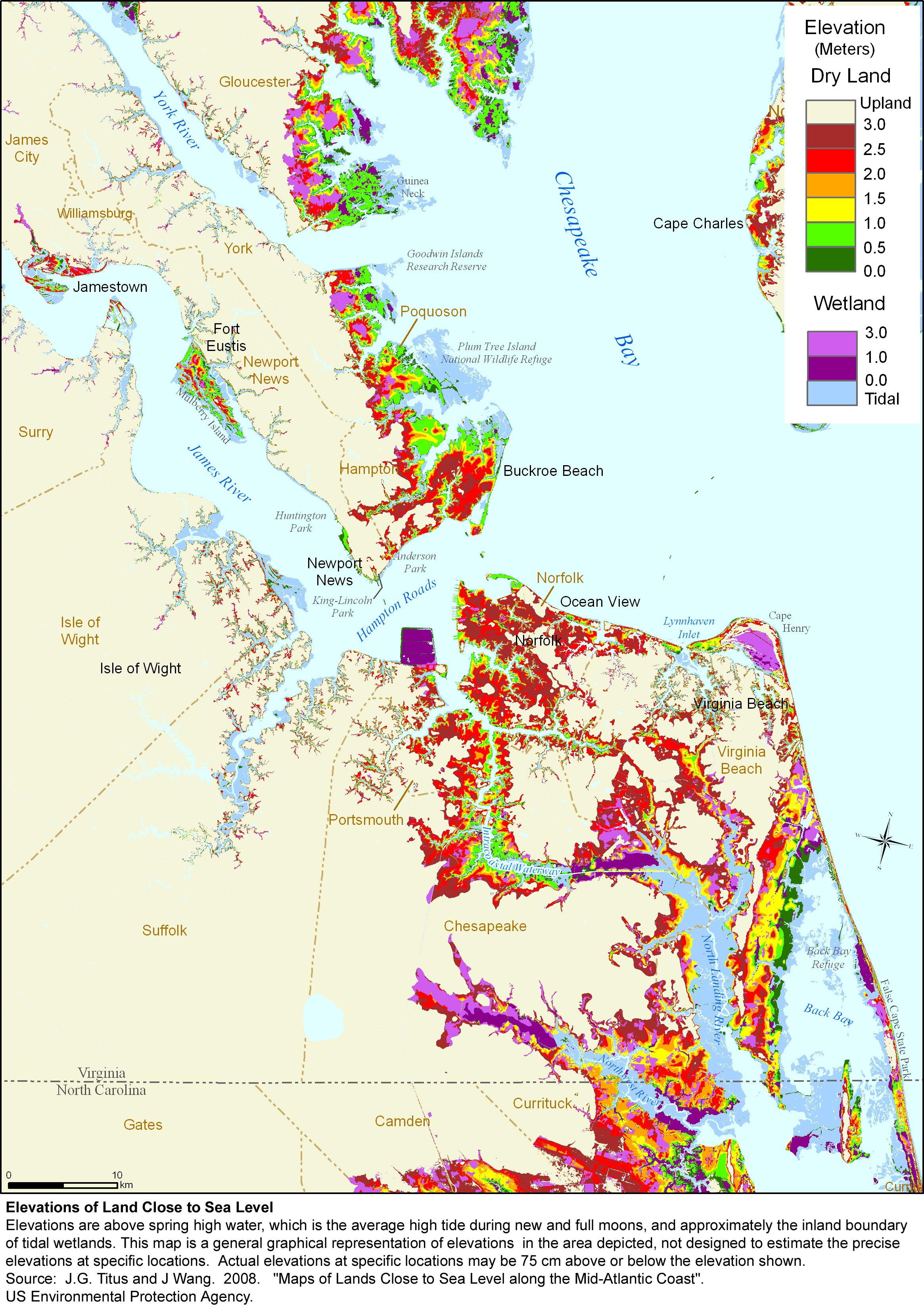
A $2 million effort to map the likelihood of shore protection as sea level rises is summarized in a new article entitled "State and local governments plan for development of most land vulnerable to rising sea level along the U.S. Atlantic Coast." The maps divide coastal low lands into four categories: developed (shore protection almost certain), intermediate (shore protection likely), undeveloped (shore protection unlikely), and conservation (no shore protection).

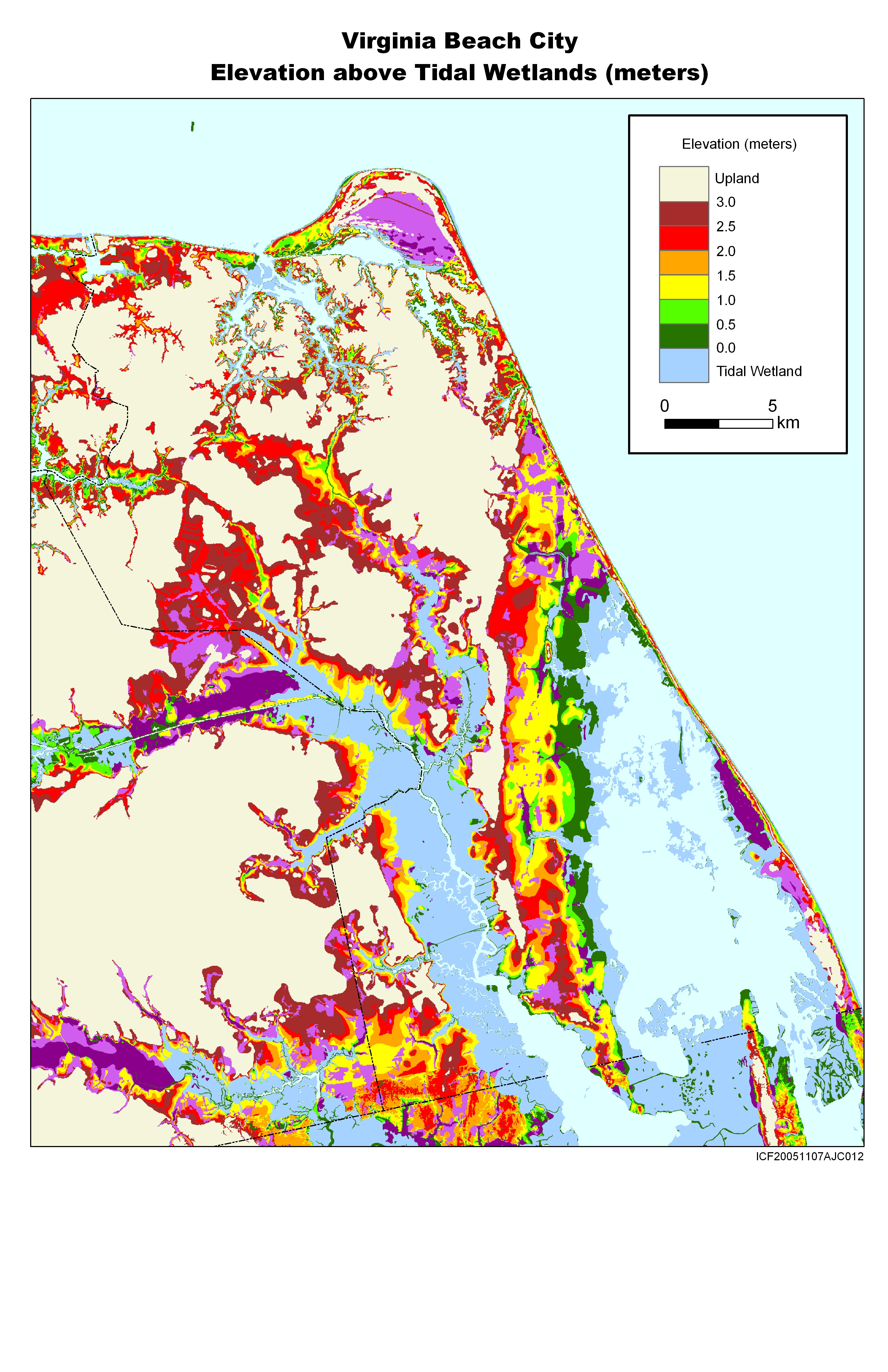
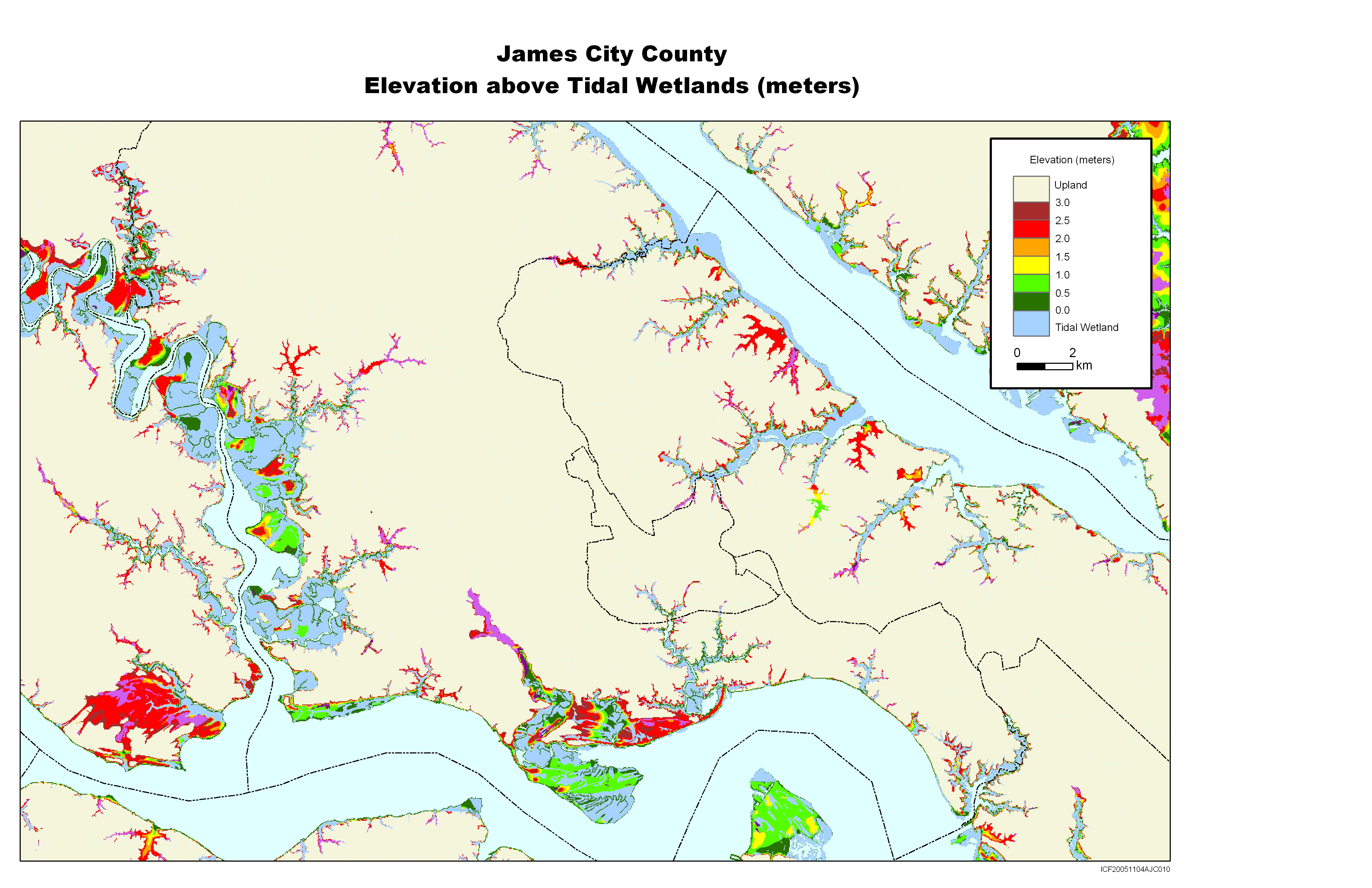
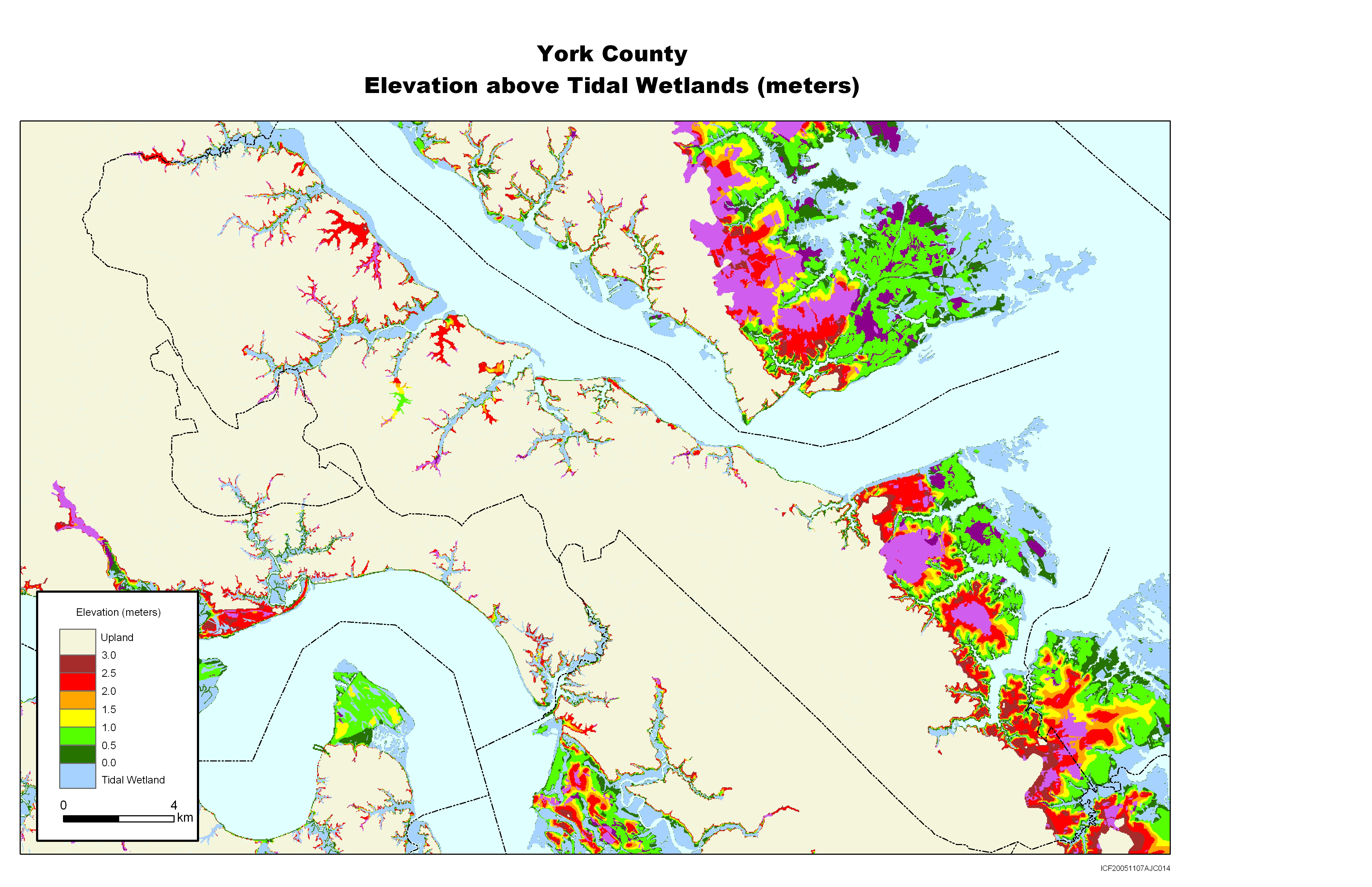
Northern Virginia and most of the Hamnpton Roads areas are intensely developed except for park and conservation lands, and almost certain to be protected. Near the North Carolina border, however, Virginia Beach plans to keep the area south of its "Rural Line" largely undeveloped. The City of Chesapeake, by contrast, plans to develop much of its rural lands. Development is not immediately expected for much of the Eastern Shore and along many of the tributaries to Chesapeake Bay. No policies are in place, however, to prevent such development either. Along the Atlantic ocean, almost all of the barrier islands are off limits to development. For further details, see the report by Titus, Hershner et al. or the summary of Virginia findings.

The maps from this study can be downloaded individually by clicking on a thumbnail map below; the entire set is also available in a zipped file. These jpg files were designed for printing at 300 dots per inch on 8-1/2 X 11 inch paper. If you simply click on the links below and try to read them on your computer screen, some of them may look strange, depending on your internet browser. If so, please save the jpg map onto your computer's hard drive and then open the file with the program you normally use to read jpg files.


The Whole Kitten Kaboodle
Download a zipped file with the 22 maps shown here, as well as locality-specific maps for every other county or independent city with a tidal shoreline in the Hampton Roads, Middle Peninsula, Northern Neck, Rappahannock Area, and Northern Virginia planning regions.

Commonwealth of Virginia
Virginia (view online)
Corresponding Elevation Map
Summary of findings for Virginia

Accomack and Northampton Counties, Virginia: sea level rise planning map
Virginia Eastern Shore
Corresponding Elevation Map
Environmental Implications: bay side
Environmental Implications: sea side

The Mother Load of Maps


The MACGES web site has zipped files containing all of the maps produced by this study. Just tell us where to dump it!

Potomac River: sea level rise planning map (Maryland, Virginia, and Washington DC)

Potomac River (view online)
Elevations: Lower Potomac River
Elevations: Upper Potomac River
Environmental Implications--Lower Potomac

Northern Neck and Middle Peninsula, Virginia:  sea level rise planning map


Northern Neck and Middle Peninsula
Corresponding Elevation Map
Environmental Implications--Northern Neck
Environmental Implications--Middle Peninsula


Hampton Roads, Virginia: sea level rise planning map
Hampton Roads (view online)
Corresponding elevation map
Environmental Implications

Virginia Beach sea level rise planning map


Virgina Beach
Corresponding levation map
Environmental Implications

Chesapeake, Virginia: sea level rise planning map Chesapeake
Corresponding Elevation Map

Hampton, Virginia.  Sea level rise planning map
Hampton
Environmental Implications

Suffolk Virginia. Sea level rise planning map
Northern Suffolk
Corresponding elevation map

Isle of Wight, Virginia.  Sea level rise planning map
Isle of Wight County

Jamestown Virginia. Sea level rise planning map
James City County
Corresponding elevation map

York County Virginia, sea level rise planning map
York County
Corresponding elevation map
Environmental Implications

Gloucester County, Virginia.  Sea level rise planning map
Gloucester County
Corresponding elevation map
Environmental Implications

Mathews County, Virginia.  Sea level rise planning map Mathews County
Corresponding Elevation Map
Environmental Implications

Lancaster County, Virginia.  Sea level rise 
					planning map

Lancaster County
Corresponding elevation map
Elevations: Lower Potomac River
Environmental Implications

Northumberland County, Virginia:  Sea level rise planning map

Northumberland County
Corresponding elevation map

Colonial Beach, Virginia.  Sea level rise planning map

Westmoreland County
Corresponding elevation map

King George and Caroline counties, Virginia.  Sea level rise planning map


King George and Caroline Counties
Environmental Implications

Stafford county, Virginia.  Sea level rise planning map
Stafford County
Environmental Implications

Prince William County, Virginia.  Sea level rise planning map
Prince William County
Environmental Implications

Fairfax Virginia.  Sea level rise planning map
Fairfax County

Alexandria, Arlington, and
Washington DC (view online)

Tangier Island, Chincoteague, Virginia.  Sea level rise planning map
Accomack County
Corresponding elevation map
Environmental Implications: bay side
Environmental Implications: sea side