!

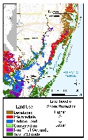
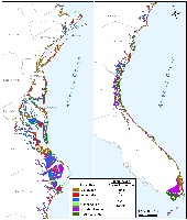
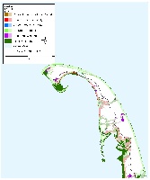
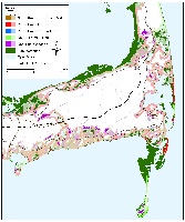
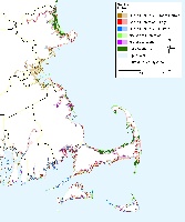
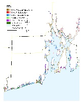
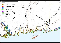
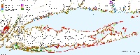
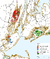
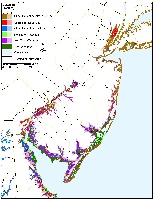
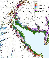
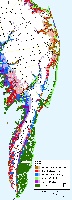
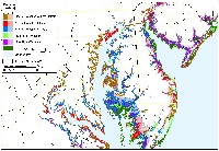
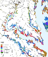
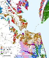
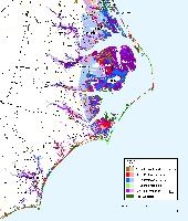
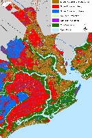
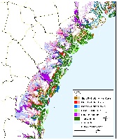
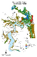
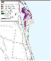
Maps depicting likelihood of shore protection from a new article in Environmental Research Letters

!

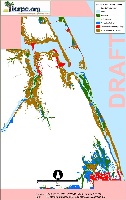
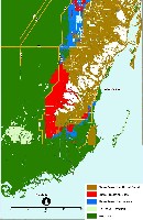
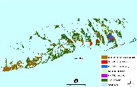
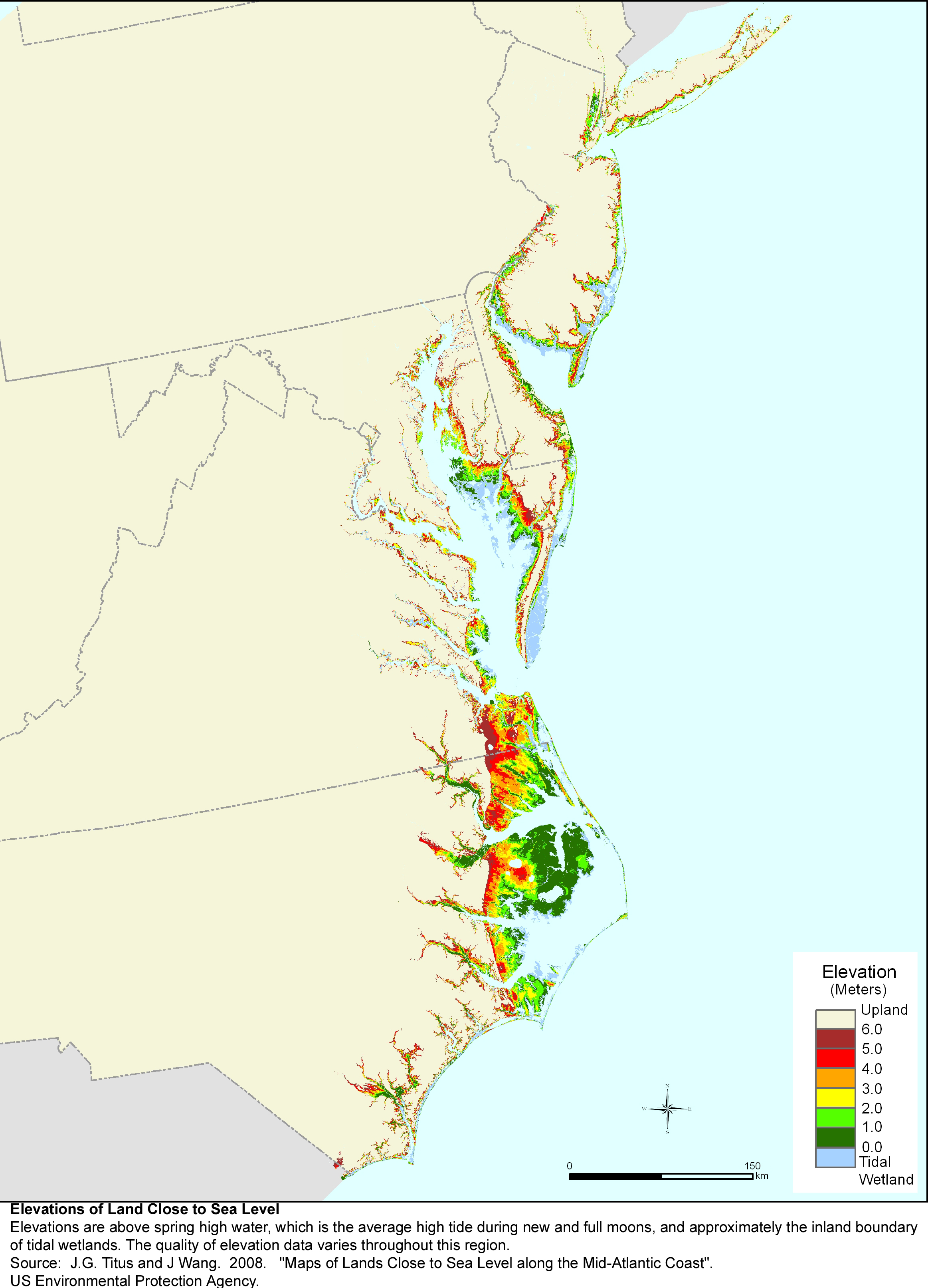
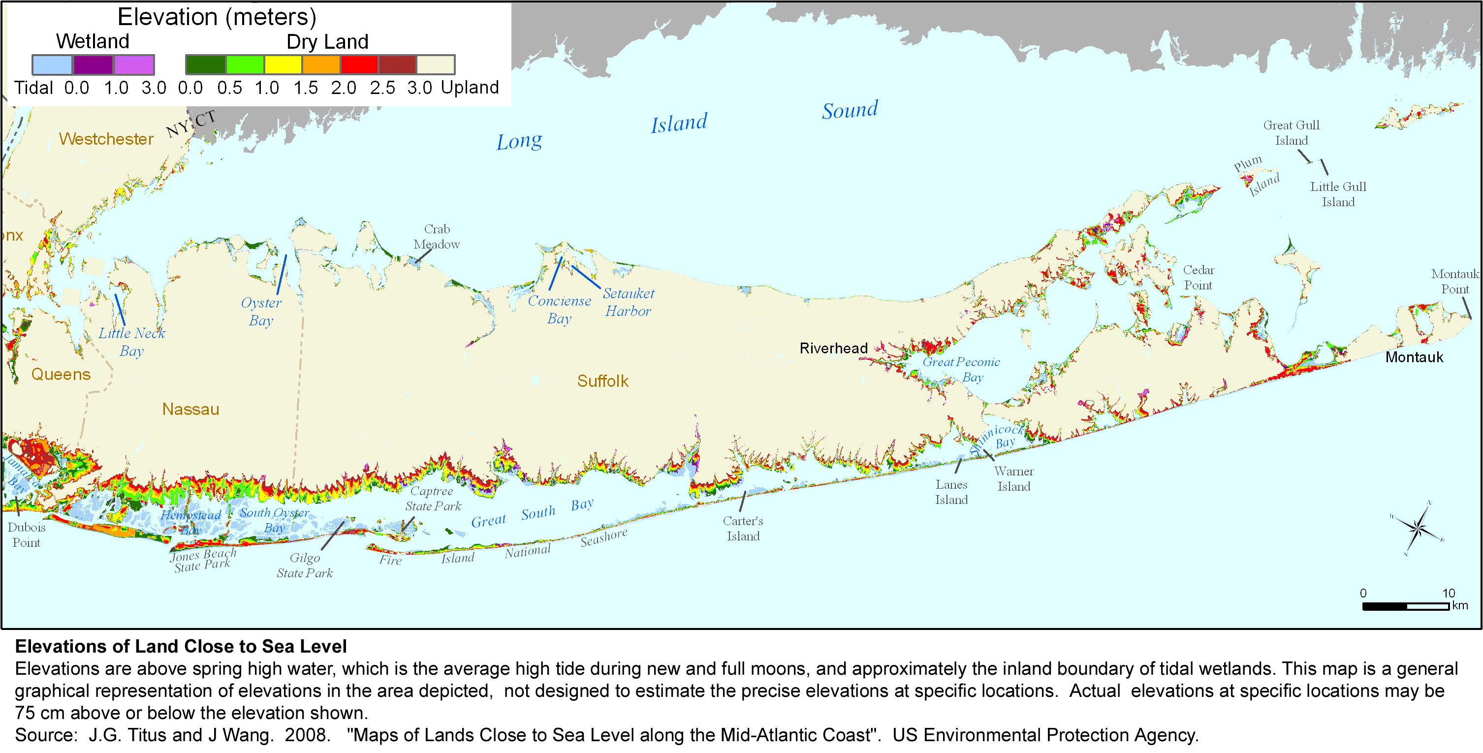
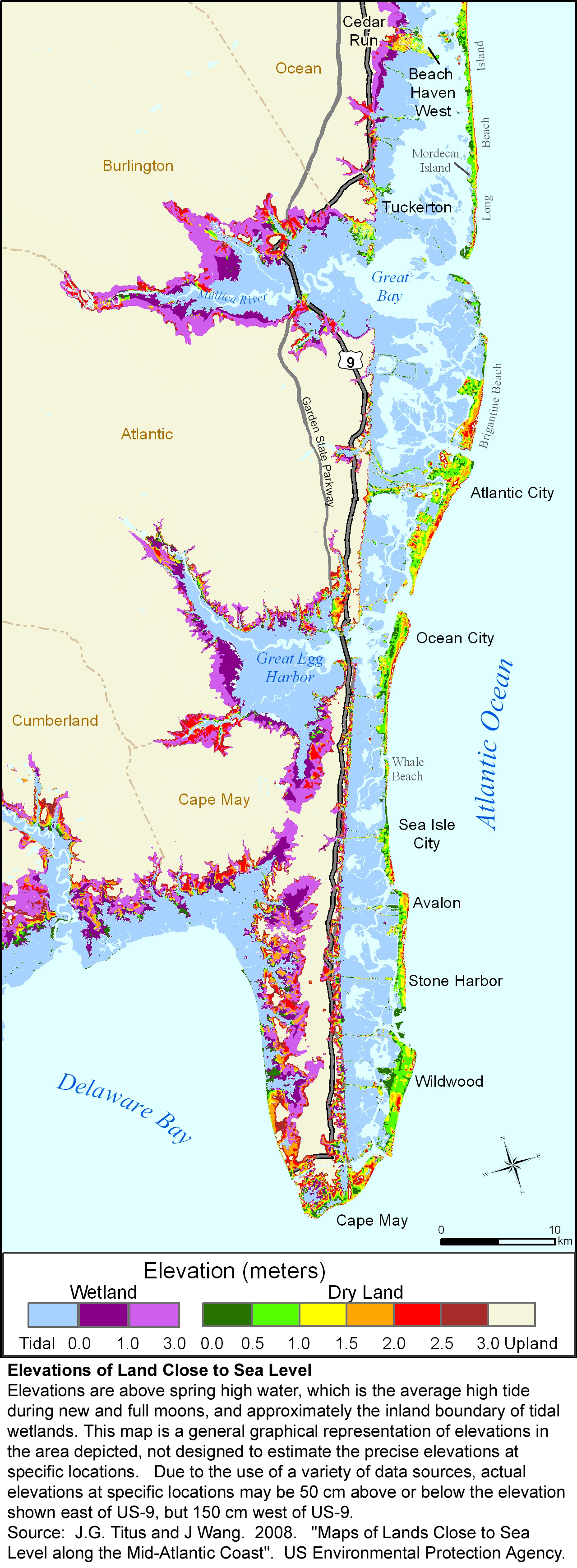
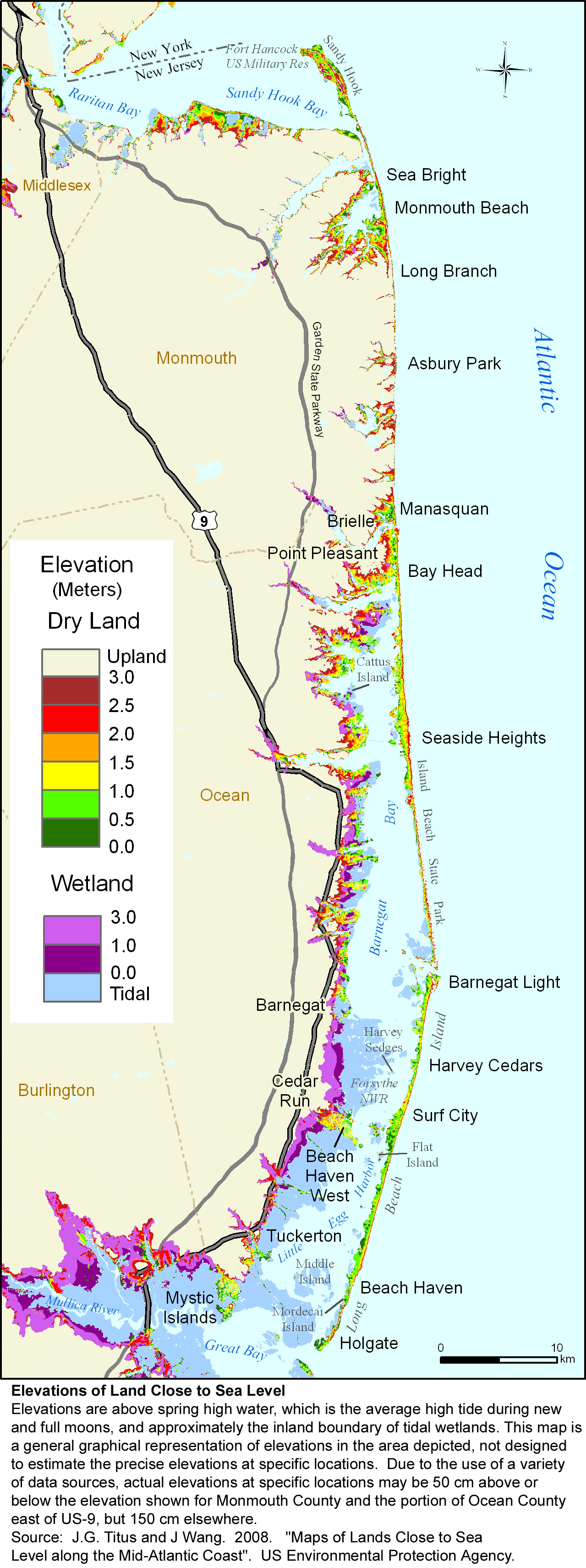
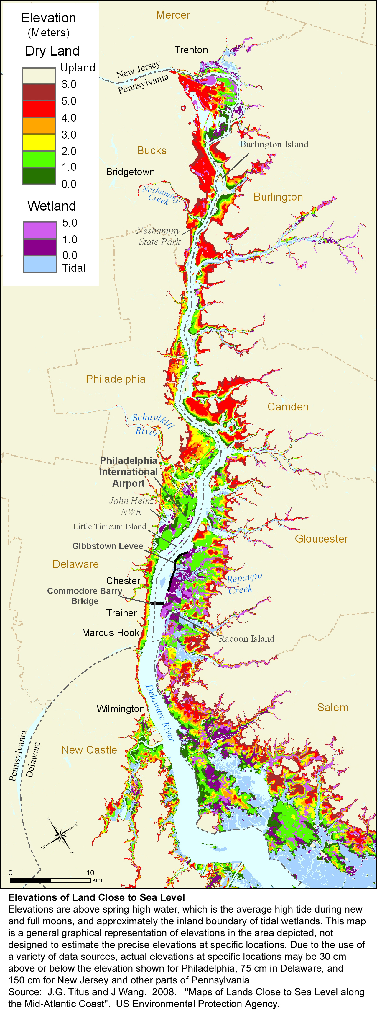
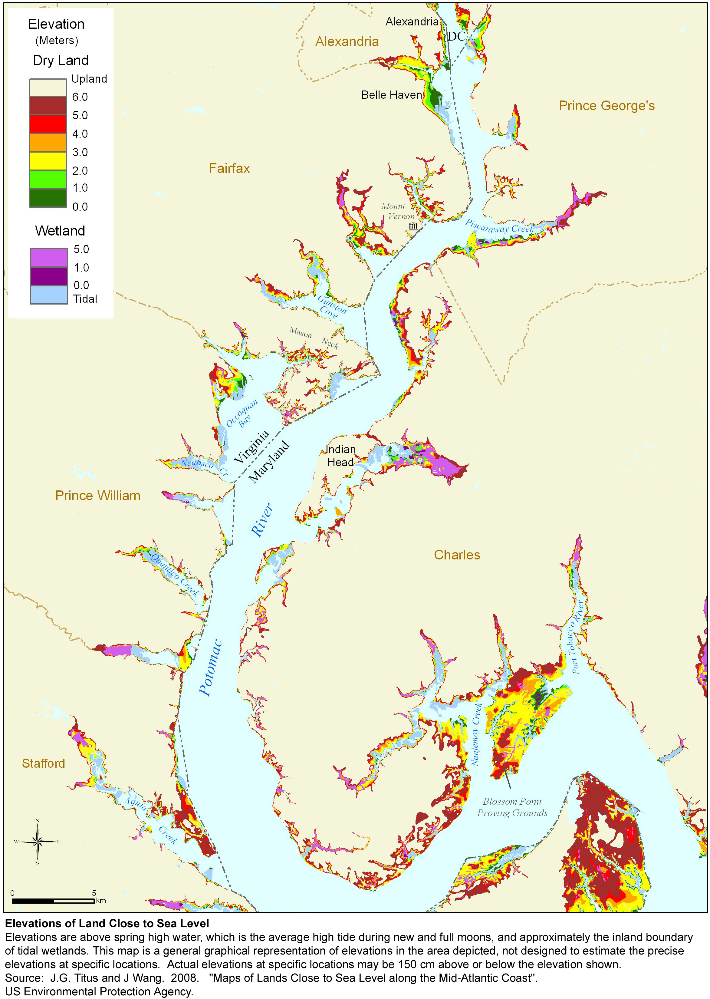
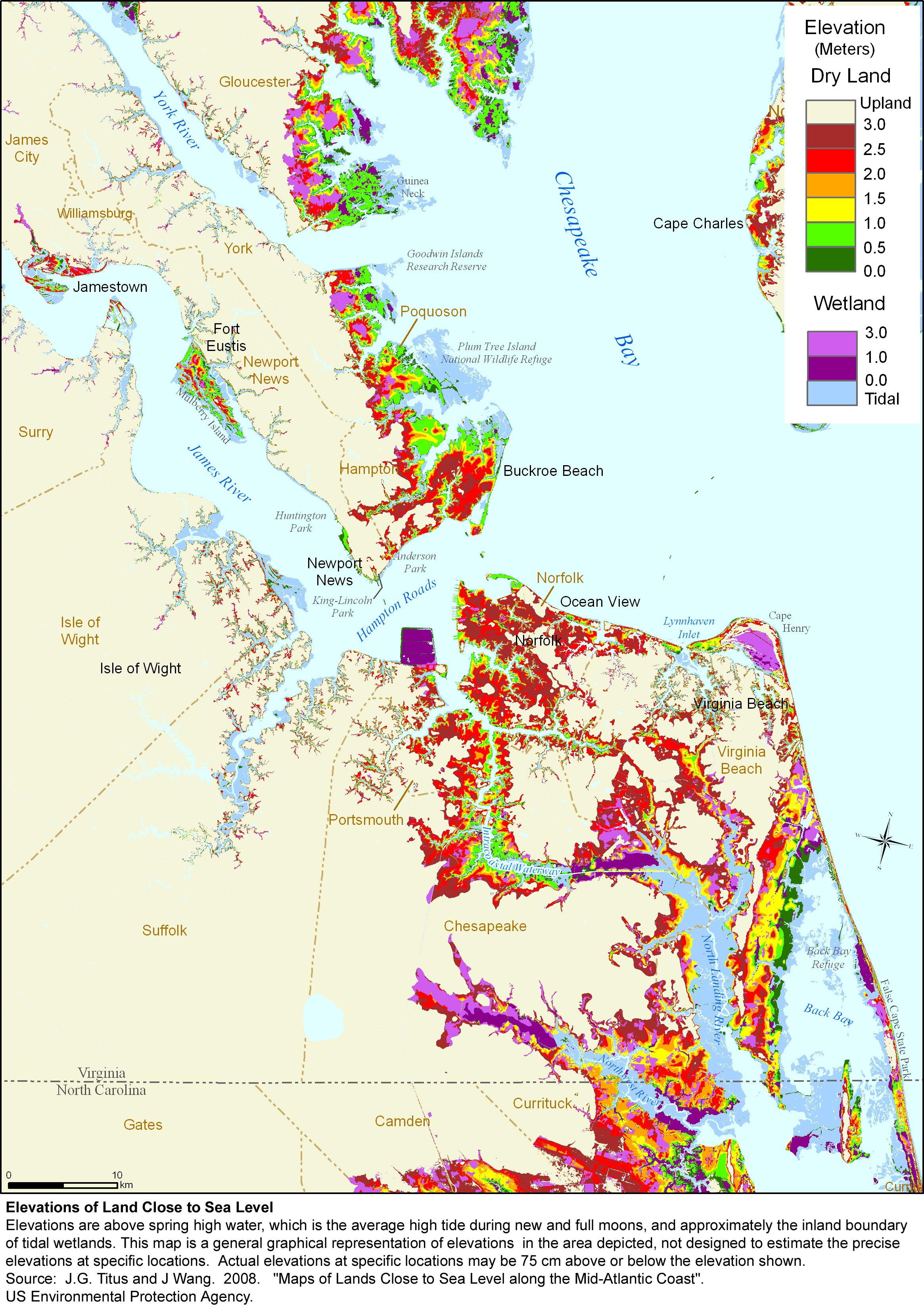
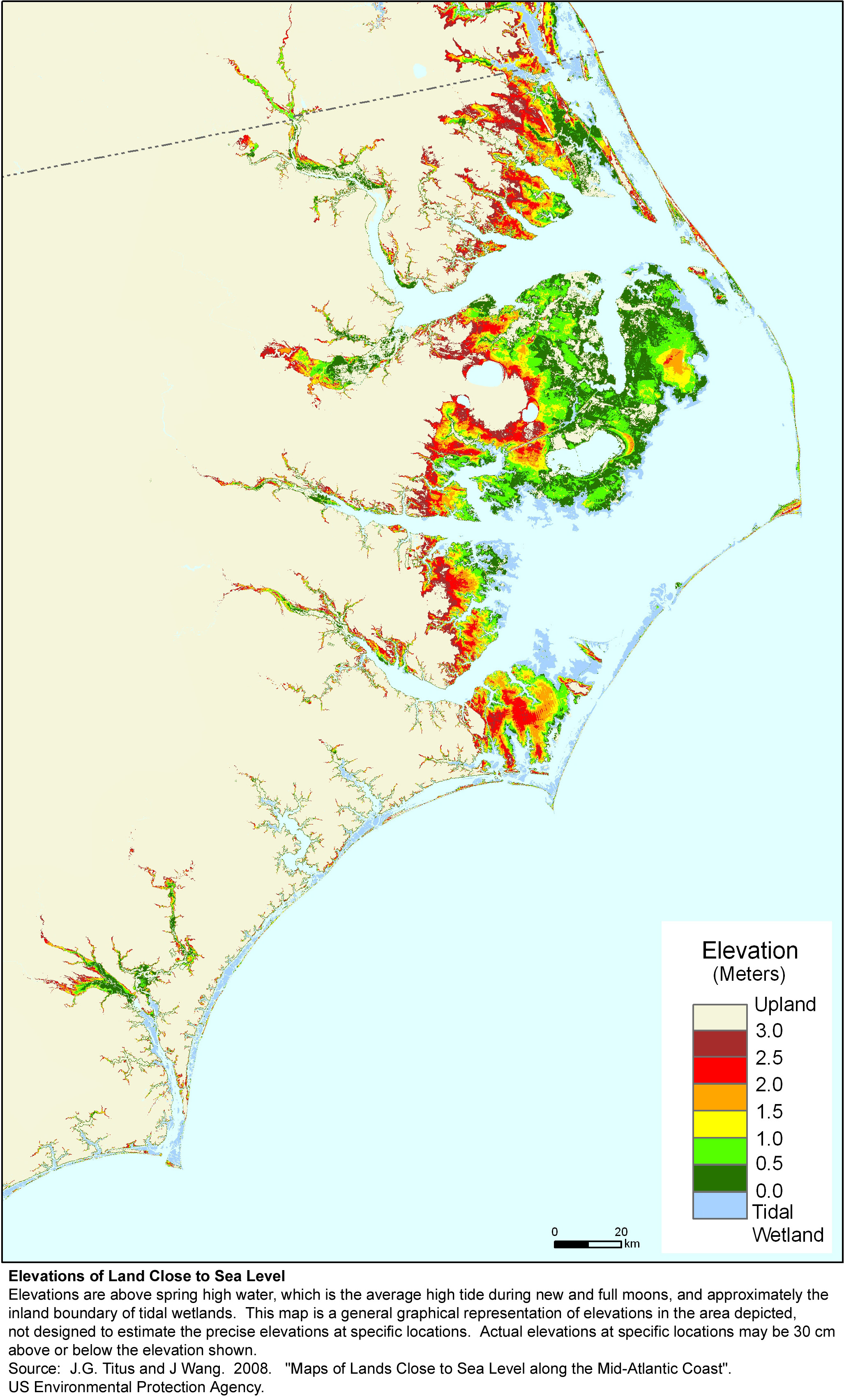
A $2 million effort to map the likelihood of shore protection along the Atlantic Coast of the United States is summarized in a new article entitled "State and local governments plan for development of most land vulnerable to rising sea level along the U.S. Atlantic Coast." The maps divide coastal low lands into four categories: developed (shore protection almost certain), intermediate (shore protection likely), undeveloped (shore protection unlikely), and conservation (no shore protection). The paper included a sampling of the maps produced by the study.

Unlike the state-specific pages on this site, this page links to maps that you can view online (though they may be a bit larger than your screen). If you then click on one of the those maps, you will download a larger jpg file designed for printing at 300 dots per inch on 8-1/2 X 11 inch paper.


The Whole Kitten Kaboodle


Download a zipped file with all the maps shown here.


Figure 1: Worcester County, Maryland
Corresponding elevation map

Likelihood of Shore Protection from Cape Cod to Key West

Figure 3: Atlantic Coast
Elevation: North Carolina to New York

The Mother Load of Maps


The MACGES web site has zipped files containing all of the maps produced by this study. Just tell us where to dump it!

Provincetown and vicinity: Cape Cod sea level rise planning map

Figure S2: Northern Cape Cod

Chatham and Vicinity

Figure S3: Southeastern Cape Cod

Boston, Nantucket, Martha's Vineyard. Massachusetts sea level rise planning map

Figure S4: Massachusetts

Rhode Island and Providence Plantations sea level rise planning map

Figure S5: Rhode Island and Providence Plantations

New London, Connecticut sea level rise planning map


Figure S6: New London County, Connecticut


Figure S7: Long Island
Corresponding elevation map


Figure S8: Greater New York area Corresponding elevation map

Meadowlands to Sandy Hook to Cape May
Figure S9: New Jersey
Elevation map: Southern Jersey Shore
Elevation map: Northern Jersey Shore


Figure S10: Delaware Bay
Corresponding elevation map


Figure S11: Delaware River
Corresponding elevation map


Figure S12: Delmarva ocean coast
Elevations: Delaware and Maryland
Elevations: Virginia

Maryland and adjacent aras


Figure S13: Maryland
Corresponding Elevation Map


Figure S14:Potomac River
Elevations: Lower Potomac River
Elevations: Upper Potomac River

Hampton Roads, Virginia: sea level rise planning map

Figure S15: Hampton Roads, Virginia
Corresponding elevation map

Pamlico and Albemarle Sounds are adjacent to one of the largest areas of undeveloped coastal lowlands in the United States.  North Carolina sea level rise planning map


Figure S16: North Carolina Corresponding elevation map


Figure S18: Charleston, South Carolina and vicinity

Georgia sea level rise planning map
Figure S18: Georgia

Jacksonville, Florida sea level rise planning map
Figure S19: Duval County, Florida

Cape Canaveral, Florida:  Sea level rise planning map
Figure S20: Brevard County, Florida

Jupiter Island
Figure S21: Martin County, Florida

Miami, Everglades, and Homestead, Florida sea level rise planning map
Figure S22: Miami-Dade County, Florida

Key West and Big Pine Key, Monroe County, Florida:  sea level rise planning map


Figure S23: Key West and vicinity