Maps of Lands Close to Sea Level: Delaware
50-cm contour interval and distinguishing nontidal wetlands from dry land
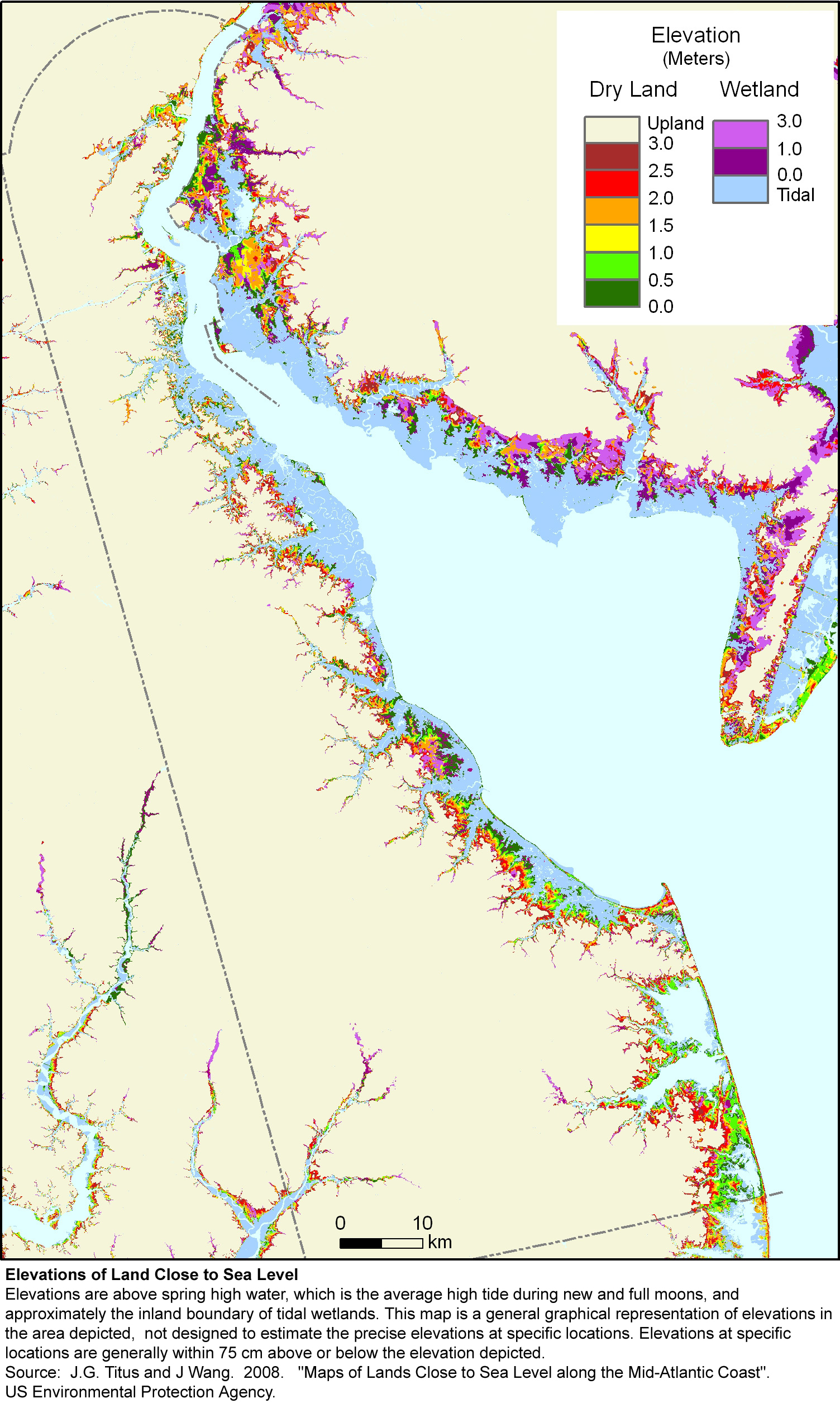
Download print quality version of the Delaware with 50-cm contour interval.
Greenhouse Effect and Sea Level Rise: America Starts to Prepare
Download print quality version of the Delaware with 50-cm contour interval.